Curated OER
Geologic Mapping I
Students create a geologic map and cross-section of an area of horizontal sedimentary rocks, exposed in several locations. Map must include a complete key or legend with rock descriptions of the various formations.
Curated OER
Floodplains in the field (with GIS)
Students measure a topographic and geologic cross-section across a floodplain by simple surveying and auguring techniques. They consider the spatial context of the field observations, use GPS measurements, and desktop GIS analyses.
Curated OER
Matter and Heat
Students examine how heating causes substances to expand, and cooling cause it to contract. They investigate the states of matter.
Curated OER
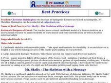
Health: The Skeleton with a Message
Students identify human muscles and bones from a cardboard skeleton, named "Mr. Skelly." Using dialog balloons as props, the teacher holds up advice from Mr. Skelly, such as noting he drinks milk to keep his bones strong. The lesson...
Curated OER
Positive Weather Reports
In this weather report worksheet, students complete a weather report on their favorite season in a group. Students observe and evaluate, complete a table for the report, and present it in a group.
Other popular searches
- Hyperbole Examples Pictures
- Dr Seuss Hyperbole Examples
- Hyperbole Examples Sentences
- Hyperbole Examples of Book


