Curated OER
Educational Technology Clearinghouse: Clip Art Etc: Robert La Salle
A celebrated explorer, born in Rouen, France, Nov. 22, 1643; assassinated March 19, 1687. In 1669 he emigrated to Canada, and soon after entered upon a number of remarkable expeditions of discovery. He visited the Illinois River, Lake...
Curated OER
Educational Technology Clearinghouse: Maps Etc: Chicago, 1922
A map from 1922 of Chicago and neighboring counties. The map shows county boundaries and county seats, cities, towns, railroads, canals, lakes, rivers, and the shoreline of Lake Michigan.
Curated OER
Educational Technology Clearinghouse: Maps Etc: Chicago, 1911
A city plan from 1911 of Chicago showing major streets, railroads and stations, the Chicago Union transfer railway yards, canals, Plaines River, parks, harbor, and major landmarks of the city.
Curated OER
Educational Technology Clearinghouse: Maps Etc: Chicago and Vicinity, 1901
A map from 1901 of Chicago and vicinity showing the city limits, major streets, neighboring cities and towns, major landmarks, the drainage canal, stock yards, parks, Lake Calumet, rivers, and the shoreline of Lake Michigan.
Curated OER
Educational Technology Clearinghouse: Maps Etc: Chicago and Vicinity, 1916
A map from 1916 of Chicago and vicinity, showing the railroad network of the area, major cities and towns, rivers, and the southern portion of Lake Michigan from Waukegan to Chicago. The map coverage includes the cities of Elgin, Aurora,...
Curated OER
Etc: Maps Etc: Chicago and Surrounding Area, 1909
A map from 1909 of Chicago and vicinity, including the State capitol of Springfield. The map shows the railroad network of the area, major cities and towns, rivers, and the southern portion of Lake Michigan.
Other
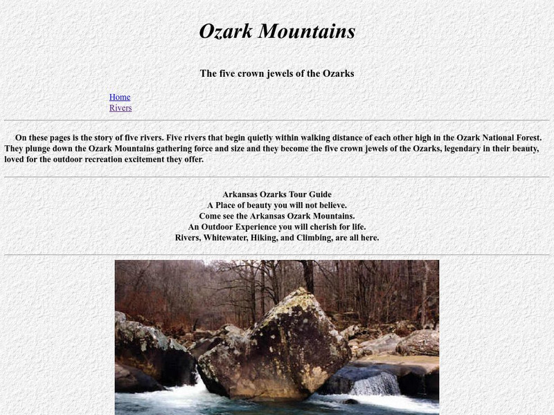
Ozark Mountains
Visit this extensive site detailing all aspects of the Ozark Mountains, from wildlife to topography to visitor information. Discover the diverse landscape of the Ozarks and the many activities available there.
Walled Lake Consolidated Schools
Loon Lake Elementary School: Jacques Marquette
A biography of Jacques Marquette (1637-1675), a French explorer and Roman Catholic missionary who was one of the earliest European explorers in North America. He joined the French explorer Louis Jolliet on a trip down the Mississippi...
Curated OER
Educational Technology Clearinghouse: Maps Etc: Mississippi Valley, 1672 1673
A facsimile from the collection of Francis Parkman (1865) of an early map of the Mississippi River Valley from the Great Lakes to the Gulf of Mexico, showing the explorations of Father Jacques Marquette (1672-1673). The map shows Lac de...
Curated OER
Etc: Development of the Northwest Territory in Us, 1790 1810
A map of the American Northwest Territory showing the boundary developments in 1790, 1800, and 1810. The upper left map shows the territory acquired by the United States from Britain after the Revolutionary War as established by the...
Curated OER
Etc: Route of George Rogers Clark, 1777 1779
A map of the Ohio country where in 1778-1779 George Rogers Clark led the Illinois Campaign to capture the British stronghold at Vincennes, marking an end to British power in the west. The map shows Clark's route from Pittsburgh along the...
Curated OER
Educational Technology Clearinghouse: Maps Etc: Black Hawk War, 1832
A map of the Illinois and Michigan territory (present day Illinois and Wisconsin) showing the battle sites of the Black Hawk War of 1832. The map shows Black Hawk's Village (Saukenuk) near Rock Island on the Mississippi, Prophetstown,...
Curated OER
Educational Technology Clearinghouse: Maps Etc: The Northwest Territory, 1787
A map of the Northwest Territory of the United States north of the Iroquois or Ohio River in 1787 showing early forts and settlements with dates of establishment given, rivers, and the general territories of the Illinois, Miami, and...
Curated OER
Etc: Maps Etc: The Country East of the Mississippi, 1650
A map from 1872 of the country east of the Mississippi for the year 1650, forty-seven years after the settlement of Jamestown. This map shows early commencement of European settlement and the principal Native American tribal lands east...
Curated OER
Educational Technology Clearinghouse: Maps Etc: St. Louis, 1911
A map from 1911 of the vicinity of St. Louis, Missouri, showing major streets and roads, railroads and stations, neighboring cities and towns, parks, and major landmarks. The map shows St. Louis, Missouri, separated by the Mississippi...
Curated OER
Etc: Maps Etc: The Theatre of Western Campaigns, 1861 1865
A map showing the Theatre of Western Campaigns in the American Civil War. The map includes parts of the states of Missouri, Illinois, Indiana, Ohio, Kentucky, Arkansas, Tennessee, Mississippi, Alabama, Georgia, and North Carolina, and...
Curated OER
Educational Technology Clearinghouse: Maps Etc: Utah, 1898
A map from 1898 of Utah showing the capital at Salt Lake City, principal cities and towns, railroads, mountains, lakes, rivers, and the Great American Desert to the west of Salt Lake. "Settled 1848 at Salt Lake by Mormons from Illinois,...


