Curated OER
Coral Bleaching in the Caribbean
Students use authentic satellite data on the NASA website to determine when the sea surface temperature meets the criteria to induce coral bleaching.
Curated OER
Exploring the Aral and Salton Seas
Learners investigate the environments of the Aral and Salton Seas. They use images taken from the space shuttle, the U2 spy planes, and remote sensing satellites to learn more about what is happening in each region. Students discuss the...
Curated OER
Salmon Run
Students examine the life cycle of the Pacific salmon and the impact of humans on salmon migration. They watch a Powerpoint presentation, trace migration routes on satellite imagery, and complete mock calculations of salmon energy...
Curated OER
You Decide
Fourth graders, who live on a Native American reservation, investigate how land management is addressed at Tribal Council meetings. They participate in a simulation of a meeting as the discover the workings of tribal government. They...
Curated OER
Using My Nasa Data To Determine Volcanic Activity
Young scholars use NASA satellite data of optical depth as a tool to determine volcanic activity on Reunion Island during 2000-2001. They access the data and utilize Excel to create a graph that has optical depth as a function of time...
Curated OER
Antarctic Jukebox
In this environment worksheet, students read an excerpt about Antarctica, including the many challenges explorers face. Then they imagine that they are a sound recordist in Antarctica and record 3 CDs. Students look at the images given...
Curated OER
Paint By The Numbers
Students, in groups, explore how astronomical spacecraft and computers create images of objects in space.
Curated OER
Warm up to the Gulf Stream
Students find out the temperature difference between the Gulf Stream and the surrounding water. They locate the Gulf Stream on the infrared image of the eastern seaboard of the US.
Curated OER
Pixel Transmission
Students develop code systems to transmit information between groups. They explore, explain and apply techniques used to transmit remote sensing data to better understand remote sensing images.
Curated OER
Who's Range is it?
Students investigate the habits of panthers by analyzing radio transmitted data. In this animal life lesson plan, students utilize computers to view the range of different statistics dealing with Florida panthers. Students...
LABScI
Viscosity: The Fluid Lab
There's more to fluids than meet the eye—they include gases, liquids, and polymers, too! Scholars complete three hands-on activities exploring different properties of fluids. They explore viscosity by measuring the resistance, or...
Curated OER
Geography: Snow Cover on the Continents
Students create maps of snow cover for each continent by conducting Internet research. After estimating the percentage of continental snow cover, they present their findings in letters, brochures or Powerpoint presentations.
Curated OER
How Do We Forecast Weather?
Third graders investigate how scientists collect weather data in order to forecast the weather. They work in small groups in order to research one type of weather technology such as, satellite images, radar, surface observations, or...
PHET
Where to See an Aurora
Where can you see an aurora in North America? After completing an astronomy activity, scholars can locate the exact coordinates. Pupils plot points of the inner and outer ring of the auroral oval and answer questions based on...
Curated OER
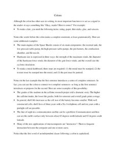
Colons
Clarify colon misconceptions with this explanatory handout. Get into the nitty-gritty of grammar with multiple examples of the proper use of the colon. While this isn't an interactive handout, it could be used as a grammar guide for your...
Curated OER
Understanding Light: Lesson 2 - The Electromagnetic Spectrum
Students investigate the Electromagnetic Spectrum and realize there is energy beyond visible light. They identify parts of the EM Spectrum.
Curated OER
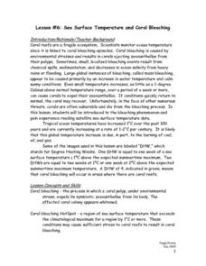
Lesson #6: Sea Surface Temperature and Coral Bleaching
Fifth graders examine the concept of coral bleaching and sea surface temperature. They view a teacher demonstration, interpret sea surface temperature data, explore a website, and complete worksheets.
Curated OER
Lesson #5: Symbiosis and Coral Anatomy
Fifth graders examine the basic structure of corals and the concept of symbiosis. They watch a Powerpoint Presentation, develop an original pair of organisms living symbiotically, and create an edible model of a coral polyp.
Curated OER
Start the Space Flight Time Line
Students research space flight exploration and technology. In small groups, they research a significant event from early time until the start of the space age. A class time line is created from the research groups.
Curated OER
Solar Storm Timeline
For this solar storm timeline, learners read about a series of events that took place in space beginning with a solar flare. Students gather the information and create a time line of events mentioned. They determine the length of time it...
National Wildlife Federation
Quantifying Land Changes Over Time Using Landsat
"Humans have become a geologic agent comparable to erosion and [volcanic] eruptions ..." Paul J. Crutzen, a Nobel Prize-winning atmospheric chemist. Using Landsat imagery, scholars create a grid showing land use type, such as urban,...
Curated OER
Comparison of Snow Cover on Different Continents
Students use the Live Access Server (LAS) to form maps and a numerical text file of snow cover for each continent on a particular date and analyze the data for each map, corresponding text file to determine an estimate of snow cover for...
National History Day
“Saving the Bear”: The Russian Expeditionary Force of World War One
How have Russian politics affected countries on a global stage? The discussion of the Russian Revolution and World War I begins with an analysis of primary resource letters. Learners finish with a project where they create a timeline of...
Curated OER
Take Your Class to the Moon
Get your kids talking about our lunar neighbor with these hands-on lessons.
