TLS Books
Neptune
Did you know that Neptune is named after the Roman god of the sea? Young astronomers read about this and other facts about the eighth planet from the sun in a short informational text passage.
Curated OER
Plasmasphere
In this plasmasphere worksheet, students determine how long the plasmasphere takes to rotate around the Earth using two satellite images taken three hours apart.
Curated OER
FINDING A RESOLUTION
Students examine detailed Moon and Earth views provided by the NASA-sponsored "World Wind" computer program. They work in groups to create maps of different scales using landmarks of their choice, and challenge their classmates to...
Curated OER
A Lunar Transit of the Sun from Space
For this moon worksheet, students determine the angular size of the moon and draw a scaled model of the Earth, moon, and sun and given distances and positions. This worksheet has 4 problems to solve.
Curated OER
Chandra Explores Angular Size
In this angular size worksheet, high schoolers read about how astronomers determine the size of objects in the sky by using their angular size. Students are given equations that allow scientists to convert the angular size into...
Curated OER
Book Excerpt from "The 23rd Cycle"
In this solar storms worksheet, students read an excerpt from the book "The 23rd Cycle: Learning to Live with a Stormy Star". Students answer 7 questions about the effects of solar storms on radiation exposure, health risk of airline...
Scholastic
Study Jams! Severe Storms
Tornadoes and hurricanes and blizzards, oh my! Severe storms are always occurring somewhere on the planet. By reading through these slides, learners discover the characteristics of each type. Have them do this as homework and then take...
Curated OER
Character and Class
Students connect photographic images with the literary texts of Eudora Welty and William Faulkner. They identify and distinguish narrators and protagonists of literary works. Students recognize patterns of social class as a literary...
Curated OER
Forests and Photosynthesis
Fourth graders explore the concept of photosynthesis. They investigate the effects of light on seedlings. Students grow plants and record the data. Students view satellite images that show the monthly amount of vegetation present in the...
Curated OER
"Hard" Data from Space
Students use satellite images to analyze development patterns within Baltimore City. They prepare a land cover map for Baltimore indicating the prevalence of impervious surfaces and explore how these patterns affect water pollution.
Curated OER
Landscape Diversity in the Yukon Territory
Students review and analyze a satellite image of the Yukon territory.
Curated OER
Hold on Tight!
Students explore the close connection between plant roots and the soil in which they grow. They investigate the roots of plants, make models of plant roots using pipe cleaners, and examine photos and images to explore the connection...
Curated OER
Hurricane Strength: Spatial Association of Wind Speed and Water Temperature
In this hurricane worksheet, students read and analyze satellite images of hurricane Rita. They complete 4 short answer questions about it.
Curated OER
Environment: Just Around the Bend
Students decipher landforms on a map and corresponding satellite imagery. They consider the impact of pollution on agriculture and water. They draw diagrams demonstrating how pollution works its way into the food source.
Curated OER
The Bulbs: Camas and Daffodil
Fourth graders become aware of the importance of the camas bulb to the Nez Perce people, they learn the parts of plants, and gain understanding of the interdependence of Nature. They study about the possible causes and outcomes of global...
Curated OER
Solar Flip Book
Students view and discuss various images of solar events. They research and create a flip book demonstrating the progression of two solar events, and write a poem describing their chosen solar event.
Curated OER
Changing Faces: A Study of Solar and Planetary Rotation Rates
Students determine rotation rates of a variety of solar system objects using images and the Internet.
Curated OER
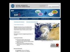
Troical Atlantic Aerosols
Young scholars explore the effect aerosols have upon he weather and climate. They observe NASA satellite images to explore and draw conclusions about aerosol transport. From studying the images, students track the path of aerosols. They...
Curated OER
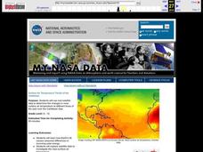
Surface Air Temperature Trends of the Caribbean
Students investigate the seasonal changes to sea surface and near-surface air temperatures near the equator. They use actual satellite data to track and graph the differences in air and sea temperatures during different seasons in the...
Curated OER
The Science Behind Phone Systems
Learners, in groups, discuss the origin of voice communications. In small groups students research the science behind innovations related to voice communications up through today's satellite systems. They make models or demonstrations.
Curated OER
The North and South Magnetic Poles
In this north and south magnetic poles worksheet, students read about the presence of auroras over the earth's magnetic poles as opposed to the geographic poles. Students use 2 photographs taken by the IMAGE FUV and the Polar instruments...
Curated OER
Land Use Over Time
Students view aerial photos and topographic maps of their local area. They compare and contrast major land use patterns over time by comparing these images to maps that are at least 50 years old. They analyze them using the four land use...
Curated OER
Awesome Saturn
Students brainstorm words that describe Saturn. They view images sent to Earth from satellites. They write poems about the planet using different poetic forms.
Curated OER
Mediterranean Lands: A Pilgrimage Through Time and Space
Students will use context clues and examine several maps to answer series of short answer questions over range of geographical topics, identify specific places, practice using GoogleEarth to compare satellite views to those produced two...


