Curated OER
Acid Rain
Students use real-time weather maps to determine the likelihood of acid rainfall in a region. Students apply their understanding of interaction between weather systems, land and air pollution, to address acid rain and the effects on...
Curated OER
Mapping West Virginia
Fourth graders explore West Virginia. In this Unites States geography lesson, 4th graders discuss the type of land and the cities in West Virginia. Students create two overlays, with transparencies, that show the natural land and the...
Science 4 Inquiry
An Investigative Look at Florida's Sinkholes
In May of 1981, the Winter Park Sinkhole in Florida first appeared and is now referred to as Lake Rose. Scholars learn about the causes of sinkholes through an inquiry project. Then, they analyze recent data and draw conclusions to...
Curated OER
Meteorology
Seventh graders examine the job of meteorologists. They decide which characteristics of the atmosphere that meteorologists focus on. They use local weather maps from newspapers to predict weather in their area.
Curated OER
Weather Or Not
Students use the internet to find pen pals to share in their weather experiment. Individually, they research the high and low temperatures for cities within the United States and email the results to their pen pal. They also develop a...
Curated OER
Project Jukebox
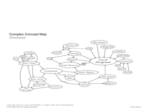
Students analyze an interview with the Climate Change Project Jukebox in order to help them undertand how to use a concept map. In this writing and climate change lesson, pairs of students log onto the Internet site for Climate...
Curated OER
Hot n' Cold
Students keep a weather log. For this weather and temperature lesson, students discuss the information that can be obtained from a map and lead into a discussion about temperature. Students watch a video about temperature and...
Curated OER
Create a Weather Newscast
Fourth graders explore, research and study how to make and give a weather newscast. They assess a variety of weather terms, research skills on the Web and develop an oral presentation on a weather newscast to present to their classmates.
Curated OER
Clouds and the Weather
Fourth graders analyze the relationship of clouds and local weather. Students also observe and record cloud data and weather conditions daily as they research different cloud types. The data is analyzed looking for trends in daily...
Curated OER
Oceanic Heat Budget Activities
Young scholars map and research imaginary islands located in different parts of the world. They describe the weather and climate of their island and show how local currents, water temperatures and waves may influence the weather patterns.
Curated OER
Data Analysis and Measurement: Ahead, Above the Clouds
Students explore and discuss hurricanes, and examine how meteorologists, weather officers, and NASA researchers use measurement and data analysis to predict severe weather. They plot points on coordinate map, classify hurricanes...
Discovery Education
Sonar & Echolocation
A well-designed, comprehensive, and attractive slide show supports direct instruction on how sonar and echolocation work. Contained within the slides are links to interactive websites and instructions for using apps on a mobile device to...
NASA
Earth's Global Energy Budget
Introduce your earth science enthusiasts to the earth's energy budget. Teach them using an informative set of slides that include illuminating lecturer's notes, relevant vocabulary, embedded animations, colorful satellite maps, and a...
Curated OER
NIGHT AND DAY: DAILY CYCLES IN SOLAR RADIATION
Students examine how Earth's rotation causes daily cycles in solar energy using a microset of satellite data to investigate the Earth's daily radiation budget and locating map locations using latitude and longitude coordinates.
Curated OER
Tracking the Salt Front
Using the Hudson River as the focus, learners discuss the difference between salt water and fresh water environments, analyze maps and graphs, and complete addition and subtraction problems. This lesson comes with a wealth of...
Curated OER
What is Climate?
Students explore the differences between climate and weather. For this introductory lesson of a climate unit, students discuss the vocabulary and concepts associated with weather and climate. They build their information base for the...
Curated OER
Pangaea Puzzle
Students explore plate tectonics and the formations of the Earth's surface and why maps are distorted. In this Earth's surface lesson students complete a lab and answer questions.
Curated OER
Exploring and Comparing Other Communities
Third graders search TDC database for images of physical geography maps, weather maps, natural resources maps, and old travel brochures. They create a new travel brochure of an area of their choice using the information they gathered.
Curated OER
Infrared-Hot
Students describe how the sun heats the Earth, explain the nature of infrared light, explain how thunderstorms are formed and use infrared maps to predict severe weather.
Curated OER
Gallery Walk Questions about Energy and Material Cycles
Students state the physical, chemical or biological processes associated with these environments: Pelagic ocean zone, California coat Cave, Indiana Barrier island beach, North Carolina Sand dune, Dunes National Park, Colorado Wetland and...
Curated OER
Under the Weather
Students consider the increase in floods. In this current events lesson, students visit selected websites to research the occurance of floods in Britain.
Curated OER
Clouds
Students read the "Cloud Book" by Tomie de Paola and create a map of clouds identifying atmospheric conditions, color and type, and what type of weather each cloud indicates. Emphasis is placed on the use of Kidspiration.
Curated OER
Kalahari Explorations
Students explore world geography by completing graphic organizers and researching the Internet. In this Kalahari desert lesson, students identify the geographic location, weather and creation of the Kalahari desert. Students define a...
Curated OER
Where Do Canadians Live?
Learners investigate Canadian people by researching the geography of the country. In this world geography lesson, students identify locations within Canada with large populations based on their access to waterways. Learners...


