Curated OER
Etc: Maps Etc: Isthmus With Completed Panama Canal, 1914
A map from 1914 of the completed canal across the Isthmus of Panama. The map shows the Caribbean Sea entrance at Colon, the route of the canal through Gutan Lake and lock system, the Pacific entrance at the city of Panama, the Canal Zone...
Curated OER
Educational Technology Clearinghouse: Maps Etc: The Isthmus of Tehuantepec, 1852
A map from 1852 of the Isthmus of Tehuantepec in Mexico, showing the proposed railroad route connecting the Gulf of Mexico and the Pacific. This was an alternative proposal to the construction of the Panama or Nicaragua canals, and was...
Curated OER
Educational Technology Clearinghouse: Maps Etc: Isthmus of Nicaragua, 1901
A map from 1901 of the Isthmus of Nicaragua, showing the proposed route of the Atlantic-Pacific canal from San Juan del Norte (Greytown) on the Caribbean coast to Lake Nicaragua, then to Brito near San Juan del Sur on the Pacific coast....
Curated OER
Educational Technology Clearinghouse: Maps Etc: The American Isthmus, 1913
The American Isthmus, showing the routes investigated for a ship-canal.
Curated OER
Etc: Maps Etc: Routes to the Panama Isthmus, 1913
A map from 1913 of the eastern United States, the Caribbean, and the Panama Isthmus showing the directness of the steamship routes from New York and New Orleans to Colon. Since the Panama Canal did not open to commercial traffic until...
Digital History
Digital History: How the Us Obtained the Panama Canal [Pdf]
The story behind building a canal through the isthmus of Panama is one of incompetence and corruption on the part of the French, who first attempted the feat. Many of the actions of the United States in acquiring the land through which...
ClassFlow
Class Flow: Geographic Terms
[Free Registration/Login Required] These five Activote questions will help determine if students can identify major geographic features to include fjords, canyons, cliffs, channels, sea, bay, and isthmus.
Curated OER
Etc: Maps Etc: The Isthmus With Completed Canal, 1913
A map from 1913 detailing the Panama Canal Zone and completed canal, with an inset map of the entire country of Panama "The dotted lines show the boundary of the territory known as the Canal Zone, a strip ten miles wide, from deep water...
Curated OER
Etc: Maps Etc: United States Canal Zone Isthmus of Panama, 1912
A map from 1912 of the United States Canal Zone in Panama. The map shows the location of the canal, the deepened approaches to the canal, and the locks. The map also shows mountain ranges, railroads, projected railroads, post offices,...
Other
Maps & Globes: Other Land Forms
A very simple overview of various land forms and their characteristics: peninsula, cape, isthmus, valley, canyon, cliff, and swamp.
University of New Brunswick (Canada)
Henry George Clopper Ketchum the Railway to Glory or Despair
This is a fascinating, largely forgotten piece of Canadian history. In the late 19th century, Henry Ketchum, an engineer from Fredericton, New Brunswick, envisioned the building of a railway to transport ships from the Bay or Fundy to...
Other
Panama Canal Authority: El Canal De Panama: Canal History
This site presents a history of the construction of the Panama Canal. Content includes information on the Panama Canal Treaty, the canal's construction, involved government leaders, and the transition of the canal from U.S. hands to...
Yale University
Yale University: Hay Bunau Varilla Treaty
Open this page to read the full text of the Hay-Bunau-Varilla Treaty, which gave the U.S. rights to build the Panama Canal.
CZBrats
Goldrush Days
This page is an article entitled "Gold Rush Days On The Isthmus", by Willie K. Friar, from "The Panama Canal Review" (Fall 1971). Read about this significant event in Panamanian history, which falls into the "Independence" years...
Scholastic
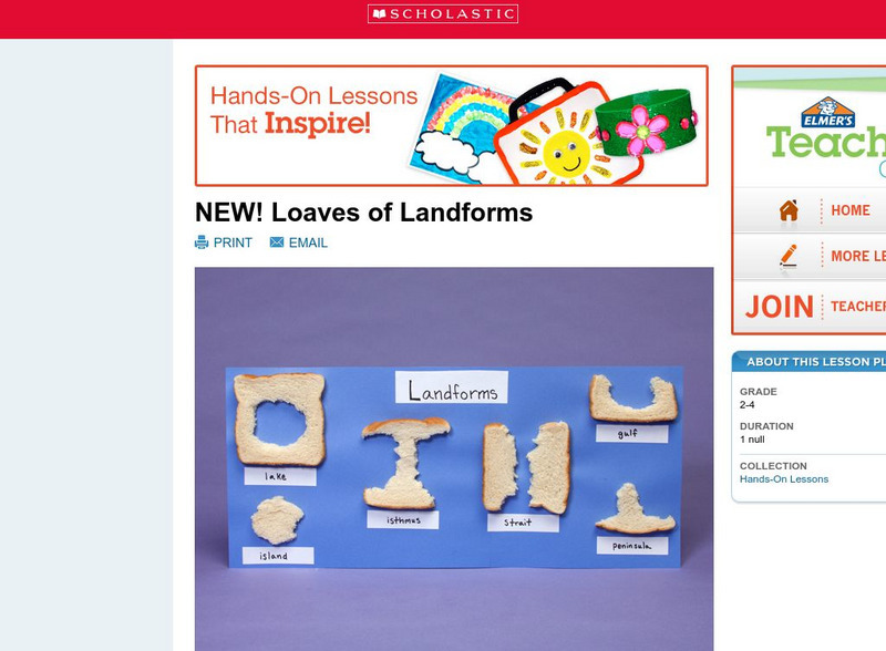
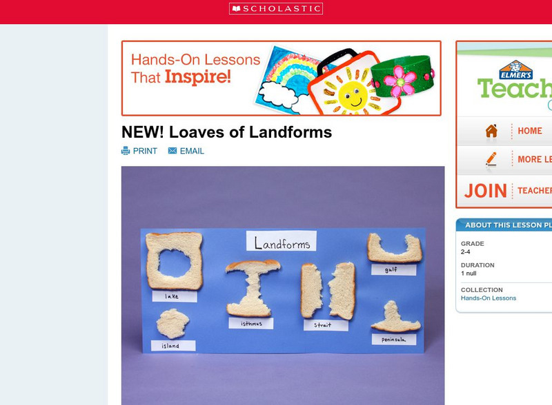
Scholastic: Loaves of Landforms!
A foundation in geography begins with an understanding of the terms geographers use to describe the features of Earth. This lesson is designed to help students grow their vocabulary and learn to recognize common landforms in a hands-on...
Khan Academy
Khan Academy: Mesoamerica
Civilization in Mesoamerica flourished and crashed repeatedly, giving rise to a distinctive worldview and some remaining mysteries. This article discusses the rise of early civilizations in this region.
Scholastic
Scholastic: Loaves of Landforms
This is a comprehensive lesson plan to teach primary students about landforms. A foundation in geography begins with an understanding of the terms geographers use to describe the features of Earth. Help students grow their vocabulary and...
A&E Television
History.com: Vasco Nunez De Balboa
A short biography of Vasco Nunez de Balboa, a Spanish explorer, who is credited with sighting the Pacific Ocean while crossing the isthmus of Panama.
PBS
Pbs Teachers: Expedition Panama: Bridge That Changed the World
Investigate the Coriolis effect on the directional flow of currents by measuring linear speeds at different places on the globe. Create a timeline demonstrating geologic time.
Mariners' Museum and Park
The Mariner's Museum: Vasco Nunez De Balboa
A biography of the life of explorer Vasco Nunez de Balboa.
Curated OER
Educational Technology Clearinghouse: Maps Etc: The Barbary States, 1802 1805
A map of the Mediterranean Sea region showing the Barbary States and southern Europe at the time of the Tripolitan War (First Barbary War - 1801-1804) between the United States and the North African Ottoman Empire regencies. The map...
Curated OER
Educational Technology Clearinghouse: Maps Etc: Newfoundland, 1903
A map from 1903 of the Canadian province of Newfoundland, showing cities, towns and ports, railways, lakes, rivers, and coastal features, as well as the coastal districts of White Bay, Bonne Bay, Bay of Exploits, Bonavista Bay, St....
Curated OER
Nova Scotia, New Brunswick, Prince Edward Island, and Newfoundland, 1903
A map from 1903 of the Canadian Maritime Provinces of New Brunswick, Nova Scotia, Prince Edward Island, and an inset of Newfoundland. The map shows province and county borders, rivers, cities, and railroads. "New Brunswick, a province of...
Other popular searches
- Land Forms Lakes Isthmus
- Isthmus of Panama
- Isthmus Geography
- Isthmus Panama
- Isthmus of Suez
- The Isthmus of Panama


