Other
Sacred Destinations: Cities of Italy Map
Use this interactive map of Italy to take a virtual tour of the major cities and sights found in Italy. Click on any of the hotspots to get pop-up facts and photos.
Other
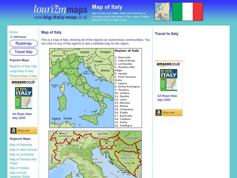
Tourizm Maps: Map of Italy
A map of Italy labeling the country's 20 different regions. Click on any region to get a full scale map of that specific area.
Other
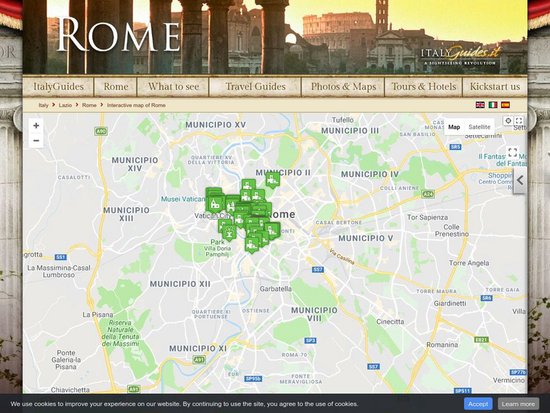
Italy Guides: Cities of Italy
Take a virtual tour of the many historic cities of Italy. Click on any city shown on the interactive map to view related facts and beautiful photos. Though a tourist site, the map and accompanying information is useful to anyone...
Lizard Point Quizzes
Lizard Point: Italy: Regions Quiz
Try this interactive geography quiz which tests your knowledge about the regions of Italy.
Franco Cavazzi
Roman empire.net: Roman Italy Map
This site from Roman-Empire.net is an interactive map of Roman Italy. Areas, Regions, Tribes, Towns, Cities, Rivers, Lakes, and Mountains can be searched for with pull-down menus.
University of Texas at Austin
University of Texas: Historical Maps of Italy
Review these two maps of Italy during the Renaissance from the Perry Castaneda Collection. Zoom in to see the details of a map of the Milanese under the Visconti and one of the Republic of Florence.
Other
Italy Guides: Rome
Welcome to the 'Eternal City' of Rome, Italy! Although this is a commercial site, the interactive city map along with beautiful photos and links to historic areas make this informative for both students and educators.
Other
Italy Guides: Venice
Welcome to the beautiful city of Venice, Italy! Although this is a commercial site, the interactive city map with its many incredible photos and links to historic sights make it a useful tool for both students and teachers to learn about...
United Nations
Unesco: Interactive Map of the Cities Along the Silk Roads
A map showing the locations of cities that participated in trade along the Silk Roads, stretching from Italy to Japan. Each red dot is provides information about the location and links to a UNESCO page with more in-depth information...
Nations Online Project
Nations Online: Italy
Offers a country profile and travel guide to beautiful Italy, background details, and numerous links to extensive information on the nation's culture, history, geography, economy, environment, population, news, government, and much more.
National Geographic Kids
National Geographic Kids: Find People and Places: Italy
Click-through facts-and-photo file about the geography, nature, history, people, culture, and government of Italy. Includes a map of this Western European country that pinpoints the location of this boot-shaped peninsula.
Franco Cavazzi
Roman empire.net: Roman Empire Map
This site from Roman-Empire.net provides an interactive map of the Roman Empire. The expanse of the empire can be viewed by dates. The site can be searched by Provinces, Territories, Tribes, Towns, Cities, or Barbarian Incursions.
Other
Italian Tourism: Discover Italy
Take a visual tour through the sights and regions of Italy. Click on the interactive map or a photo to access detailed information from throughout the country.
University of Calgary
U Calgary: Italy During the Decline of the Etruscan League and the Rise of Rome
A map showing the relative small size of Rome in relation to its neighbors in 380 BC. The Greek colonies are shown at the foot of the boot of Italy, the Etruscan League is to the north and the Italic Tribes to the east.
University of Oregon
Mapping History: European History
Interactive and animated maps and timelines of historical events and time periods in European history from Greek and Phoenician colonization up to the 20th century.
Other
The World of Dante: Map Images
Interactive map images from Dante's "Inferno." With reproduced maps of Italy from the time of Dante's life (1300s).
United Nations
Unesco: Longobards in Italy: Places of Power (568 774 Ad)
The Longoboards buildings reflect the accomplishments of the Lombards, a Germanic culture originally from northern Europe. These early medieval buildings are located across the Italian Peninsula and date from the 6th to 8th centuries....
BBC
Bbc History: Animated Map: The Italian Campaign
This animated map gives a good visual of the Italian Campaign which began in Sicily in 1943. Each map has a description of the action, a key is provided, and just the map animation can be replayed, or view the entire site again.
Curated OER
Science Kids: Science Images: Map of Italy
A map featuring Italy and its neighboring countries.
Curated OER
Etc: Maps Etc: Italy Divided by Augustus Into Eleven Regions, 7 Bc
A map of Roman Italy, or Italia in 7 BC, when, according to Pliny the Elder, Augustus Caesar divided Italia into eleven regions (regiones), Latium et Campania (I), Apulia et Calabria (II), Lucania et Brutii (III), Samnium (IV), Picenum...
Other popular searches
- Map of Italy
- Blank Map of Italy
- Choropleth Map of Italy
- Choropleth Map for Italy
- Physical Map of Italy
- Landforms Map of Italy
- Map of Renaissance Italy
- Worksheet Map of Italy
- Printable Map of Italy
- Choropleth Maps Italy
- Outline Map of Italy
- Renaissance Italy Maps


