Curated OER
China Quest
Read and research information on China. Young researchers complete a knowledge hunt about China then locate and describe each location using directional words. They recognize the word meaning through context clues and application practice.
SeaWorld
Animal Migrations
Here is a fabulous set of activities for your young scientists. Each lesson contains map, hands-on, and game activities that will help the class understand why and how animals migrate from one place to another. First they'll examine the...
Curated OER
On the Road Again
Students trace the migration route of a gray whale. They color and label a map of North America, and using photocopy pictures of a gray whale, they move the whale along the migration route over a ten week period.
Curated OER
The Country of Nigeria - Map Work
In this map worksheet, students label 14 items on a map of Nigeria. They follow directions to label and color Nigeria, and the water-bodies and countries that surround it.
Curated OER
Mapping Japan
In this Japan worksheet, students label cities, islands, seas, and more. Students label 11 different areas of the country of Japan.
Curated OER
Creating a Map of France
In this crating a map of France activity, students find and label important parts of France, bodies of water, mountains and surrounding countries.
Curated OER
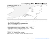
Mapping the Netherlands
In this Netherlands worksheet, students label cities, countries, landforms, and more. Students label 10 places in the Netherlands.
Curated OER
Mapping Brazil
In this Brazil worksheet, students label cities, oceans, and surrounding countries around Brazil. Students label and color 10 places.
Curated OER
Mapping the United States
In this map of the United States worksheet, students label mountains, surrounding countries, oceans, and more. Students complete 12 tasks.
Curated OER
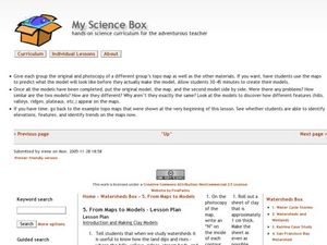
From Maps to Models
Fourth graders study topography maps and learn the importance of their contour lines. In this map lesson plan students create their own topography map.
Curated OER
States On A Map
Third graders locate the states of Main and Kansas on a map. In this state location lesson plan, 3rd graders read the book Sarah, Plain and Tall and discuss what states she traveled through.
Curated OER
Reading distance on maps
Eighth graders complete worksheets on reading the distance on maps in miles or kilometers. For this maps lesson plan, 8th graders use a calculator and ruler.
Curated OER
Printable Map of Arkansas
In this printable map of Arkansas worksheet, students see a clip art picture of the state of Arkansas superimposed on the map of the United States. The see the capitol city, Little Rock, labeled on the map. There are no directions given...
Curated OER
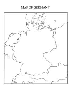
Map of Germany
In this map worksheet, pupils can color and label a blank map of Germany. This map show Germany and it's surrounding neighbors.
Curated OER
Kansas State Map
In this map of Kansas activity, students color and label major cities and physical features of this state. Students also study the location of Kansas in relation to the other states in the U.S. by studying the background map.
Curated OER
Indiana State Map
In this Indiana state map worksheet, students color and label the important cities and physical features on this outline map. Students also learn of Indiana's location in the U.S. by studying the background map.
Curated OER
Iowa State Map
For this Iowa state map worksheet, students color and label the important cities and physical features. Students also study the background map that shows the location of Iowa in the United States.
Curated OER
Maryland State Map
In this map worksheet, students will study a map of the Maryland. Students will use this map to label and/or familiarize themselves with various aspects of the state.
Curated OER
Maine State Map
In this map worksheet, students will study a map of the Maine. Students will use this map to label and/or familiarize themselves with various aspects of the state.
Curated OER
Louisiana State Map
In this map worksheet, students will study a map of the Louisiana. Students will use this map to label and/or familiarize themselves with various aspects of the state.
Curated OER
Kentucky State Map
In this map worksheet, students will study a map of Kentucky. Students will use this map to label and/or familiarize themselves with various aspects of the state.
Curated OER
Washington State Map
For this Washington map worksheet, students color and label the major cities and important physical features on the map. Students also study a second map that shows the location of Washington in the United States.
Curated OER
Antarctica Map
In this Antarctica worksheet, students study a very detailed map of this continent. Important features on this map are labeled.
Curated OER
Idaho State Map
In this Idaho state map activity, students color and label important physical features and cities. Students also study the background map to learn the location of Idaho as related to the rest of the U.S.
Other popular searches
- Map Labeling
- Africa Map Labeling
- Midwest Map Labeling
- Geography Map Labeling
- Labeling a Map Continents
- Blank Labeling Maps
- Labeling Maps Pangaea
- Labeling Map Parts


