Curated OER
Gridding a Site
Students establish a grid system over an archaelogical site. They label each grid unit. They determine the location of artifacts within each grid unit. They construct a scientific inquiry concerning the location of artifacts on the site.
Curated OER
Countries of the World
Students in a ESL classroom examine a world map and study the various countries' names. The study the cultures of selected countries and create a vocabulary list. Finally they label an empty map with the countries' names and a short...
Curated OER
Finding Your Spot in the World
Students practice locating places on a Thomas Brothers map. In this map skills lesson, students locate places on the map of where their ancestors are from and then practice finding various community places on a map. Students graph the...
Curated OER
The Birmingham River System
After a lesson on geography and the features of a river, students view a map of the Birmingham river system, which is in England. They are then asked to label 4 features on the map.
Curated OER
Where In the World Are You?
Fourth graders fill in blank copies of the United States Map and then the World Map.
Curated OER
Topography: Know the topography of your neighborhood
Middle schoolers read and identify features on a topography map. In this topography lesson plan, students learn how to read a topography map, and then go out and take pictures of their own and discuss the topography pictures they took.
Curated OER
The UK and the Republic of Ireland
In this maps activity, students label the cities and countries of the United Kingdom and the Republic of Ireland and answer a short answer questions. Students complete 4 activities.
Curated OER
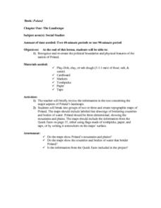
The Landscape of Poland
Students recognize and re-create the political boundaries and physical features of the nation of Poland. They create three dimensional topographic maps of Poland. In addition, they compose two journal entries written in two different...
Curated OER
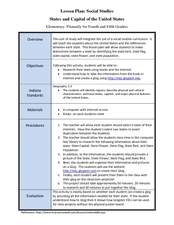
States and Capitals of the United States
Learners label states and capitals on a United States map and complete research on one of the states. In this states lesson plan, students fill in the states on blank maps.
Curated OER
Apple: Seed to Tree
Students grow seeds of an apple and learn about Johnny Appleseed. In this apples lesson plan, students map Johnny Appleseed's travels, learn how he got his name, compare different Johnny Appleseed books, and grow apple seeds themselves.
Curated OER
The Edge of the Lake
Second graders explore the geography of Nevada. In this map-making instructional activity, 2nd graders use salt dough to create a relief map of Nevada. Students label the landforms and bodies of water that are studied and specified in...
Curated OER
Partition of Africa Questions
In this colonial Africa activity, students study a map of Africa from 1885-1914. Students then respond to 9 short answer questions based on the information presented in the map.
Curated OER
Continents
Students investigate World Geography by researching the different continents. In this Asian Geography lesson, students discuss the continent of Pangaea and color a worksheet of the continents. Students locate China on the map worksheet...
Curated OER
Unnatural Scavenger Hunt
In this science observation scavenger hunt worksheet, learners use 10 riddles to find items hidden in an outside area then map the locations of each item.
Curated OER
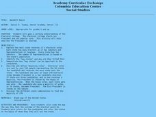
Majority Rules
Students color code a map of the United States and label the amount of Electoral votes each state has. In this Electoral College lesson plan, students conduct a vote of their own.
Curated OER
Africa - Not Just One Big Safari
Students draw a picture of an African city that is similar to a U.S. city and discover how other parts of the world have the same types of buildings. In this global similarities lesson, students create a map of an ...
Curated OER
Wild Animals in the World
In this wild animals worksheet, students answer multiple choice map questions, choose the correct animal names for the pictures, and more. Students complete 4 activities.
Curated OER
Hurricane Tracking
Students access the Internet to find information on current hurricanes. They get locations, speeds, and air pressures and then plot the location of the hurricane on a hurricane-tracking map. They also access the FEMA website to solve...
Curated OER
Settling the Plymouth Colony
Students label blank maps with the names of the New England Colonies. They explain the difficulties that the Pilgrims had and how hard they worked to survive in Plymouth.
Curated OER
Traveling on the Sea of Gold: An Adventure in Japan Through Literature
Learners explore the geography and culture of Japan through the story "Sea of Gold" by Yoshiko Uchida. They draw a travel poster of Japan, label a map of Japan, use chopsticks to eat Cheerios, read and discuss various books about Japan,...
Curated OER
The Influence of The Byzantine Empire on Russia and Eastern Europe
Students examine the influence on Russian and Eastern European language, religion, art, and architecture by the Byzantine Empire. They define key vocabulary terms, listen to a lecture and participate in a class discussion, and label a map.
Curated OER
The Persian Wars
In this Persian Wars worksheet, students read and complete a variety of activities including labeling a map (included), reading primary sources, and answering comprehension questions.
Curated OER
The Russian Revolution
Students complete a matching game based on geographic features of Russia and label a map with these features. In this geography and politics lesson, students identify resources and populations in Russia and complete a T-Chart on a video...
Curated OER
Move Around the Map
Fourth graders, while working with a partner, label and identify on a tarp map six major cities and five major rivers in Indiana. They traverse along the rivers utilizing a different locomotor skill (hop, skip, walk, run, leap, gallop,...
Other popular searches
- Map Labeling
- Africa Map Labeling
- Midwest Map Labeling
- Geography Map Labeling
- Labeling a Map Continents
- Blank Labeling Maps
- Labeling Maps Pangaea
- Labeling Map Parts


