United Nations
United Nations: Cartographic Section: Great Lakes Region (Map 1) [Pdf]
The United Nations offers this very clear map of part of the Great Lakes region in eastern Africa. The lakes, of course, are labeled, as are the rivers, major cities, and countries.
Other
International Journal of Wilderness: Don Aragon: Wind River Indian Tribes [Pdf]
A comprehensive article honing in on concerns for federal wilderness protection by learning from indigenous peoples, specifically the Eastern Shoshone and Northern Arapaho Indians in Fort Washakie, Wyoming.
Other
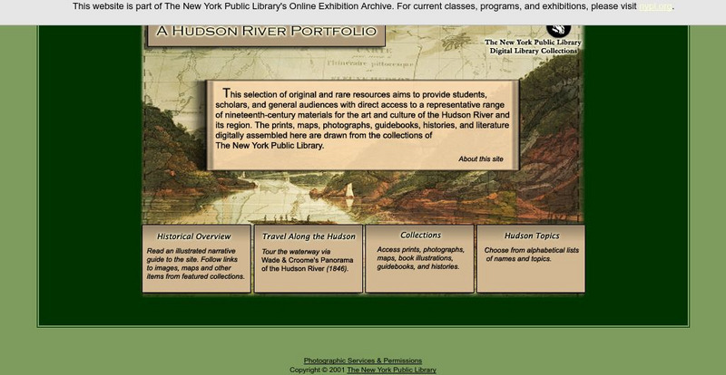
New York Public Library: A Hudson River Portfolio
Learn about the Hudson River and the role it played in the westward and northward expansion of America (to the Great Lakes regions and to Canada) in the nineteenth century. Useful for understanding the importance of rivers as means of...
Science Education Resource Center at Carleton College
Serc: Investigating Water Quality Through Quantative and Qualitative Analysis
By looking at the bottom dwelling macroinvertebrates, students will investigate water quality and habitat quality in this field lab. Students will record the number of creatures found at the bottom of a pond, lake, ditch, stream or river...
Other
Sos Children's Villages: Our Africa Geography and Wildlife
Our Africa is a project that allows the children of Africa to film their lives and their country the way they see them. This section summarizes the geography and wildlife and includes videos about forestry, the Nile, Lake Naivasha, and...
US Geological Survey
U.s. Geological Survey: Groundwater Information by Topic
A massive amount of information about groundwater. Topics covered include groundwater basics, humans and groundwater, groundwater quality, and its place in the water cycle. Includes true-and-false quiz and a Q&A section, as well as a...
Missouri Botanical Garden
Missouri Botanical Garden: Freshwater Ecosystems
At this site from the Missouri Botanical Garden, you can learn about the wide variety of plant and animal life in or around fresh water ecosystems. Click on the links to "wetlands," "Ponds and Lakes," or "Rivers and Streams" to view...
Other
Alberta Riparian Habitat Management: Protecting Shorelines & Streambanks [Pdf]
Protecting Shorelines & Streambanks - Naturally explains the critical importance of healthy shorelines for preventing soil erosion and filtering out pollutants. It looks specifically at riparian areas, such as those in Alberta, which...
Curated OER
University of Texas: Central Africa: Relief Map
A good relief map of the countries of Central Africa showing mountains, lakes, and valleys. Clicking on the map will enlarge it. From the Perry Castaneda Collection.
Curated OER
University of Texas: Democratic Republic of the Congo: Relief Map
An interesting map showing the relief of Democratic Republic of the Congo. See the highlands, lowlands, and rivers that cross this country. From the Perry Castaneda Collection.
Other
Pollution Probe: Mercury in the Environment [Pdf]
High levels of mercury exposure can cause birth defects, permanent brain or kidney damage, and/or death. This resource focuses on the impacts of mercury in the environment. Learn how mercury can reap havoc on lakes and other aquatic...
Other
Wildlands League
Wildlands League is a registered charity in Ontario, and a chapter of the Canadian Parks and Wilderness Society (CPAWS). It aims to preserve wilderness areas and the biological diversity of lakes, forests, rivers, grasslands and...
Other
Minnesota Lakes, Rivers and Streams
This site gives information about Minnesota rivers and streams, stream flow information, and recreational information as well.
State Library of North Carolina
N Cpedia: Lake Mattamuskeet
Lake Mattamuskeet-so named by Algonquian Indians-is North Carolina's largest natural lake. The ancient body of water has not escaped man's intervention. Originally, Mattamuskeet was a shallow, self-contained lake without creeks or rivers...
State Library of North Carolina
N Cpedia: Catawba River
Catawba River rises in the Blue Ridge Mountains of McDowell County, approximately 20 miles east of Asheville, flowing east-northeast above Hickory until turning southward into the massive Lake Norman Reservoir. It then continues south,...
Other
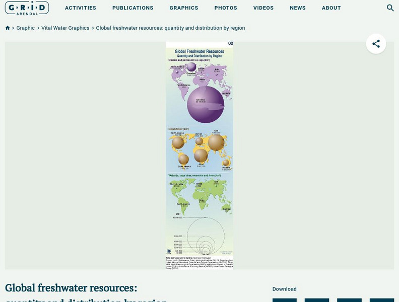
Grid Adrenal: Global Freshwater Resources: Quantity and Distribution by Region
Glaciers and icecaps contain approximately 70% of the world's freshwater, but groundwater is by far the most abundant and readily available source of freshwater. This graphic illustrates the quantity (in cubic kilometres) and...
Polk Brothers Foundation Center for Urban Education at DePaul University
De Paul University: Center for Urban Education: Reversing the Chicago River [Pdf]
"Reversing the Chicago River" is a one page, nonfiction passage about how the leaders of Chicago reversed the polluted Chicago River so that it emptied into the Mississippi River instead of the lake. It is followed by questions which...
Countries and Their Cultures
Countries and Their Cultures: Sara
"Sara" is the term employed by outsiders to refer to a group of non-Muslim tribes in southern Chad, all of whom speak mutually intelligible dialects. Each tribe is a distinct geographic, political, and endogamous entity. Major tribes are...
Countries and Their Cultures
Countries and Their Cultures: Palestinians
Palestinians inhabit an area east of the Mediterranean Sea and south of Lebanon. The Jordan River, Lakes Huleh and Tiberias, and the Dead Sea separate Palestine from Jordan. Christians refer to Palestine as "the Holy Land." Today...
Countries and Their Cultures
Countries and Their Cultures: Assyrians
Ancient Assyrians were inhabitants of one the world's earliest civilizations, Mesopotamia, which began to emerge around 3500 B . C . The Assyrians invented the world's first written language and the 360-degree circle, established...
Curated OER
Educational Technology Clearinghouse: Maps Etc: Albany and Vicinity, 1919
A map from 1919 of the vicinity of Albany showing neighboring counties, cities and towns, railroads, canals, lakes, and rivers.
Curated OER
Educational Technology Clearinghouse: Maps Etc: Albany and Vicinity, 1920
A map from 1920 of the vicinity of Albany showing neighboring counties, cities and towns, railroads, canals, lakes, and rivers.
Curated OER
Educational Technology Clearinghouse: Maps Etc: Twin Cities and Vicinity, 1922
A map from 1922 of the Twin Cities (Minneapolis and St. Paul) and neighboring counties. The map shows county boundaries and county seats, cities, towns, railroads, lakes, and rivers.
Curated OER
Etc: Maps Etc: United States and Neighboring Lands, 1920
A map from 1920 of southern Canada, the United States, and northern Mexico showing terrain features, lakes and river systems, and general vegetation types of the region. The map is keyed to show the submerged portion of the continental...
![United Nations: Cartographic Section: Great Lakes Region (Map 1) [Pdf] Graphic United Nations: Cartographic Section: Great Lakes Region (Map 1) [Pdf] Graphic](https://static.lp.lexp.cloud/images/attachment_defaults/resource/large/FPO-knovation.png)


