Curated OER
Land Formations
Second graders explore land formations. In this science lesson plan, 2nd graders develop an understanding of how land is naturally developed, investigate several land formations as well as earth science and chemical terminology, and ...
University of Georgia
Heating and Cooling of Land Forms
Compare heating and cooling rates of different land forms. A lab activity has groups collect data on the rate of heating and cooling of soil, grass, saltwater, fresh water, and sand. An analysis of the rates shows how the different land...
Curated OER
Lesson 2 Its a Small World (Day 2)
Students are able to explain how the water cycle recycles the earth's water supply. They are able to make use of the knowledge of land forms learned in social studies. Students are able to form a hypothesis on how/why the water cycle...
Curated OER
Landforms of Illinois
Fifth and sixth graders are introduced to the primary landforms of Illinois and discover how they were created. Landform cards are made for each pupil. They use the twenty-questions format until they have identified each one. Then,...
Curated OER
Land Assessment
Students work in small groups on a problem based learning activity. Students are presented with a problem of buying land to use for educational purposes only and must determine if it is feasible to buy it based on soil analysis and plant...
Curated OER
Ozark Karst: A Fragile Landform
Young geologists become familiar with the Karst Topography in the Ozark Mountains. They study how human activity has affected the cave ecosystem. They conduct a simulation in which a large development is proposed in the area, and they...
Curated OER
Marine Energy
In small groups, energy engineers research and make a topographic map of a marine natural resource. They report to the rest of the class pros and cons of extracting their assigned resource. The two activities may take up to four class...
Curated OER
Topographic Maps
Your choice of hands-on topographic mapping tasks is provided in this resource. From actual map-making to viewing and interpreting stereographic photos, the activities are sure to succeed. To make the most of this lesson, you will need...
Curated OER
Plate Tectonics
Students examine plate tectonics and landforms. In this plate tectonics instructional activity students complete an activity. Students practice drawing maps that show different fault lines and the land formations that were caused.
Curated OER
Plate Tectonics & Land Forms
Fourth graders discuss the different interactions of plates and the ways mountains are created. For this plate tectonics lesson students complete an activity in groups.
Curated OER
Who Are the Aliens in Our Inland Seas?
Students work in teams to research specific landforms in Great Lakes Watershed, compile information into data table, and write legend explaining landform for children's book. Students then research area surrounding landform, compile...
Curated OER
Geological Features: How Weathering & Erosion Help Create Landforms
Young scholars explore how the Earth's surface changes resulting in geological features and landforms. They perform a read-a-loud on Thomas
Locker's Mountain Dance, complete a KWL chart, and create a
landform using plaster of paris.
K20 Learn
Filling Our Land with Landfills: Solid Waste Disposal
New ReviewThough it comprises only 5 percent of the world's population, the US generates 40 percent of the world's waste. Scholars learn about landfills, their safety, and other solid waste methods. They use experiments and research to learn more....
Space Awareness
Meet Our Home: Earth
Earth is a complex structure. Learners explore their home, the earth, using a fun hands-on activity. They create tactile models of the earth using ordinary household materials that represent some common features: land, polar caps,...
Polar Trec
Where in the World Is Our Teacher?
Kirk Beckendorf, a middle school teacher, joined researchers at the McMurdo Station in Antarctica to help maintain automatic weather stations. The lesson encourages pupils to track his travels around the region. They connect with the...
Curated OER
Water Works Wonders
Students examine where water is found in the world, how we use it, and the various forms it takes. They observe the refraction of light through a prism, record the day and night sky over a week's time, and create a topographic model of...
Curated OER
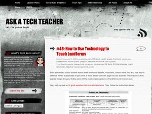
How to Use Technology to Teach Landforms
Students create a landform table on the computer. In this geography instructional activity, students use Microsoft Word to design a 3 column table. They list different landforms, examples, and attach a picture of each.
Curated OER
Wet Water, Dry Land
Students observe and examine relationship between landforms and bodies of water, recognizing differences between them. Students then define island, peninsula, isthmus, archipelago, lake, bay, straight, system of lakes, and identify land...
Curated OER
Sanctuary: Quail Island Banks Peninsula
Students explore world geography by creating a 3D diorama. In this New Zealand land form activity, students examine color images of New Zealand's wildlife and discuss the different elements inside them. Students utilize these images to...
Ocean Explorer
Easy as Pi
Seamounts are large, extinct volcanoes that rise up from the bottom of the ocean floor. They are a relatively new landform in the scientific community, and this activity invites students to learn about the amazing diversity of life found...
Curated OER
Forces of Change
Second graders discuss various ways in which landforms change over time. They, in groups, research and create a reference book about landform change including tsunamis, earthquakes, weathering, erosion and volcanic eruptions.
Messenger Education
Look But Don’t Touch—Exploration with Remote Sensing
Mars is home to the tallest mountain in our solar system, Olympus Mons. In this set of two activities, learners review geologic land formations through the analysis of aerial maps. They then apply this knowledge to aerial maps of objects...
Curated OER
Creating a 3d Model and Corresponding Topographic Map
Students create a landform model and topographic map. In this topography lesson, students use a real landform to create a model and topographic map to scale.
Curated OER
Landforms Slideshow
Students identify twelve different types of landforms, and create a slideshow about each landform that includes a title, pictures, definitions, conclusions and a reference page.
Other popular searches
- Landform Maps
- France Geography Landform
- Landform Map of Virginia
- Landform Vocabulary
- Geography Land Forms
- East Asia Land Forms
- Geographic Land Forms
- Landform Change
- 3d Models Land Forms
- Landform Regions of Canada
- Land Forms in Egypt
- Ocean Land Formations


