Curated OER
Location
Students explore the tools used by Columbus to chart his latitude. They study the change of a location over time.
Curated OER
Cookie Topography
Students construct a cross section diagram showing elevation changes on a "cookie island." Using a chocolate chip cookie for an island, they locate the highest point in centimeters on the cookie and create a scale in feet. After tracing...
Curated OER
Problems Encountered by Surveyors of Arkansas
Fifth graders examine the six geographic regions of Arkansas by examining the problems encountered by surveyors in Arkansas after the Louisiana Purchase. They conduct Internet research, create a chart, and write an essay comparing two...
Curated OER
You Gotta Know the Territory
Pupils examine the relationship between Native Americans and those who settled the Iowa territory. In this Iowa history lesson, students investigate the process for settling the territory and how intercultural relationships developed...
Curated OER
Teachers' Notes: Switch Gets Ready!
Students practice multiplication facts, answer simple math questions from two, five, and ten times-tables, explore concept of halves and quarters, complete worksheet containing range of shapes to make shape picture, and sort data and...
Curated OER
Faulty Movement
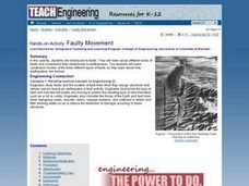
Students discover the faults throughout the Earth. They describe the different types of faults and how they are related to earthquakes. They build models of the faults.
Curated OER
Earthquakes
Students observe the melting of ice. In this phase change instructional activity, students observe ice as it melts. They discuss the process and create a Venn diagram comparing water and ice.
Curated OER
Where Is That Place?
Students determine the difference between a country, state, and a city while recording the weather conditions for their school in Nebraska. They examine weather for another school in the state while practicing using weather equipment to...


