Curated OER
Over and Through Information Sheet
Eager earth scientists practice using vocabulary related to landforms and bodies of water. On the first page they categorize the terms and form sentences with them. Then, they test their knowledge with twenty-five multiple-choice...
Curated OER
Landforms and Bodies of Water
A simple worksheet helps your learners with geographic terms. This could be used as a template for future worksheets which have learners identify some geographic terms, then complete an essay about one of the terms.
Curated OER
Landforms and Bodies of Water Memory Game
In this matching or memory game instructional activity, students cut out two of each picture of labeled landforms and bodies of water and match them. Students match 24 pictures.
Curated OER
Landforms - Landform Types (Matching)
In this landforms worksheet, students match land forms with their definitions. Students complete 11 matches total on this worksheet.
Curated OER
The Country of Chile - Map Work
In this map activity, students label a map of Chile by following 11 directions given at the bottom of the page. They label landforms and water bodies associated with the country.
Curated OER
Asia Physical Map
In this Asia physical map instructional activity, students make note of the major landforms and bodies of water located on the continent.
Curated OER
Americas: Physical Map
In this Americas physical map worksheet, students make note of the major landforms and bodies of water located on the North American and South American continents.
Curated OER
Geography Challenge
In this geographical features worksheet, students read the 10 statements about geographical features. Students select the correct to complete 10 statements.
Curated OER
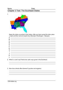
Chapter 3 Test: The Southeast States
In this geography worksheet, students complete a test about the southeastern United States. They name the states, tell about the climate and crops, complete a matching activity about the landforms. and another about the industry.
Curated OER
U.S. Geography for Children: The Northeast
In this map skills of the northeastern United States worksheet, students observe an outline map, locate and label the states, and designated landforms and bodies of water; and create symbols and a map key for sources of economy and other...
Curated OER
U.S. Geography for Children
In this U.S. map activity worksheet, students observe maps of the continental United States, Hawaii, and Alaska, locate and label landforms and bodies of water, and create symbols for natural resources and places of interest. Students...
Curated OER
The Country of Venezuela
In this map skills of Venezuela worksheet, students use an outline map to find an label important cities landforms, and bodies of water. Students label and color code 10 answers.
Curated OER
Eurasia Physical Map
In this Eurasia physical map worksheet, students make note of the major landforms and bodies of water located in this world region.
Curated OER
Australia and Oceania: Physical Map
In this Australia and Oceania physical map worksheet, students make note of the major landforms and bodies of water located within this region.
Curated OER
South America: Physical Map
In this South American physical map worksheet, students make note of the major landforms and bodies of water located on the continent.
Curated OER
Europe Physical Map
In this Europe physical map worksheet, students make note of the major landforms and bodies of water located on the continent.
Curated OER
USA: Physical Map
In this United States physical map worksheet, students investigate the major landforms and bodies of water located throughout the country.
Curated OER
Africa & Asia: Physical Map
In this African and Asian physical map worksheet, learners investigate the major landforms and bodies of water located on the African and Asian continents.
Curated OER
Map of Italy
In this map of Italy worksheet, learners find, color and label cities, surrounding countries, bodies of water and landforms in the country of Italy.
Curated OER
Australia Outline Map
In this Australia and Oceania outline map instructional activity, students make note of the major landforms and bodies of water located within this region.
University of Miami
What is it? Weathering, Erosion, or Deposition?
Just as rocks move through the rock cycle, your giddy geologists will move descriptions around until they are all in the correct category. After cutting out several types of rock movement, learners determine whether the action is...
Curated OER
Kinds of Maps
In this map worksheet, students match a set of descriptions with the names of different types of maps and answer true/false questions and short answer questions about using maps.


