Curated OER
Chandra Spies the Longest Sound Wave in the Universe!
In this black hole activity, students use an x-ray image and a sound waves image to determine the size and the wavelength of the sound wave. This activity has 3 problems to solve.
Curated OER
Imagery on Fabric
Students practice placing images on their completed quilts. Using their quilt they made in an earlier lesson, they print off photographs from a printer and use heat to transfer them to the fabric. They share their quilts with the class.
Curated OER
An application of the Parallax Effect
In this parallax effect activity, students observe 2 photographs taken of an active area of the sun by 2 STEREO satellites and 1 photograph taken of the same active area of the sun by the SOHO satellite. Students observe the shift in...
Curated OER
Earths Waters
Students research Everglades National Park, Three Gorges Dam, Hoover Dam, Roaring 40s, and Mariana Trench. After reviewing the sites, they choose one to illustrate a postcard with an image on one side and a description of the site on...
Curated OER
Global Greenup
Students utilize satellite images to track the life cycle of vegetational growth over a large area. Animal migratory patterns are compared to this cycle.
Curated OER
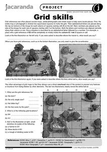
Grid Skills
For this geography worksheet, students use grid references on a map to locate places in the pictures given. They also identify another advantage of using a grid map, which they have an overhead view of the content to prevent any features...
Curated OER
Geography: examining the Glacial Features of Cape Cod
Students examine satellite images of the glacial features of Cape Cod. They analyze where human activity is located in terms of those features. Students make models of the features, including kettle holes. They also use contour maps...
Curated OER
The Hand of Chandra!
For this nebula worksheet, students read about the Chandra X-ray Observatory that captured the given image of a pulsar and its nebula. Students solve 3 problems including using similar triangles and proportions to find the image width,...
Curated OER
Dangerous Waters (and Lands)
Young scholars investigate the dangers of various geographical locations and the threat they pose to humans and other living things. They, in groups, research dangerous geographical locations and create a group "front page" highlighting...
Curated OER
Seeing Solar Storms in STEREO-I
In this geometric calculations of solar storms activity, students use a diagram indicating the location of 2 STEREO satellites, the earth and the sun to calculate the distance between a Coronal Mass Ejection and the Earth. They use...
Curated OER
Asteroids!
Middle schoolers explore how to visually identify asteroids in SDSS images. They are able to explain that stars are so far away that they do not appear to move, even over the course of a human lifespan. Students identify the location...
Curated OER
Construction Starts on Freedom Tower
Students are introduced to an image of Freedom Tower, then read a news article about the construction of this building that will be completed in 2011. In this current events lesson, the teacher introduces the article with an...
Curated OER
Follow the Leader
Students examine the roles of national leaders and the three branches of government and their duties. They view and discuss the images on the South Dakota Quarter Reverse transparency, complete a worksheet, and create a mobile of the...
Curated OER
Magical Metamorphosis
Students explore the life cycle of the butterfly and the process of metamorphosis through the creation of painted life cycle habitat. They place each part of the cycle in the correct location through the use of a visual diagram.
Curated OER
Small European Countries
Learners examine the advantages and disadvantages of being a very small European country in today's world. They locate each country on a map using the coordinates, discuss the governments of each country, and develop a list of...
Curated OER
Our 50 States
Students identify the location of the 50 states using an interactive map. They practice geography skills by playing a fun game. Pupils become familiar with the state abbreviations for the US states. Students become familiar with the...
Curated OER
Design an Island
Students explore islands. They create a two- or three-dimensional map of an island. They explain how the topography of an area influences the location of water sources, ecosystems, and human settlements. Lesson includes adaptations for...
Curated OER
Describe My City
Students explore the functions of cities by creating a visual image of their own neighborhood. Students diagram, list, and label the major businesses and cultural areas of the neighborhood where they grew up, then write a letter to a...
Curated OER
Welcome to My World!
Students use maps to locate information. They read the story, "It Looked Like Spilt Milk", view images of the continents and discuss the various continents. Afterward, they make their own Atlas to record information that they can later...
Curated OER
Cities and Seasons
Students explore how satellite images show seasonal changes in seven cities in North and South America. Through a sequence of images, they study the green-up and brown-down of the seasons and how seasons change over time. Afterwards,...
Curated OER
Students Slide to School on Air-Powered Sled
Students locate the Great Lakes on a US map, then read a news article about a sled being used as a wintertime school bus in Wisconsin. In this current events lesson, the teacher introduces the article with a map and vocabulary activity,...
Curated OER
6: Parts of a Flower
Students draw and label the parts of a flower using a coin from the Northern Mariana Islands. For this flower parts lesson, students look at a transparency of the reverse side of a quarter from the Mariana lslands. They discuss the...
Curated OER
Map Your State: Regions of Arizona
Fourth graders define vocabulary and locate physical features on maps. In this mapping activity, 4th graders explore regions of Arizona through landforms found on topographic maps. Students research the history and culture of...
Curated OER
Craters on the Moon
In this moon craters instructional activity, learners use a high resolution image of the lunar surface and calculate the image scale in meters per millimeter. They use the image scale to find the largest crater in the image, the smallest...


