Curated OER
Degrees and Minutes
In this latitude and longitude learning exercise, learners place 9 cities on a map using the latitude and longitude of each. Once cities are placed in the correct location, students complete 2 short answer follow-up questions.
Curated OER
Viewpoints
In this latitude and longitude worksheet, students complete 10 matching questions identifying key features or locations on a map. Students also use lines of latitude and longitude to identify the time in 4 different places.
Curated OER
Latitude
In this latitude worksheet, students answer questions about latitude that include absolute locations of countries and coordinates. Students complete 12 questions.
Curated OER
Plotting Earthquakes and Volcanoes
In this earthquakes and volcanoes worksheet, students are given the latitude and longitude of earthquakes and volcanoes and they plot them on a world map. They answer questions based on their results.
Curated OER
Global Wind Patterns Notes
In this global wind patterns worksheet, students take notes on the wind patters in the southern and northern hemispheres. They indicate the latitude the winds occur at, the pressure, the characteristics and the direction the wind moves....
Curated OER
Design Your Own Imaginary Continent
In this continent worksheet, students design their own continent and include latitudes, mountain ranged, river, wind patterns, and temperature highs and lows. They also include a variety of cities in specified locations.
Curated OER
Mapping Worksheet #1
Get out the compass and a pencil its time to use a coordinate grid to practice mapping skills. Young cartographers use the prompts and provided grid to plot locations, draw parallel lines, and determine distances between points.
Curated OER
Seasons and Day Time
Learners label a diagram of the Earth rotating about the sun and indicate the direction of the rotation and the seasons at each location. They indicate the seasons, the poles, the hours of daylight at each pole, the direction of rotation...
Curated OER
The Sun's Path
Starting with questions about the tilt of the Earth and apparent motion of the sun, a worksheet provides instructions on how to figure the paths of the Sun on certain dates. Learners answer three more questions, complete with...
Curated OER
Regents High School Examination: Physical Setting Earth Science 2009
In this earth science worksheet students complete a series multiple choice questions. There are 85 questions that include diagrams.
Curated OER
Google Earth
In this Google Earth worksheet, students access the Google Earth website and find the latitude, longitude, and elevation for their house and school. Then they do the same for a variety of world locations. This worksheet has 10 fill in...
Curated OER
States and Capitals - Lesson 4 - U.S. Political Map
In this U.S. state capitals worksheet, students identify the capital cities of the 50 states using the latitude and longitude coordinates provided.
Curated OER
Student Exploration: Summer and Winter
In this recognizing the seasons online/interactive worksheet, students explore the Earth's positions and determine the summer and winter season. Students answer 21 short answer questions
Curated OER
Earth Viewer Welcomes You- Web View of the Earth
In this science and Internet technology worksheet, students access the given web site to look at a current view of the Earth's surface. They enter longitude and latitude co-ordinates before answering 8 questions. They change the...
Institute for Geophysics
Understanding Maps of Earth
Here is your go-to student resource on primary geography concepts, including facts about the surface of the earth and its hemispheres, latitude and longitude, globes, types of maps, and identifying continents and oceans.
Statistics Education Web
What Percent of the Continental US is Within One Mile of a Road?
There are places in the US where a road cannot be found for miles! The lesson asks learners to use random longitude and latitude coordinates within the US to collect data. They then determine the sample proportion and confidence interval...
Curated OER
Parallels and Meridians
For this parallels and meridians worksheet, learners read about parallels and meridians and answer questions about lines of latitude and longitude. Students complete 8 problems.
Curated OER
Earth Science
In this earth science worksheet students complete a series of multiple choice and short answer questions on the different moon phases, gravitational pull and the earths layers.
Curated OER
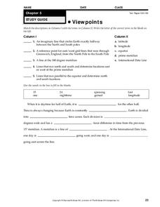
Viewpoints
In this map worksheet, learners review latitude, longitude, equator, and prime meridian. This worksheet has 5 matching and 8 fill in the blank questions.
Owl Teacher
Introduction to World of Geography Test
Assess your learners on the five themes of geography and the most important key terms and concepts from an introductory geography unit. Here you'll find an assessment with 15 fill-in-the-blank and 14 multiple-choice questions, sections...
Curated OER
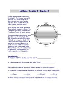
Globe Lesson 7 - Parallels and Meridians - Grade 6+
In this parallels and meridians worksheet, students read a 2-paragraph review of parallels and meridians and respond to 7 short answer questions.
Curated OER
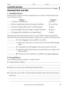
Viewing Earth and Sky
In this earth and sky worksheet, students review terms associated with map reading. Students also review topographic maps and how contour lines represent elevation. This worksheet has 5 matching, 5 true or false, 5 fill in the blank, and...
Curated OER
Plotting Earthquakes
In this earthquakes worksheet, students access a website to gather information about the magnitude and location of earthquakes for 5 days. Then students complete 7 short answer questions.
Curated OER
Globe Lesson 9 - Around the World - Grade 6+
In this geography skills worksheet, students read 5-travel scenarios and use their problem solving skills to respond to 9 short answer questions.
Other popular searches
- Latitude and Longitude
- Latitude Longitude
- Latitude and Longitude Games
- Latitude & Longitude
- Latitude and Longitude Maps
- Longitude and Latitude Game
- Longitude and Latitude Math
- Geography Latitude Longitude
- Whaling Latitude Longitude
- Longitude Latitude Minutes
- Longitude and Latitude Lines
- Volcano Latitude Longitude


