Curated OER
The Brief American Pageant:The Triumphs and Travails of the Jeffersonian Republic
Add these slides into your lecture about the Jeffersonian Era in American history. Slides detail the results of the Presidential Election of 1800, four Barbary states of North Africa (Morocco, Algeria, Tunisia, and Tripoli) and the...
Curated OER
Beyond Louisiana
Eleventh graders examine the challenges that faced United States as a new nation. In this American History lesson, 11th graders study the chronology of events leading up to the expedition of Lewis and Clark. Students organize...
American Battlefield Trust
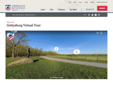
Gettysburg Virtual Tour
Step into one of the most iconic battlefields of the American Civil War with an educational interactive resource. Young historians learn about key moments, locations, soldiers, and turning points in the battle with a clickable map and...
Curated OER
Geography: How do Louisiana Rice Farmers Help the Environment after they Harvest Rice?
Third graders study maps of the United States locating Louisiana, the East Coastal Plain, the Mississippi Alluvial Plain, the West Gulf Coastal Plain, and five of the main rivers. In this geography instructional activity, 3rd...
Global Oneness Project
Then and Now
The devastating changes happening to the Native American inhabitants of an island off the coast of Louisiana are the topic of an informational lesson. After scholars break into groups to explore particular topics, they come back together...
Curated OER
Louisiana Parishes
Students research a parish in Louisiana. They research things such as: what makes that parish different from others, major cities, what is the land like there, are there any bodies of water, what is the population, are their any colleges...
Curated OER
The War of 1812
You won't find a better worksheet than this! Here is a fabulous, comprehensive test on the War of 1812. Learners complete 50 questions of a wide variety; true or false, matching, fill-in-the-blank, multiple choice, and essays. They must...
Curated OER
The Wild Wild Mid-West
Eleventh graders examine reasons for Louisiana Purchase and identify those who played key roles in it, create map of Louisiana Purchase and states that are part of it, and analyze overall importance of Louisiana Purchase.
Curated OER
A-Z List
Learners practice using vocabulary terms about the Louisiana Purchase by creating a picture dictionary, an ABC book of terms, a word sort, or a game. Each project should include people, places and terms as they relate to the Louisiana...
Curated OER
Defining a Cultural Region Worksheet
In this cultural regions worksheet, students click on the webpage names listed to find information about the different cultures and cultural regions in Louisiana that may be used for research purposes.
Curated OER
Living Swamps, Bayous and Forests
Third graders explore interesting environments by exploring Louisiana. In this wetland lesson, 3rd graders utilize the web to research the State of Louisiana, the bayous in the area, and the Gulf of Mexico. Students write a journal entry...
Curated OER
Grade 8 Unit 4
Eighth graders analyze aspirations and ideals of the people of the new nation, in terms of its physical landscapes and political divisions, and the territorial expansion of the United States during the terms of the first four presidents.
Curated OER
Territory and Statehood of Iowa
Fifth graders recognize the steps to create a territory, a district and a state. In this Iowa activity, 5th graders discuss the three capitals and their importance. Students recognize the key people in the development of...
Curated OER
Lesson 2 Activity 2: In the Wake of Lewis and Clark
Students study the route of Meriwether Lewis and iam Clark's travels and the important events in their journey. They mark the sites on a map and then plan a trip along part of the route.
HISTORY Channel
Westward Expansion of the United States
How did early American pioneers decide what to take with them on their journeys, and what was their traveling experience like? Here you'll find a collection of activities to help you explore Westward Expansion with your young learners.
Louisiana Department of Education
Comprehensive Curriculum Social Studies (Grade 7)
US history from 1776 through 1877 is the focus of a comprehensive curriculum guide designed for seventh graders. Each of the seven units in the 102-page packet includes a list of guiding questions, grade-level expectations, links to...
Curated OER
Cardinal and Ordinal Directions
Learners use a compass to locate cardinal and ordinal directions. In small groups, they describe and create a journey for their classmates using their compass. Groups create a scale map for their classmates to follow and relate this...
Curated OER
Westward Expansion
In this westward expansion worksheet, students read and assess comprehension. In this short answer, matching, and timeline worksheet, students write answers to twenty-five questions.
Curated OER
Build a U.S. Strategy for Responding to the Crisis in Sudan
Students work together in groups to discover the situation in Sudan. They discuss what problems arise from helping a foreign country. They answer questions and watch a video as well.
Port Jefferson School District
Hurricane Katrina
Young scientists track Hurricane Katrina across the Atlantic Ocean as they learn about these destructive forces of nature. Provided with a table of data tracking the location and conditions of Katrina over a one week span, learners...
ReadWriteThink
Biography Project: Research and Class Presentation
I Have A Dream ... that after the lesson, all individuals master the reading, writing, researching, listening, and speaking skills the biography project helps them develop. Martin Luther King, Jr. serves as a topic example for a model...
Curated OER
Our Goal Pole
Studnets discuss the meaning of exploration and investigate a map of the Louisiana Territory. They discuss Lewis and Clark's expedition and complete worksheets. They create a "goal pole" that represents their learning.
Curated OER
Rice Farming History
Second graders map the progress of rice farming by using a map of the United States. In this rice farming lesson plan, 2nd graders draw a line on the map from where rice farming started to the progression of its growth.
Curated OER
Why Do Geese Fly South For the Winter?
Fifth graders examine migration by tracing animal migration routes on a map. In this animal life lesson, 5th graders observe a map of North America and read about the migration patterns of geese. Students trace the path most...

