K12 Reader
Water Carves the Land
What affect do bodies of water have on the world around us? Kids can find out by reading this passage. After reading, they answer five questions related to the text.
National Institute of Open Schooling
Water Pollution
Fifteen million children under the age of five die each year due to diseases in their drinking water. Water pollution is the topic of lesson 34 in the series of 36. Scholars, through reading and discussing, study numerous aspects of...
Curated OER
Learning About Watersheds
In this learning about watersheds worksheet, students answer 15 questions using links to web resources about water use in their community. This page includes numerous links to helpful websites.
Curated OER
Body Parts, Systems & Functions
In this body parts instructional activity, students match words to definitions, categorize organs into systems, name functions of organs, and more. Students complete 5 activities.
Curated OER
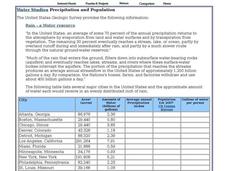
Water Studies: Precipitation and Population
In this water worksheet, students complete the chart about precipitation and population and answer short answer questions. Students complete 14 rows in the chart and answer 4 questions.
Curated OER
Cities Near Water Quiz
In this online interactive geography quiz activity, students respond to 18 identification questions about world cities located near water. Students have 4 minutes to complete the quiz.
Curated OER
World Rivers
For this world rivers worksheet, students match 20 major world cities on the left side of the sheet to the rivers that they lie on found on the right side of the sheet.
Curated OER
Major Lakes of North America
In this North American learning exercise, high schoolers explore the locations of the major lakes on the continent. The map may be used for a variety of geography lessons.
Curated OER
Asia Physical Map
In this Asia physical map instructional activity, students make note of the major landforms and bodies of water located on the continent.
Ms. Catsos
Ancient Rome Map Worksheet
It wasn't just the great leaders of ancient Rome that shaped their civilization—the geography of the region played a major role as well. After first identifying major land masses, bodies of water, and city states on a map of Europe,...
Curated OER
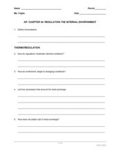
AP: Chapter 44: Regulation of the Internal Environment
When nature calls, you need to answer. Physiology learners discover that it is a just your body's way of regulating pressure and water content. Along with osmoregulation, they also examine thermoregulation, two vital processes with which...
Curated OER
Southeast Asia and the South Pacific: Political
In this Southeast Asia and the South Pacific political map worksheet, students examine boundaries of each of the countries and the placement of the capital cities. The major bodies of water are labeled.
Curated OER
Asia and the South Pacific : Political Map
In this Asia and the South Pacific map worksheet, students examine the boundaries of the nations in this region of the world. Students also note the location of capital cities as they are denoted by stars. Major bodies of water are labeled.
Tracy Pendry
Cardiovascular/Circulatory System
Explore the circulatory system with a cardiovascular pump activity that promotes discovery and discussion as class members create a functioning model of the heart. Continue the learning process through a web quest showcasing the...
Curated OER
Eurasia Physical Map
In this Eurasia physical map worksheet, students make note of the major landforms and bodies of water located in this world region.
Curated OER
Australia and Oceania: Physical Map
In this Australia and Oceania physical map worksheet, students make note of the major landforms and bodies of water located within this region.
Curated OER
South America: Physical Map
In this South American physical map worksheet, students make note of the major landforms and bodies of water located on the continent.
Curated OER
Europe Physical Map
In this Europe physical map worksheet, students make note of the major landforms and bodies of water located on the continent.
Curated OER
USA: Physical Map
In this United States physical map worksheet, students investigate the major landforms and bodies of water located throughout the country.
Curated OER
Americas: Physical Map
In this Americas physical map worksheet, students make note of the major landforms and bodies of water located on the North American and South American continents.
Curated OER
Africa & Asia: Physical Map
In this African and Asian physical map worksheet, learners investigate the major landforms and bodies of water located on the African and Asian continents.
Curated OER
Australia Outline Map
In this Australia and Oceania outline map instructional activity, students make note of the major landforms and bodies of water located within this region.
Institute for Geophysics
Understanding Maps of Earth
Here is your go-to student resource on primary geography concepts, including facts about the surface of the earth and its hemispheres, latitude and longitude, globes, types of maps, and identifying continents and oceans.
Curated OER
Maintaining the Internal Environment
Explore homeostasis in animals with this all-encompassing learning exercise. Advanced biology pupils consider a variety of mechanisms for maintaining internal conditions such as temperature and waste products. Eighteen short-answer...


