Curated OER
Major American Water Routes
Sixth graders locate and identify the major bodies of water and waterways in the United States. Through a simulation activity, they describe how early explorers would have described their surroundings. Working in groups, they create...
Space Awareness
Continental Climate and Oceanic Climate
There's nothing better than a cool breeze blowing in from the ocean. Scholars explore how water affects change in temperature using a hands-on experiment on climate. They use measurement tools to compare the continental and oceanic...
Curated OER
Water: Where in the Watershed?
Students become connected to their watershed by exploring a local water body and mapping its features. They focus on how the local watershed fits into the larger scheme of the watershed.
Curated OER
Water Quality Testing
Student explore factors affecting ecosystems. They test local water samples for pH level. After creating a methodology for data collection, they collect data, compare results, and draw conclusions based upon results.
Curated OER
Water Cycle (Grades 2-4)
Students demonstrate their understanding of the water cycle and how it effects the environment by graphically depicting and describing the water cycle.
Curated OER
Malta: The Landscape
Learners work in small groups to create a topographic map of Malta. They must include labeled line drawings of bordering countries and bodies of water. Students use salt and flour clay to make Malta three dimensional, showing the nearest...
NASA
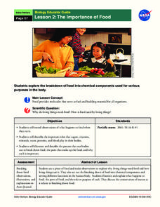
The Importance of Food
Pupils make observations while eating food. They act out the process of food breaking down in the body and the roles of various chemical components, such as sugar and protein. It concludes with an activity illustrating the process and a...
Centers for Ocean Sciences
Ocean and Great Lakes Literacy: Principle 1
Is your current lesson plan for salt and freshwater literacy leaving you high and dry? If so, dive into part one of a seven-part series that explores the physical features of Earth's salt and freshwater sources. Junior hydrologists...
Curated OER
Microscopic Water Life
Young scholars use a light microscope to observe the organisms living in a sample of ocean or fresh water. Students create a drawing of the organisms that they observe. Young scholars then discuss the different body plans of the...
Curated OER
Mapping Landforms of South Carolina
Third graders analyze South Carolina maps. In this geography lesson plan, 3rd graders locate the five land regions in the state are and discuss how the regions are different. Students identify the major bodies of water and analyze how...
Curated OER
Where is the Water?
Students explore freshwater ecosystems. For this geography lesson, students brainstorm all the lakes and rivers they know then mark them on a map. Students will then mark all the major freshwater resources on each of the seven...
Curated OER
Making and Using a Gel Person to Teach Human Anatomy
Students investigate organs, anatomical planes and transverse sections of the human body using gel people. In this human anatomy lesson plan, students use gel molds, gel and food items to make models of the human body. They create a...
Curated OER
Water Quality and Watersheds: A GIS Investigation
Requiring more than one class period, this resource takes earth science learners on a journey through a watershed. Using ArcGIS Explorer, an online geographic information system, they view maps of watersheds and surrounding landscapes....
Curated OER
The Water Around Us
Students discuss importance of reading maps and knowing about the geography of the United States, and locate bodies of water on different types of maps and examine how they are used in the state or local community.
Curated OER
Survival: The Human Body in Extreme Environments
Students create a list of signs the human body gives during threatening weather conditions. They investigate the causes and conditions of dehydration, overheating, and hypothermia.
Curated OER
Italy: The Landscape
Students work in small groups to create a topographic map of Italy. They must include labeled line drawings of bordering countries and bodies of water. Students use salt and flour clay to make Italy three dimensional, showing the many...
Curated OER
Microsoft Publisher Country Brochure
Learners explore geographic information. In this geography and technology lesson, students choose a county and answer related questions on a Webquest. Learners create a word web and design a country brochure.
Curated OER
Water Cycle
Students answer short answer questions about the water cycle and other cycles. In this water cycle lesson plan, students explore clouds, rain, evaporation, and more.
Curated OER
Winter
High schoolers explore the nature of water and water molecules. They examine the role of ice on organisms.
Curated OER
Rivers Run Through It
Using a relief map of New York State, learners answer questions about the distance between different cities, identify bodies of water, and more. First, they discuss vocabulary related to the Hudson River area. Then, they complete a...
Curated OER
Map Skills
Students create two types of maps. In this map skills instructional activity, students discuss map vocabulary and view maps of Florida. Students draw a free hand map of Florida and include major cities, bodies of water and land forms. ...
Curated OER
Kansas Ponds, Lakes & Reservoirs
Students compare the ponds, lakes, and reservoirs of Kansas. In this geography instructional activity, students use Google Earth to research the different ponds, lakes, and reservoirs in Kansas. Students will discover that many of the...
Curated OER
War of 1812
Eighth graders locate the major land forms and bodies of water on a map of Louisiana. In groups, they discuss the role of the Mississippi River in the Battle of New Orleans and how land and water affect the outcome of battles. To end...
Curated OER
Body Shields: Peaceful Protesters or Iraqi Pawn?
Learners research human shields, mostly European peace activists who stand against war. They guard civilian sites to prevent attack on schools, hospitals, etc. Student research is to include articles by those who support the war as well...


