Curated OER
Making Globes
Fifth graders construct and design paper mache globes. They paint and draw the continents and oceans, and label each continent and ocean.
Curated OER
Introducing the Concept: Proportions
Students measure distances. In this proportions lesson, students use a map to find how far it is between different cities. Students use their knowledge of measurement, multiplication and fractions to find the distances.
Curated OER
Geography With Dr. Seuss
Students read the book, The King's Stilts by Dr. Seuss and discuss the geographical information given in the book. Then they discuss and locate on a map the physical features that make up the continent of Africa. They create an original...
Curated OER
Malta: The Landscape
Students work in small groups to create a topographic map of Malta. They must include labeled line drawings of bordering countries and bodies of water. Students use salt and flour clay to make Malta three dimensional, showing the nearest...
Curated OER
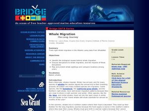
Whale Migration - The Long Journey
Marine biology learners examine right whale sighting data from the WhaleNet website. They plot the data on a map and write down the number of adults and calves spotted. Questions accompany the data analysis activity, making this a...
Curated OER
Orienteering - Lesson 10 - Putting It All Together
Wrap up this unit by navigating through a prescribed course using a map and a compass. Put all the skills learned about reading a compass and using a map to navigate through an unknown course. Each learner should have a control card...
Curated OER
Tracking Ocean Ecology
Learners look at the data maps given to them about how chlorophyll affects the algae blooms and make predictions about the harm they will cause. In this data maps lesson plan, students manipulate data sets from the website.
Curated OER
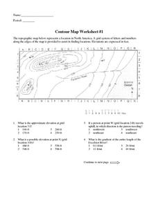
Contour Map Worksheet #1
Being able to read a topographic map is a standard in middle school earth science units and imperative for outdoor enthusiasts. As you introduce learners to this skill, you can assign this as an assessment or reinforcement. Pupils view a...
Curated OER
Follow Your Dreams: Career Goals
It is so important for impending high school graduates to start thinking about their potential careers. Here, they discuss the persistence of Blondie Hasler and his impressive transatlantic trip. They follow various routes on a map and...
Curated OER
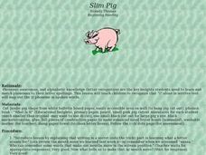
Slim Pig
Beginning readers study the short /i/ sound. First they determine how the mouth moves when they say the target words in a tongue twister. They complete letterbox activities by making words with the short /i/ before reading What Is It and...
Project Food, Land & People
Loco for Cocoa
Students create a time line and map about how chocolate traveled the world. In this chocolate lesson plan, students also create and taste chocolate.
Curated OER
Contour Map Worksheet #3
Earth scientists answer five multiple choice questions about the topographical map atop the worksheet. Use this as a quick assessment of understanding after having taught how to read contour lines and topographic maps.
National Park Service
Petrified Forest National Park
Poetry Soup, a reading and writing unit constructed by the Petrified Forest National Park, will have scholars hungry to learn about nature. The cross-content unit contains topics related to history, science, and language arts. Content...
Curated OER
Pirate Messages
Students research the actual history of pirates and pirating. They draw and write directions on an imaginary map in the historical style of a treasure map. To make their map look well and used, they tear around the edges, fold and refold...
Curated OER
Practical GPS Applications in Forestry & Agriculture
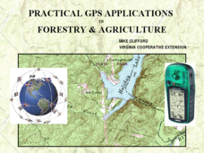
An explanation of the Global Positioning System (GPS) and the Geographic Information System (GIS) is given in this presentation. Uses and applications are considered. How it works and sources of error are also touched upon. A large...
Curated OER
How Much Water is in That River?
Young scholars practice measurement using the Hudson River. They calculate the discharge measurement at a location on the Hudson River using ingenuity and a topographic map.
Curated OER
Ancient Trade Routes
Students research details about ancient trade routes such as the silk, amber, tin, and incense routes. They make a map showing the trade routes and add details to maps, such as keys and samples of products traded. They compare ancient...
Curated OER
The Big Circle
Students explore geography by participating in a mapping activity. In this concentric ring instructional activity, students utilize a poster board, string and markers to identify their current location within the entire world. Students...
Curated OER
Worksheet 3/7 A Gaggle of Collective Nouns
Encourage your class to identify the correct usage of collective nouns in sentences with this activity. Given three choices, with the collective nouns circled in each possible choice, class members choose the sentence in which the...
Curated OER
The Oregon Trail
For this Oregon Trail worksheet, students practice their map skills while they explore the states of Oregon, Missouri, Idaho, Nebraska, and Wyoming. Students us a map of the US to plot six points on the map that show the Oregon Trail.
Curated OER
Wild Animals in the World
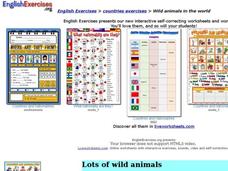
In this wild animals worksheet, students answer multiple choice map questions, choose the correct animal names for the pictures, and more. Students complete 4 activities.
Curated OER
Making a Point
Students become familiar with maps as insights to new perspectives. They also evaluate maps that were designed to express a perspective. They explain the qualities of an equidistant azimuthal projection
Mathematics Assessment Project
Interpreting Distance–Time Graphs
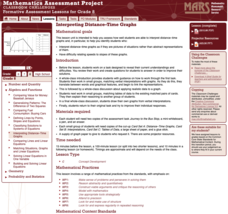
Pre-algebra protégés critique a graph depicting Tom's trip to the bus stop. They work together to match descriptive cards to distance-time graph cards and data table cards, all of which are provided for you so you can make copies for...
Curated OER
Mapping The Ocean Floor
Young scholars explore and analyze the bottom structure of underwater habitats. They describe and explain what can't see through the collection and correlation of accurate data. Learners assess that technology is utilized as a tool for...


