Curated OER
Passive
Review the passive voice with this printable exercise! Middle and high schoolers choose the appropriate passive verb phrases for 15 sentences to make each one grammatically correct. Don't forget to print the answer page (it appears in a...
Curated OER
Word Association Poetry with Visual Thesaurus (or Not)
Young poets get inspiration and guidance for making word association poems with the Visual Thesaurus. Your class could complete this project with nothing more than a pencil and paper as well. A nice one-off for a substitute during your...
Curated OER
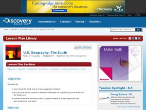
U.S. Geography: The South
Young geographers complete a research project. They list the physical features found in the American South. They then discuss the economy, culture, and geography found in the South. They work in groups to research one of the five...
Google
Intermediate 1: Picking the Right Search Terms
A search can be strengthened by unique terms. With the activities and presentation included here, show your class how to target their searches with unique terms and context terms. They can then practice their search skills with...
Kenan Fellows
Sensors, Sensors…..Everywhere! Middle School Meteorologist Create Weather Bots!
My forecast is that you'll want to use the resource. Pupils design and create a weather bot as part of a project-based unit. These bots should be able to measure temperature, humidity, barometric pressure, wind speed and direction, and...
Global Change
Impact of Climate Change on the Desert Pupfish
A fish that lives in the desert? You and your class can meet the desert pupfish as they examine its habitat, the role humans play in diminishing water supplies, and how climate change might impact this fishy friend. There are four short...
Roald Dahl
The Twits - Dirty Beards
The problem with beards is that they collect a lot of food. The first lesson in an 11-part unit related to The Twits by Roald Dahl explores the hairy jungle that is Mr. Twit's beard. A concluding project has learners create their own...
Curated OER
Social Studies: The Human and Animal Connection!
Students infer the connection among humans, animals, and disease through the interpretation of concept maps. They are introduced to the idea of a connection human disease and the domestication of animals.
Curated OER
GIS: Mapping Watersheds of the Edwards Aquifer in Travis County
High schoolers manipulate existing GIS data to create and map a new layer of information that shows that watersheds in Travis County that are on top of Edwards Aquifer. They create and map that shows the watersheds in Travis County that...
Curated OER
Breads Around the World
Pupils read about bread. For this lesson studying bread, students read about the history of bread and it's significance around the world. Pupils identify the three main crops used to make bread and ten common types of bread from...
Curated OER
Park Problems
Students calculate park acreage and map the distribution of parks in Austin, TX using GIS. Students use a specific website to find the information.
Curated OER
Investigation 4 - Plot Studies
Third graders use a plot map to study the plants and animals living in a small area of their environment.
Curated OER
Graphin' And Glyphin' Utah Weather
Fourth graders investigate the concepts of looking at sets of data. The focus of the study is upon the local weather of Utah. They study the weather found in the city and in the country and make comparisons based upon geographical location.
Curated OER
Let's Travel!
Students review the rules and expectations, they earn points each day by making the correct behavioral choices. They read maps and do Internet reserach, students become aware of United States and or world geography. Students check...
Curated OER
Urban Planning: Plan a City
Students analyze the concept of urbanization by planning the placement of some of the major urban/suburban features that make up most cities. They arrange the cultural features to benefit the people who live there, and maintain respect...
Curated OER
A Picture's Worth a Thousand Notes
Students listen to classical music and create a listening map for each piece. In this classical music lesson, students select a piece of classical music and create a visual map for the piece. Students set their pictures to music in a...
Curated OER
Milkweed and Monarch Quiz
In this milkweed and monarch butterfly worksheet, students take a quiz online about the milkweed and monarch butterflies. Students complete 10 multiple choice questions.
Curated OER
Plotting the Ocean Floor
Fourth graders plot points on a graph, connect the dots to make the ocean floor profile and label the topographical features. They utilize a worksheet and a website imbedded in this plan to plot the ocean floor.
Curated OER
Rainfall Mapping
Students explore rainfall and habitats. In this rainfall lesson, students explore the relationships among rainfall, vegetation, and animal habitats. Resources are provided.
Curated OER
Mapping the Middle East
Students examine how the countries of the Middle East were created. They explore the influence of various political and geographic factors in their creation. They list the things they should consider in deciding how to draw new borders...
Curated OER
Readers Who Struggle Can Learn From Wonderful Teacher/Student Created On-Level Reading Projects
Learners create their own books. In this book making lesson plan, students pick a subject and take photographs of it. They use these photographs to write their own story using their sight words.
Curated OER
Projects For USA Units
Students study different regions of the United states through interdisciplinary activities. This lesson presents very creative, artistic ways for students to explore the variety of regions found in the United States.
Curated OER
Design Your Own Building
Students explore the use of design principles in the real world. They evaluate how problems can be solved using design principles. In groups, students design the floor plan for a building of their choice.
Curated OER
Exploring Wyoming Species Habitats
Students are introduced to the concept of species habitats and ranges. They introduced to ArcView GIS as a tool for mapping. Pupils use query data for species withina county, elevation, range, rivers and streams, land cover, and etc....


