Curated OER
Tasty Mapping
Students create an edible map. In this civics and geography lesson, students research their town's features and local government. Students work in groups to design and create a physical map of their town based on research.
Curated OER
FUN WITH MAPS
Second graders receive a general overview about how maps are made and used, how specific information can be derived from them, and how a student can gain personal information about their surroundings from examining them.
Curated OER
Literacy Map Activity
Students write directions using maps and ad, they define driving directions and convert cardinal numbers to there ordinals. They write directions which are given orally in these multi-level literacy activities.
Curated OER
Reading Weather Maps
Fourth graders the symbols that are used on weather maps. They develop five day forecasts based on information they gather from weather maps in the newspaper and on the Internet.
Curated OER
Me on the Map Lesson 1
Students use maps, globes, geographic information systems and other
sources of information to analyze the nature of places at a variety of scales. They identify on a map and determine the population
of the city, county, state, country...
Curated OER
Map Out the Important Stuff!
Students practice summarization by creating a story map. Students listen to a read aloud by the teacher, after which the class creates a storymap of the major events in the story. They read a passage from the Indian in the Cupboard...
Curated OER
Making Good Decisions
Students examine the consequences of behaviors and what the concept of trade offs are. In this good decision lesson students read an article and answer questions on making good decisions.
Curated OER
Angles, Bearings and Maps
In this angles, bearings and maps worksheet, students measure angles and classify, calculate the size of unknown angles, and complete related multiple choice and word problems.
Curated OER
New York: Agricultural Products Maps
In this agricultural products worksheet, 4th graders use the information on four maps of New York Agriculture to make a comprehensive map of all products and answer four questions.
Curated OER
Landscape Picture Map
Students explore pollution of water sources. In this ecology lesson, students define and identify natural resources. Students use map skills to locate local rivers and lakes used for recreation. Students brainstorm ways in which to keep...
Curated OER
Map Skills
Students examine the nations, battlefields, troop movement of the Germans through Belgium and the location of both fronts during World War I by creating a map. They visualize the strength of the Germans early in the war.
Curated OER
Washington, D.C. Map
Here is an outline map of Washington, DC. Some of the points of interest in the city are labeled, as are Maryland, Virginia and Arlington. There are plenty of important monuments and locations not identified, making for a good...
Curated OER
Making Predictions by Analyzing Key Ideas and Details
Students make predictions. In this language arts lesson, students read nonfiction texts and make predictions about what they are going to read. Students confirm and revise their predictions as they read the text.
Curated OER
Map of Town
Third graders draw a map of the town given different sites to locate on the map by the teacher. They explain that latitude and longitude are used to locate places on maps and globes, identify the distinctive physical and cultural...
Curated OER
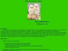
Ollie the Own Says: WHO
Scholars examine the strategy of making a story map or outline to identify the main elements of a story. They discuss the who, what, where, when, why, and how of a story, in an outline form. As a class they read a short story, answer the...
Curated OER
Acting as a Pre-write Tool
Second graders use acting to help them in a prewriting activity to develop a story. In this prewriting lesson plan, 2nd graders form a character map and brainstorm ideas for their story.
Beacon Learning Center
What Goes Up Must Come Down
After your class has completed The Cay by Theodore Taylor, assess understanding of the plot. First, model how to fill out a plot line for your class. Next, have class members fill in the plot of The Cay on the provided story map. Invite...
Curated OER
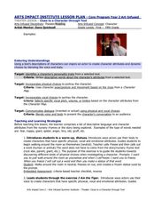
Clues to a Character through Text
Readers will read a text and fill out a character map based on the characters in that text. They will explore different qualities of each character for their map. this can be modified to support younger learners. They will learn about...
Curated OER
Around the Town
In the world of GPS, make sure your kids can still read maps and determine distances between locations. You will need neighborhood street maps, ideally of your class' home turf. Ask kids questions about different locations in relation to...
Curated OER
Tools of the Trade: The Use of Geographic Tools
Learners examine the tools of demographic analysis and apply them to real-world situations. They analyze maps, define terminology, and write an information paper for the appropriate government agency to recommend an action or policy change.
Curated OER
National Expansion
Students investigate the Manifest Denstiny. They explore how the idea was evident in 19th century American maps. Students brainstorm the relationships between maps and national expansion. They review a map from 1816 that called for...
Curated OER
Geography of South America
Student's identify geographic features of a South American map. They use the scale of the map to calculate distances between points. They identify examples of the five geographic themes on the map of South America.
Curated OER
This is My Neighborhood
Students predict the things that they may see, smell, or hear in their neighborhood. They take part in a neighborhood walk, creating a rough map of their neighborhood as they go. Upon return to the classroom, students create a final map...
Curated OER
Exploring Hawaiian Mountain Zones
Fourth graders watch a video that describes the climate and vegetation zones of Hawaii. They describe the different physical conditions that create vegetation zones from the sea to the mountains. In groups, they create an illustrated...
Other popular searches
- Making Maps Geography
- Making Maps and Research
- Making Maps Using Technology
- Making Maps of History
- China, Making Maps
- Making Maps of Community
- Reading Making Maps
- Neigborhoods and Making Maps
- Making Maps Lesson Plans
- Making Maps Usign Technology
- China Making Maps
- Neighborhoods and Making Maps


