Curated OER
Toy Making and Resourcefulness
Students demonstrate their understanding of resourcefulness by making a toy and describing how they were resourceful. They find Malawi on a map and tell the interesting things about the book Galimoto.
Curated OER
Tree Inventory and Map Project
In this tree inventory and map project activity, students follow the directions on how to take inventories of trees and create a map from it. Students follow 4 sets of directions.
Curated OER
Map Creation
Second graders identify a map, symbol, key, and compass rose. Students create and print a map for teacher evaluation using the computer. Students identify the symbols on their map and orally present them to the class.
Curated OER
Map your Schoolyard
Pupils practice their mapping skills by creating an accurate map of their schoolyard using an aerial photo from the National Map web site. Students include legends, a scale, and a north arrow on their maps.
Curated OER
The Importance of Site Maps in Archaeology
Students consider the importance of site maps in archeology. They interpret site maps, draw site maps of their classroom and home and then participate in simulated Paleolithic archeological camp activity.
Curated OER
Topographic Map Unit Plan
Learners examine topographic maps and discover how to decipher contour intervals, use contour lines and apply information to complete a topographic map lab. Working in groups, they identify the scale of the map, latitude and longitude,...
Curated OER
Making Topographic Maps and Mountain Profiles
Students study how to mark inclines and construct a mountain profile. In this topographic map lesson students mark contour intervals and draw mountain profiles.
Curated OER
Isolines on a Weather Map
Ninth graders explore weather by analyzing maps. In this temperature instructional activity, 9th graders view black and white weather maps of locations in which the weather changes often. Students identify the isolines used on the maps...
Curated OER
Maps In Our Everyday Lives
Students break into groups and complete a chart about information on maps of their hometown.
Curated OER
Mini - Lesson #5: Get To Know - Mapping
Students examine and draw landscape maps. In this mapping lesson, students investigate what a landscape map is. They draw a map showing objects on a small piece of natural landscape. Students fill in a grid sheet and a worksheet to make...
Curated OER
Analyze a Street Map
For this street map worksheet, students analyze a section of a street map of Washington D.C, finding parallel streets, listing streets that form given shapes, and following directions. Answers on page 2.
Curated OER
Using Concept Maps to Design 3D Spheres
Students create three dimensional shapes using concept maps. In this geometry lesson, students investigate the impact of mental schemas on humans. They collect data on this topic and plot their data on a coordinate plane.
Curated OER
ABC Scavenger Map
Students explore phonetics by participating in a class game. In this alphabet sounds lesson plan, students collaborate in a ABC's activity where they identify a random letter, the sound it makes, and place it in it's correct spot on a...
Curated OER
Geologic Mapping I
Students create a geologic map and cross-section of an area of horizontal sedimentary rocks, exposed in several locations. Map must include a complete key or legend with rock descriptions of the various formations.
Curated OER
Introduction of the Lunar Relief Map Project
Pupils investigate the geographic features of the surface of the moon. In this lunar relief map instructional activity, students watch and discuss the Apollo II Moon landing and make preliminary plans for their lunar maps.
Curated OER
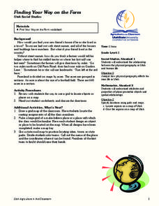
Finding Your Way on the Farm
Third graders make a grid map. In this directionality lesson plan, 3rd graders review how to use a grid to locate objects or places on a map. Students draw a grid map of the classroom and locate seating assignments. Students create a...
Curated OER
Treasure Hunt
First graders read and follow a map in a treasure hunt to find the location of the treasure. They demonstrate their knowledge/understanding of symbols, keys on a map, and directions by following the map with ease.
Curated OER
The Oregon Trail
Students use maps and diagrams to examine the Oregon Trail. In groups, they create their own poster of the trail showing the different types of artifacts found along the way. To end the lesson, they identify the sources of water and...
Curated OER
Sequencing / Story Events
Students read a story and use sentence strips to order story events. In this sequencing lesson, students learn new vocabulary words centered around the story Cloudy With a Chance of Meatballs, preview the story, make predictions...
Curated OER
Lesson 3: Seven Day Road Trip
Students plan a seven day road trip. For this travel lesson, students plan a driving trip that includes five major cities or attractions in Florida or another state of their choice. They show the trip on a map, calculate distances that...
Curated OER
Welcome to My World!
Students use maps to locate information. They read the story, "It Looked Like Spilt Milk", view images of the continents and discuss the various continents. Afterward, they make their own Atlas to record information that they can later...
Curated OER
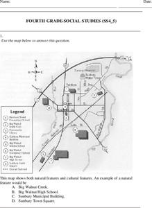
Fourth Grade Social Studies
For this social studies worksheet, 4th graders answer multiple choice questions on state maps, city maps, road maps, political maps, and more. Students complete 25 multiple choice questions.
Curated OER
Understanding: Geography
Students explore their neighborhoods. In this geography instructional activity, students make a map of their neighborhood. They must include a key, natural terrain, buildings and streets. They also write a descriptive paragraph about...
Curated OER
Explorers’ Experience
Learners investigate the Exploration Age. In this research skills lesson, students discover the impact of exploration as they locate information about selected explorers. Learners design and create relief maps that feature exploration...
Other popular searches
- Making Maps Geography
- Making Maps and Research
- Making Maps Using Technology
- Making Maps of History
- China, Making Maps
- Making Maps of Community
- Reading Making Maps
- Neigborhoods and Making Maps
- Making Maps Lesson Plans
- Making Maps Usign Technology
- China Making Maps
- Neighborhoods and Making Maps


