Curated OER
Project Whistlestop:Missouri Vacation Learning Unit
Fourth graders reserach the state of Missouri. For this Missouri History lesson, 4th graders plan a vacation to a region of Missouri. Students work in collaborative groups to determine all aspects of the trip. Students use math...
Curated OER
Around the Town
Young scholars explore reading maps. In this map reading lesson, students compare distances fom place to place. Young scholars work in groups and predict the distance then find the actual distance using string or rulers.
Curated OER
Planning A Railroad
Students use topographical maps students explain the challenges involved in building the railroad in the Sierra Nevada mountains.
Curated OER
Arthur's Nose
Students read a story and complete a story map. In this diversity and acceptance lesson, students read Arthur's Nose, make a story map, research Aardvarks, complete a Venn Diagram comparing Arthur's nose to other animals in the...
Curated OER
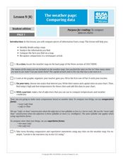
The Weather Page-Comparing Data
Students examine weather patterns in the United States. In this weather instructional activity, students use a United States map to identify high and low temperatures in two states. Students compare the data and record their findings...
Curated OER
Navigation
Students explain that globes are the best way to show positions of places, but flat maps are portable and can show great detail. They make a mercator projection of the route Lewis and Clark took on their journey.
Curated OER
Understanding Geography
Students create a map of their own neighborhood to show the relationships between the geography of the neighborhood and its economy and culture. They view and discuss an introductory video on how geographers study an area then go out...
Curated OER
Drake's West Indian Voyage 1588-1589
Students investigate several maps detailing Sir Francis Drake's voyages. For this geography lesson, students practice reading maps and locating the precise locations of where Sir Francis Drake visited. Students create an...
Curated OER
Cardinal Directions
First graders study cardinal directions on maps. In this geography lesson, 1st graders determine and show where North, South, East, and West are on various maps.
Curated OER
Ecology of the Savanna-Forest Boundaries in Central Brazil
Students explore photosynthesis. In this photosynthesis lesson, students label parts of photosynthesis and take notes. Students conduct experiments on leaves, make observations and record their findings.
Curated OER
From Claws to Jaws: Atlantic Regions of the United States
Students explore New England, Mid-Atlantic, and southeastern regions of the United States. In this social studies thematic unit, students research a state and make a regional quilt. Students wrte a book report and read two novels...
Curated OER
Surveying the Land
Students explore the different kinds of maps and the purpose of each. In this Geography lesson, students work in small groups to create a map which includes the use of a map key.
Curated OER
"We're Back ... Eagles Soar!"
Students use information from Internet websites to create a map of where Bald Eagle habitats can be found after being familiarized with the map by the instructor.
Curated OER
Directions, Directions
Third graders review cardinal directions, moving around the room so that they are standing in the part of the room that is nearest the north, south, east and west. They are asked what would you do if they are lost? Pupils work as a...
Curated OER
Wales: An Interdisciplinary Unit
Students practice basic map and geographic skills as they compare Oregon to Wales. Students color map of Wales and Oregon using color codes to distinguish between land, water, and bordering nations or states, listen to stories and...
Curated OER
Celebrate Hanukkah in Israel
Explore Hanukkah and its origins with a social studies lesson. Learners discover the history of Hanukkah and its traditions. They locate Israel on a map, hear the story of the menorah and create their own...
Curated OER
A View from the Ground
Students look at a park from ground perspective. In this map skills lesson, students are introduced to a story about a girl at a park and make observations about the park based on a picture. This prepares students for the next lesson in...
Curated OER
Where I Live…
Second graders explore their community. In this social studies lesson plan, 2nd graders use Internet tools to locate their community on a map and then locate where they live.
Curated OER
Summer Trip
Fourth graders search for information and directions to specific cities from their homes, figure cost of trip when given miles per gallon, distance, and cost per gallon of gas, develop outline budget for summer trip, and draw and label...
Curated OER
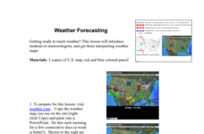
Weather Forecasting
Learners discover how to read a current weather map. In this weather forecasting lesson plan, students view weather maps from three consecutive days and observe how quickly weather moves and changes. Learners review key terms associated...
Curated OER
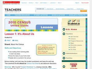
2010 Census Lesson 1: It's About Us
Students analyze data from the 2000 census to learn how the census works. In this civics instructional activity, students read a story to find out about the census, then use a map and census data to analyze changes. Lesson includes...
Curated OER
Reshaping the Nation
High schoolers learn why the census makes a difference. In this U.S. Census lesson plan, students learn how to read and use a cartogram while they explore new ways to represent data.
Curated OER
5th grade social studies geography
In this geography worksheet, 5th graders complete multiple choice questions about hemispheres, maps, cities, ecology, and more. Students complete 25 questions.
Curated OER
Lewis and Clark
Fifth graders use the Internet to research a topic. In this expeditions activity, 5th graders answer questions about Lewis and Clark based on the movie they watched previously, use the Internet to research Lewis and Clark, write a...
Other popular searches
- Making Maps Geography
- Making Maps and Research
- Making Maps Using Technology
- Making Maps of History
- China, Making Maps
- Making Maps of Community
- Reading Making Maps
- Neigborhoods and Making Maps
- Making Maps Lesson Plans
- Making Maps Usign Technology
- China Making Maps
- Neighborhoods and Making Maps


