Curated OER
Unraveling the Web
Students consider how a message might be traced along a complex network, then explore backbone maps as a basis for understanding the purpose and structure of the Internet.
Curated OER
On the Road
In this visual thinking worksheet, 1st graders read and analyze a road map in order to circle the 5 multiple choice answers to 5 questions relating to the road map.
Curated OER
Gel Electrophoresis: Sort and See the DNA
For this DNA worksheet, students access a website to learn how DNA fragments are separated through the process of gel electrophoresis. Then students model the construction of DNA fingerprints and practice interpreting restriction maps....
Curated OER
Ancient River Civilizations
Young scholars investigate the growth of the Ancient River Civilizations. In this world history lesson, students compare and contrast ancient and modern maps of the area of river civilizations.
Curated OER
I'm British But... 2
Learners view the documentary "I'm British But..." and examine the variety of ways in which people identify themselves in Britain today. In pairs they identify what is important to the lives of the young Asian people in the film, and...
Curated OER
Hunters and Gatherers
Sixth graders participate in mapping and other activities to understand why ancient civilizations developed as they did. In this ancient civilization instructional activity, 6th graders recognize that there were three important climate...
Curated OER
Loco for Cocoa
Third graders research the history of cocoa. In this cocoa lesson plan, 3rd graders investigate how the cocoa bean has been traded from one country to another. Students create a timeline and map to track the history of the cocoa bean.
Curated OER
The Writing Process
In this writing as a process instructional activity, students explore how writing is a process instead of a finished piece of work. Students also test out how to mind map a story.
Curated OER
Gel Electrophoresis: Sort and See the DNA
Young scholars construct DNA fingerprints. In this genetics lesson, students watch an on-line gel electrophoresis animation, then they work in groups to use a restriction map to create a restriction enzyme and use that to arrange a DNA...
Curated OER
The Pilgrims
Learners use distance measuring tools to follow directions and chart the path the pilgrims made from Plymouth, England to Boston, Massachusetts. In this Pilgrim voyage lesson, students use a map to chart the distance traveled by the...
Curated OER
Biology Project: Gone Fishing
Students write a scientific article using data and prediction skills. In this scientific writing lesson, students access data about fishing off the coast of New Jersey. They look at satellite data, fluorometry and CTD data over a 3 -4...
Curated OER
Which Way Is North?
High schoolers investigate the concept of finding locations with the use of a compass and a map. They practice the skill of bearing and set up courses of travel to different destinations around the school grounds. Students also practice...
Curated OER
Note Taking Worksheet--Vancouver
In this note taking worksheet, 4th graders research Vancouver and fill in facts on the graphic organizer. Students complete a map outline as well.
Curated OER
European Cities
Learners study European cities and label countries on a map, match cities to countries, and answer true and false questions. In this European cities lesson plan, students also guess the names of cities they see pictures of.
Curated OER
Sixth Grade Reading Quiz
In this reading worksheet, 6th graders answer multiple choice questions about passages they read, word parts, and more. Students complete 9 problems.
Curated OER
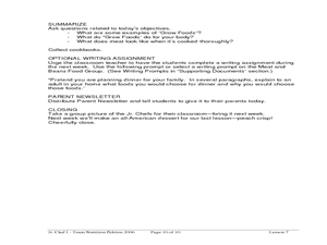
Delicious Dinners by Jr. Chefs
Students create a protein-rich dinner. In this nutrition lesson, students brainstorm foods that are rich in protein. Students make burritos and identify the color of meat when it is cooked thoroughly.
Curated OER
Oceans: A Sensory Haiku
Students create an ocean haiku. In this haiku activity, students use their five senses to write a haiku. Students watch videos about the ocean, make a sensory portrait, and create a class haiku.
Curated OER
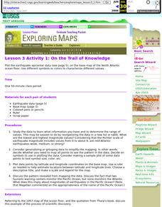
Lesson 3 Activity 1: On the Trail of Knowledge
Students plot the earthquake epicenter data on the base map of the North Atlantic ocean floor using different symbols or colors to characterize different values.
Curated OER
Salad Tray 3D Topographic Model
Students explore the characteristics of topographical maps. They examine the relationship of contour lines and vertical elevation. Students create a three-dimensional model of a landscape represented by a topographic contour map.
Curated OER
Making a Brand for Ourselves the "Cowboy" Way
Students define cowboys and learn about their roles on rangelands. In this rangeland lesson, students define cowboys and cowgirls and complete a KWL chart. Students read Cattle Kids and Til the Cows Come Home. Students visit the...
Curated OER
Arkansas History Lesson Plan: Identifying Arkansas on a Map
Students investigate their hometown of Arkansas. In this U.S. Geography lesson, students identify Arkansas on a map and distinguish it form the other states. Students investigate the history, state line, and personal...
Curated OER
Making Rocks
Students use their imaginations in order to journey to the center of the earth to find different types of minerals. They create minerals using playdough and create scientific drawings of them. Finally, students create a map to locate the...
Curated OER
Bigger Faults Make Bigger Earthquakes
Learners experiment with string to visualize how earthquakes are created. Using various lengths of string, students determine which earthquakes lasted the longest and hypothesize why. Learners look at a fault map and determine which may...
Curated OER
Mapping the Lewis and Clark Trail
Students explore how physical and human geography features effected Lewis and Clark's expedition by using the Lewis and Clark Digital Discovery Web site.
Other popular searches
- Making Maps Geography
- Making Maps and Research
- Making Maps Using Technology
- Making Maps of History
- China, Making Maps
- Making Maps of Community
- Reading Making Maps
- Neigborhoods and Making Maps
- Making Maps Lesson Plans
- Making Maps Usign Technology
- China Making Maps
- Neighborhoods and Making Maps


