Southern Nevada Regional Professional Development Program
Reading Literature - An Occurrence at Owl Creek Bridge
“An Occurrence at Owl Creek Bridge,” Ambrose Bierce’s short story, is used to model how structural moves, the decisions an author makes about setting, point of view, time order, etc., can be examined to reveal an author’s purpose. Groups...
NASA
Hurricanes and Hot Towers with TRMM
Take cover because a wild presentation on hurricanes is about to make landfall in your classroom! An outstanding PowerPoint presentation is the centerpiece of this lesson. Not only does it provide information and photographs, but several...
Curated OER
Giving Students a Little Latitude
Students use a world outline map to locate places using coordinates of latitude and longitude. They answer questions about places based on their knowledge of the map and on their research and make up more questions of this sort for each...
Curated OER
Lesson on GPS
Students investigate global positioning systems. In this technology and mapping lesson, students view a PowerPoint presentation in which they identify the features of a GPS, state its uses, and follow steps to find a waypoint.
Curated OER
Governance
Third graders participate in decision-making situations. In this social studies lesson students make connections between rules and laws and the purposes for those rules and laws. Students use critical and creative thinking skills to...
Curated OER
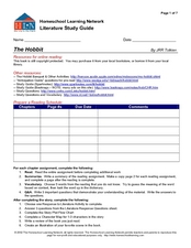
Literature Study Guide - The Hobbit
With several online resources for J.R.R. Tolkien's The Hobbit, as well as many reading and literary analysis activities, this novel study guide is a great way to keep your young readers organized during a book report. The guide...
Curated OER
Literature Study Guide - The Prince and the Pauper
Offering several reading comprehension activities, such as a character map and a plot flow chart, this book report form will help your class through Mark Twain's Prince and the Pauper. The activities in the lesson lend well to...
Curated OER
Baseball Challenge - Basic Geography Skills
A fabulous presentation/activity based on geography. The author has designed a "baseball game" where batters advance to the next base if they correctly answer a multiple choice question about geography. Geographic terms are used, along...
Curated OER
The Bear Facts
Students explore various kinds of bears and gather information about them. In this research and habitats lesson plan, students chart their bear information on large posters with illustrations of their bears. Students map the...
Curated OER
Using Your Senses
Here is a terrific lesson that uses a special State Quarter as a learning tool. This one uses the Alabama State Quarter. During this lesson, pupils learn about their five senses. They make observations about what is in paper bags using...
Scholastic
Reading Characters
Philip Pullman's The Golden Compass provides the text for a study of how writers bring characters to life. Using the provided character mapping worksheets, readers respond to questions and then write a short character sketch.
Curated OER
Anne Frank: One of Hundreds of Thousands
Young scholars conduct research to put Anne Frank's diary into historical context. They use maps, timelines, essays and websites to examine the early victories of the German army, paying special attention to the Netherlands and...
Global Oneness Project
The Value of Ancient Traditions
Imagine having to give up cell phones, computers, and TV? What would be lost? What gained? An examination of the Drokpa, a nomadic people who live in the grasslands of Tibet, provides class members an opportunity to consider how access...
Montana State University
What's the Weather?
How many jackets do you need to stay warm and climb Mount Everest? An informatie resource covers the topic of Mount Everest, the resource helps young scientists discover the difference between climate and weather. Activities include...
Curated OER
Latitude and Longitude
In this latitude and longitude learning exercise, students complete 4 activities to demonstrate understanding. Students use a protractor to measure angles on a map of the earth. Students fill out a latitude and longitude chart after...
Curated OER
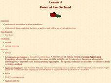
Down at the Orchard
First graders examine what an apple orchard looks like and work with cardinal directions. In this apple orchard and direction lesson, 1st graders listen to Anne Rockwell's, Apples and Pumpkins, and Amy and Richard Hutchings', Picking...
Curated OER
Saturday Market by Patricia Grossman
Readers make personal connections to Saturday Market by Patricia Grossman and answer comprehension questions while reading the book. Comparing and contrasting the different characters in a Venn diagram leads to a kinesthetic...
Curated OER
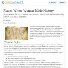
Places Where Women Made History
Using places can help students identify with the history-making women associated with them.
Curated OER
Degrees and Minutes
In this latitude and longitude worksheet, middle schoolers place 9 cities on a map using the latitude and longitude of each. Once cities are placed in the correct location, students complete 2 short answer follow-up questions.
Curated OER
Investigating Latitude and Longitude
Students examine the lines of latitude and longitude on a map, and explain why these lines might be useful. In this lesson plan students also explore websites that provide information to improve their understanding of how and why...
California Academy of Science
Optimal and Sustainable: Renewable Energy Revamp
More than 100 cities around the world have shifted from fossil fuels to renewable energy sources. Scholars investigate a city wanting to make this switch, but needs help determining how to make the shift. Groups consider all options,...
Curated OER
Where Were Your Ancestors in 1871?
Here is a nicely designed lesson plan on ancestry and family history. In it, learners read an article entitled, "Where Were Your Ancestors in 1871?" Then, they make up a series of questions to profile their family and their community 100...
Curated OER
The Rocks Under Illinois
The goal of this fine geology lesson is to have learners create a map that shows how the rock layers are arranged far underground where they can't be seen. The ambitious lesson plan requires high schoolers to learn the law of...
Curated OER
Who's The Boss?
Upper elementary and middle schoolers research and analyze some different types of governments. Democracies, Monarchies, and Dictatorships are some of the types that are looked at. Learners use the Internet to gather information that...
Other popular searches
- Making Maps Geography
- Making Maps and Research
- Making Maps Using Technology
- Making Maps of History
- China, Making Maps
- Making Maps of Community
- Reading Making Maps
- Neigborhoods and Making Maps
- Making Maps Lesson Plans
- Making Maps Usign Technology
- China Making Maps
- Neighborhoods and Making Maps


