Curated OER
WANTED EXPLORERS
Students create their own country and explore other unknown lands. Students identify past explorers and complete the included case of the missing trunks webquest. Students research resources and geographical features for their created...
Curated OER
Endangered Relationships
Students study the interrelationship between the horseshoe crab and red knot. In this ecology lesson, students explain why several species became extinct. They research about endangered species found in their region.
Curated OER
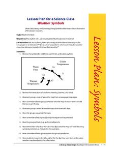
Weather Symbols
Young scholars study weather symbols. In this weather symbols lesson, students review the symbols for cold, warm, and stationary fronts. Young scholars use a weather map to study the weather symbols, complete a weather illustration and...
Curated OER
Africans in Mexico
Students read case studies to examine the role of Africans in Mexico. Using maps, they research the areas that are discussed in the text and map out movement maps of Africans to and from Africa. They research the history of the Mexico...
Curated OER
Cartography
Students research about cartography and how to be a cartographer. In this math activity, students draw a map of their classroom. They use a robot to explore navigation using a compass rose.
Curated OER
Where Did That Come From?
Fourth graders participate in a scavenger hunt. They locate specified items, finding the country origin. Students collect and organize the data, marking each country on a map. After researching the results, 4th graders write an analysis...
Curated OER
Geography of the English Settlements
Third graders locate several important American colonial cities on a map and research how their proximity to water and nearby arable land affected the rate and success of settlement.
Curated OER
Paws in Jobland
Young scholars explore jobs in different countries . In this lesson plan about different countries through research. Students are broken into groups and given a country to research. Each group is provided with a worksheet with 14...
Curated OER
Colonial Maps
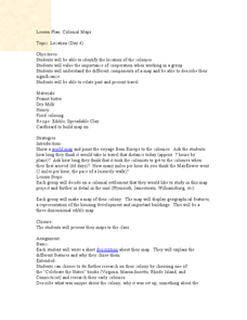
Students discover the history of America by identifying the traditional colonies. In this U.S. history lesson, students examine a world map and identify where the voyagers left from Europe to arrive at the United States. ...
Curated OER
Using Star Charts and Maps
Students study star charts and describe locations of objects. In this scientific models lesson students use coordinates and identify characteristics.
Mississippi Department of Archives and History
Protesting Violence without Violence
The ultimate legacy of Emmett Till's violent death is its role in the non-violent roots of the Civil Rights Movement. A lesson compares contemporaneous articles with the lyrics of Bob Dylan's "The Death of Emmett Till" and prompts...
NOAA
A Quest for Anomalies
Sometimes scientists learn more from unexpected findings than from routine analysis! Junior oceanographers dive deep to explore hydrothermal vent communities in the fourth lesson plan in a series of five. Scholars examine data and look...
Curated OER
Pirate Messages
Young scholars research the actual history of pirates and pirating. They draw and write directions on an imaginary map in the historical style of a treasure map. To make their map look well and used, they tear around the edges, fold and...
Curated OER
Ancient Trade Routes
Learners research details about ancient trade routes such as the silk, amber, tin, and incense routes. They make a map showing the trade routes and add details to maps, such as keys and samples of products traded. They compare ancient...
Curated OER
Planning A Vacation Online
If you could travel anywhere in the United States, where would you go? Use this question to interest your fourth, fifth, and sixth graders as they experiment with Mapquest or other direction-based resources. They choose where they'd like...
Curated OER
Port Portrait
Students research and identify exciting places to visit and plan an imaginary cruise, using maps, to study other languages, climates and geography and draw scenes from your trip. They make a portrait of your group waiting to leave one...
Channel Islands Film
Island Rotation: Lesson Plan 3
How far have California's Channel islands moved? What was the rate of this movement? Class members first examine data that shows the age of the Hawaiian island chain and the average speed of the Pacific Plate. They then watch West...
Curated OER
Investigate Non-native Neighborhood Invasion Species
Students investigate non-native species that are invading local or state environments. They choose one species to research and report on.
Curated OER
Geography: Map Making
Learners, working in groups, share notes and maps collected during a study of the Lewis and Clark Expedition. They draw large composite maps of the western United States on butcher paper including land formations, bodies of water, and...
Curated OER
Investigating Haiti
Students engage in a instructional activity that is about the island of Haiti. They conduct research using a variety of resources. The information is used in order to help students locate the island on a map. They answer questions while...
Curated OER
Natural Features as a Resource
Students research how people use land and water features to meet their basic needs. In this natural features lesson plan, students review land and water features. Students discuss how the land is used to meet needs using a landscape...
Curated OER
A Full Load
Students calculate the shipping costs between two destinations. In this math lesson, students determine the distance between two places using google map. They calculate the amount of gas needed to get to a specific destination.
Curated OER
What Is In A Name?
Fourth graders investigate the meaning of names and how they are used to name geographic places. They conduct research using a variety of resources. Special attention is paid to names given within the Native American culture. Students...
Curated OER
Four Corners Mystery: Where In The World Are We?
Students research and describe various locations around the world using five fundamental themes of geography.


