Curated OER
Acadiana Map (Map of Acadians in Louisiana) PowerPoint Slide
Is your class studying the state of Louisiana? This slide provides a good visual of Acadiana Louisiana, or as it is otherwise known; the Historic Cajun Country. The 22 parishes that make up this French-influenced region are numbered on...
Curated OER
South Carolina Jeopardy
One of the better PowerPoints I've come across is a "Jeopardy"-style game whose focus is South Carolina. Some excellent photographs and maps make the slides especially good. The "Final Jeopardy" clue is especially challenging. An...
Curated OER
The Fall of Rome and the Beginning of the Middle Ages
A major turning point in world history is the focus of this presentation. Rome has fallen, and with its descent comes the Dark Ages. With pictures, maps, and important information about the Middle Ages, this slideshow would be a great...
Curated OER
The World's Last Great Wilderness (Antarctica)
It's a shame that there are no photographs in this presentation because the information is fascinating! Each identically fashioned slide contains bullet points of information about Antarctica that will enhance an earth science...
Curated OER
The Brief American Pageant: Drifting Toward Disunion
A series of maps take viewers through the Antebellum period in American history. Focusing on the elections of Buchanan and Lincoln, as well as the Southern opposition to secession, the slideshow would make a good companion to a lecture...
Curated OER
The Brief American Pageant: The Duel for North America
Making its way through 18th century America, this presentation details the British and French territories through colorful and clearly labeled maps. Additionally, the maps chart the changes in said territory during and after the French...
Curated OER
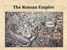
The Roman Empire
Experience the power of the Roman Empire in this presentation, which takes viewers through the Caesar, Julio-Claudian, and Flavian Dynasties. Details and maps help to make the rapid rise of this kingdom more understandable, and an...
Curated OER
World War II
Offering a comprehensive overview of the beginning of World War II, this resource could be a useful addition to a unit on this topic. It could be used as a way to lead a discussion on the war, or as a review tool before a test. Either...
Curated OER
The Persian Wars: Greece's Finest Hours
Maps and photographs help contextualize the Persian Wars in this straightforward presentation. These slides detail the motives and major events of the war between Persia and Greece, making it ideal for a lecture on ancient Greek politics...
Curated OER
The Brief American Pageant: The Great Depression and the New Deal
Experience the soaring highs and crashing lows of the 1920's and 1930's in this stark presentation. Though brief at eight slides (two are title slides), the graphs and maps would make a good accompaniment to your unit on the Great...
Curated OER
The Brief American Pageant: The Ordeal of Reconstruction
With a map on the military reconstruction in the post-Civil War South, and an interesting graphic comparing the size of Alaska to the continental United States, this presentation could be a good (albeit short) supplement to a class...
Curated OER
The Brief American Pageant: Launching the New Ship of State
The two images in this presentation - a graphic depicting American's financial structure and debt, and a map showing American posts that were still held by the British after 1783 - could be helpful for a class lecture on the emerging...
Curated OER
The Brief American Pageant: Girding for War
Though too short to be an adequate presentation, the solitary map in these slides would be a good visual aid to a lecture about Southern secession before and during the Civil War. The color coded states on the map make a good timeline...
Glynn County School System
Earth's Magnetic Field and the Moon
The surface of the moon has an amazing tale to tell. Learn about the moon's story with a PowerPoint presentation that describes the unique features of the moon's surface as well as explains its movement in relation to Earth.
Curated OER
The 13 Originals: Exploring the Who, When, Where, and Why Behind the 13 Original Colonies of Early America
Discover the stories behind each of the thirteen stripes on the American flag with this straightforward presentation. Complete with learning objectives, discussion questions, and solid information about each of the original thirteen...
Curated OER
World War II - The Allied Response
Your class will benefit from this excellent presentation on World War II, and the Allied Response to Hitler's threat. The PowerPoint is packed with important information about battles, key figures in the war, and has an excellent...
Virginia History Series
Virginia History Series: Virginia State History Reconstruction to 1900 [Pdf]
Much of Virginia was devastated after the Civil War so a period of rebuilding commenced. Follow Reconstruction through the different plans, the effects on African-Americans and the South. This slideshow has pictures,charts, and maps to...


![Virginia History Series: Virginia State History Reconstruction to 1900 [Pdf] PPT Virginia History Series: Virginia State History Reconstruction to 1900 [Pdf] PPT](https://d15y2dacu3jp90.cloudfront.net/images/attachment_defaults/resource/large/FPO-knovation.png)