Curated OER
Got Park? Or if you build it, they will come!
High schoolers use GIS and GPS technology to evaluate, research, locate, and recommend where a new park should be located that benefit the community.
Curated OER
Using Scholastic News to Introduce the Net
Third graders log on to the net, type in the address for Scholastic and browse the subjects for the week. They select one area of interest and generate five interesting facts about the article.
Curated OER
TE Activity: Nidy-Gridy
Learners make a grid and coordinate system map of their classroom as they investigate why it is important to have a common map making system. They look at how landmarks are used for navigating an area.
Curated OER
Money
Second graders show combinations for $1.00. In this dollar combinations instructional activity, 2nd graders use nickels, dimes, and quarters to model and count combinations equaling $1.00.
Curated OER
Find Yourself with Global Positioning
Students examine different types of new mapping technologies. They use the internet to gather information about mapping and navigation. They create their own global positioning tool and defend it to the class.
Curated OER
Four Corners Mystery: Where In The World Are We?
Students research and describe various locations around the world using five fundamental themes of geography.
Curated OER
Activity on United States Moon Landing: Apollo 11
High schoolers use the World Wide Web to access additional information needed to complete a set of questions. They demonstrate an understanding of latitude and longitude by interpreting a lunar map.
Curated OER
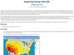
Exploring Energy with GIS
Students examine GIS technology as it is used to locate energy sources. In this GIS lesson, student access an assigned website to locate a series of lessons using the GIS software. They use the maps that are located on the primary lesson...
Curated OER
Build the Tallest Building
Young scholars examine the design and construction of skyscrapers. They use the internet to research information about different types of skyscrapers. They create their own building and defend it to the class.
Curated OER
4: In With the Imports
Students research imports of American Samoa and Hawaii and create a map showing the major imports for both. In this economics lesson, students identify where American Samoa and Hawaii are on a map, discover what the imports for the...
Curated OER
Imaginary Trip to South Korea
Students "visit" South Korea through the use of technology, in a fun, and stimulating, detailed project. They arrange travel, make choices, work through a budget, learn history, have exposure to language, and get a sense of what a...
Curated OER
Create a Weather Newscast
Fourth graders explore and study basic weather terms, strengthen research skill on the web and create a weather newscast. They choose a weather site on the web, copy weather maps and create a videotape based on a written script to...
Curated OER
Welcome to the Americas
Students research and map the North and South American continents. In this geography lesson on the Americas, students can locate North, Central and South American countries and states. Students choose a location to research and prepare a...
Curated OER
High Five Burger
Fifth graders investigate agricultural sources. In this agricultural instructional activity, 5th graders read the book Have a Hamburger and See the U.S.A. and record each component of a hamburger. Students use a map of the U.S.A. to...
Curated OER
Interactive Atlas
Second graders examine the different ways people move from place to place in a neighborhood. Using the interactive online atlas MapQuest, they identify the various ways people move around their own neighborhood by creating a map and...
Curated OER
Donde en el mundo estas?
Learners give & follow directions given in Spanish, using oral, written and graphics. They use maps, globes, atlases, and remote sensing, GIS, and GPS to acquire and process information about places.
Curated OER
Bone's Adventures
Young scholars read and discuss a chapter from the book "A Dog's Life," focusing on the point of view of the dog in the story. They explore dog rescue organization websites, and play the online game "Bone Travels On," creating a story...
Curated OER
Fractile vs. Equal
Students compare and contrast methods of categorizing data. In this data collection lesson plan, students complete worksheet activities that require them to note the differences between equal and fractile intervals. Students also discuss...
Curated OER
Aquifer Model
Learners, after researching and brainstorming about aquifers and locating aquifer maps of Texas, participate in the building of a model of an aquifer complete with a pumping station. They also answer a variety of questions at the...
Curated OER
Lone Star Round-Up
Students take a virtual tour of the Capitol Visitors Center in Austin, Texas. In groups, they receive a list of the artifacts and symbols they are to look for during their exploration of the building. To end the lesson, they make a...
Curated OER
Lines of Symmetry
First graders create symmetrical designs using a computer program. In this lines of symmetry lesson, 1st graders review their symmetrical designs and discuss other ways symmetrical designs can be made. Students work in pairs...
Curated OER
Name That Tune
Students complete a fingerprint oil lab in order to simulate how geologists use the oil and natural gas in rocks to hear sound waves that signify there are oil in those rocks. In this rocks lesson plan, students learn that the rock...
Curated OER
Comparing Countries
Students use a graphic organizer to research, compare and contrast two countries. They write a brief (or detailed - depending on age) report of their findings.
PBS
Home, Sweet, Home!
Students investigate the local history and architecture of their community. They draw maps, conduct Internet research, discuss varied architectural designs, take a walking tour of their town and work in teams to record their community's...


