Curated OER
Non-Fiction Animal Picture Books
Young scholars complete a multi-lesson unit using research to create their own book about an animal of their choice. After discussing the elements of non-fiction texts, they use internet research to explore an animal of interest to...
Curated OER
Fields of Candy Bars
Students research and write about the origins of the ingredients in candy bars. They taste them and describe what they are tasting. They use descriptive words to write a paragraph describing the candy bar. They research ingredients in...
Curated OER
GPS Treasure Hunt
Learners explore geography by participating in a treasure hunt activity. In this Global Positioning System lesson, students define the terms latitude and longitude while utilizing an electronic GPS device. Learners view a PowerPoint...
Curated OER
Creating a Watermark
Students discover how to insert a watermark into a Word document. In this word processing instructional activity, students follow step-by-step instructions to add either a picture watermark or a text watermark to the background of...
Curated OER
CURRENT AND CLIMATE
Students study currents and how they have been used to plot courses for travel. They examine the ocean currents in both the Atlantic and Pacific and discuss their effect on local weather.
Curated OER
Where in My World Am I?
Students determine exactly where they are in the world by using a local map to write accurate directions to local eating establishments. They write precise directions from the school to their home which the teacher simulates driving to...
Curated OER
Count Down
Young scholars are introduced to useing websites as a data source. Using bird population predictions, they test their predictions from various websites. They record, organize and graph the data and share their results with the class.
Curated OER
GEOBOP State Standards
Third graders write a report and draw a picture of the state of their choice. They use the internet to research their state's flower and write a paragraph about it. They also practiced inserting a picture from the internet to a word...
Curated OER
Dig Into Ireland
Students study Ireland and its distinctive culture. In this exploring Ireland lesson students view a program on Ireland, answer questions then divide into groups and research the Irish connection.
Curated OER
Choosing a Family Dog
Fourth graders research types of dogs and recommend one that would make the best family pet. They work in cooperative groups of three using Kidspiration to map out the essential question before beginning their research, write reports,...
Curated OER
Personal Fitness
High schoolers research important personal fitness and sport concepts through note taking, internet research, data collection, and the website Quia. Development of concept maps are also encouraged.
Curated OER
Civil War Letter Web
Students use the internet to gather information on a specific Civil War battle of interest to them. Using the information they gather, they organize it into a web to be used later when writing a letter. They use the web to write their...
Curated OER
Digital Picture Books
Second graders create digital picture books reflecting their experiences during the school year on field trips and various classroom activities. Using digital pictures taken during the year, they write captions for each picture and...
Curated OER
Lewis and Clark
Fourth graders research the Lewis and Clark expedition and the Corps of Discovery. They explore a variety of websites and complete a WebQuest, analyze maps, and answer comprehension questions. Students also write journal entries and...
Curated OER
Architectural Buildings
Fifth graders explore various styles of architecture. They work together to create a town with clay buildings that come together in order to form this small town. They discuss maps, layouts, and the structure of buildings.
Curated OER
Wisconsin
Fourth graders brainstorm a list of places they have visited in Wisconsin. They watch a video "Cultural Horizons." Students use the CD and find on a map several locations in Wisconsin. Students bring in photos, pictures, and artifacts...
Curated OER
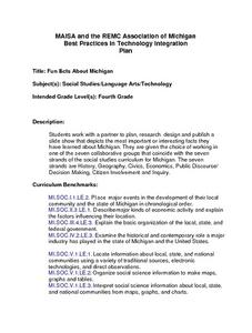
Michigan Fun Facts
Fourth graders work with a partner to plan, rese,a rch design and publish a
slide show that depicts the most important or interesting facts they
have learned about Michigan. They are given the choice of working in
one of the seven...
Curated OER
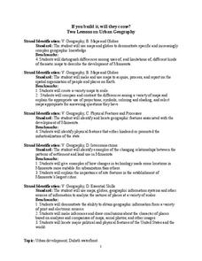
If You Build It, Will They Come?
Students examine the city of Duluth, Minnesota. In groups, they use the internet to discover its current state of urban geography. After their research, they create and plan their own redeveloping of the city. They share their results...
Curated OER
Eye From the Sky
Students are introduced to the concept of aerial perspective and scale. Students will use satellite technology to view their neighborhoods and sketch the area surrounding their schools. They will take part in a neighborhood walk to view...
Curated OER
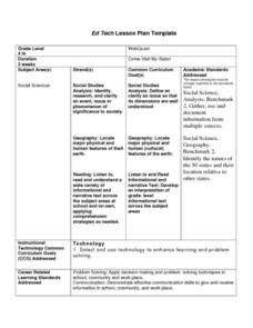
Come Visit My State!
Fourth graders conduct research on a selected state in the United States. They complete a WebQuest and conduct research on a variety of websites. Students then organize and present a visual display about their state that includes a...
Curated OER
Geometry: Classifying Angles
Students measure, construct, and classify angles as acute, right, straight, and obtuse. Once they have completed an angle worksheet, students use a map of South Carolina to locate cities by constructing the aforementioned angles.
Curated OER
Organisms and Habitats
Second graders investigate biomes and the plants and animals that are native to particular biomes. They participate in a class discussion, conduct Internet research on a selected biome, and create a shoebox biome using their Internet...
Curated OER
Fighting Obesity with Footsteps
Analyze the influence of culture, media, technology, and other factors in health through the use of pedometers and daily walking/jogging logs with this activity. The key focus is in dealing with obesity and how small steps can help...
Curated OER
Plotting Plates
Learners investigate plate tectonics and their correlation with natural phenomena like earthquakes and volcanoes. They use the internet to see real-time data about earthquakes and volcanoes. Students plot latitude and longitude points on...


