Curated OER
Name That Continent
Students practice locating the seven continents, four hemispheres, and four oceans using a large world map and a review song. They also import a world map to the Kid Pix computer program then type in proper labels on the map. There are...
Curated OER
Core Democratic Values in Action
Students compare and contrast rules they have in their homes and in the classroom. In this values lesson, students identify rules at home and relate to rules of other families. They list family rules, connect classroom rules to values...
Curated OER
Thanks for Your Service
Students thank their freedom fighters. In this Veteran's Day lesson, students honor members of the U.S. Armed Forces by designing a program to pay tribute to them. Students use technology tools to conduct interviews, take pictures, and...
Curated OER
Exploring Countries and Cultures
Fifth graders choose a country associated with a family member and research its location, government, language, economy, history, holidays, foods, sports, and famous people. They write to inform using this data and draw a map identifying...
Curated OER
City, County, Community
Students explore issues and situations that make for a city and its local environments. In this local government lesson, students design maps, define issues and create brochures that illustrate their understandings of these concepts and...
Global Oneness Project
A Collapsing City Skyline
Have your high schoolers learn about the modern history of Myanmar by close-reading an article about the city and people of the city Yangon. As they'll learn, the country is going through some dramatic transitions. After...
Curated OER
The Grand Excursion GPS Map
Eighth graders investigate the uses of a global positioning system. They create waypoints and have to find them using the system. Students must review the geographical concepts of latitude and longitude. The media requirements of the...
Curated OER
Weather Predictions
Pupils play the role of weather personalities by making five day forecasts based on data gathered from observations, weather instruments, and weather maps. Each day a small group makes a class forecast for the next day and reviews the...
Alabama Learning Exchange
Researching Hurricanes with Technology
Learners explain the components that make up a hurricane.
Curated OER
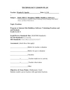
Technology Lesson Activity: Fractions
Fifth graders practice using the English measuring system by creating fractions. In this parts of a whole lesson, 5th graders combine math key bars to simulate small parts of a bigger item. Students combine the pieces to...
Curated OER
Technology: fractions
Sixth graders review equivalent fractions by using folded paper and shading in different amounts. For this fractions lesson plan, 6th graders review fractions with the paper, and then go onto internet sites to practice concepts on...
Curated OER
Making a Map of the Classroom
Students create a map of the classroom using the computer programs AppleWorks and iChat in this math-based technology lesson. Lesson extension ideas include a scavenger hunt and maps of other school buildings.
Curated OER
Mapping Your Local Community
First graders take a walking tour of their community to discover the names of numbered locations on a premade map. They then, create their own map of the community on the computer using Kidspiration software.
Curated OER
Mapping the Ocean Floor
Students study the bottom structure of underwater habitats and how they can be mapped.
Center for Learning in Action
Density
Explore the concept of density within states of matter—gases, liquids, and solids—through a group experiment in which young scientists test objects' texture, color, weight, size, and ability to sink or float.
NOAA
A Quest for Anomalies
Sometimes scientists learn more from unexpected findings than from routine analysis! Junior oceanographers dive deep to explore hydrothermal vent communities in the fourth lesson plan in a series of five. Scholars examine data and look...
Curated OER
Community Building
Seventh graders discover the similarities and differences between cities, towns, and rural communities. Using a Neighborhood map Machine, they create a Venn diagram and map of their own community. Students build a 3-D representation of...
Curated OER
Mush! Tracking Travelers on the Trail
Students get to know Alaska and the Iditarod route that is run by dogs as they track the mushers' progress on a map that they create specifically for the race. They learn about latitude, longitude, plotting on a map, checkpoints, and...
Carnegie Mellon University
Marcellus Shale: Who Pays?
After viewing short clips of unfortunate events, your class will consider two sides of a homeowner's court case, and then learn about the Marcellus shale deposit beneath the state of Pennsylvania and the hydraulic fracturing process. In...
Curated OER
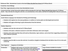
Introduction Lesson to the Book Where the Red Fern Grows
An excellent lesson plan on the classic book, Where the Red Fern Grows. Learners view the W. Wilson Rawls website and engage in a series of activities generated by the website. They write in their reflective journals, watch a video, and...
Curated OER
Who's The Boss?
Upper elementary and middle schoolers research and analyze some different types of governments. Democracies, Monarchies, and Dictatorships are some of the types that are looked at. Learners use the Internet to gather information that...
Curated OER
Butterflies, Butterflies, Butterflies
Transform your class into a butterfly museum! Research different types of butterflies, their habitat, and life cycle. Interactive components such as PowerPoint presentations, Claymation movies, and webpages add pizzaz to the museum...
Curated OER
Lesson on GPS
Students investigate global positioning systems. In this technology and mapping lesson, students view a PowerPoint presentation in which they identify the features of a GPS, state its uses, and follow steps to find a waypoint.
Curated OER
Most Wanted Villians
Students review the characteristics of various characters in fairytales. As a class, they review the story details and create a concept map using a software program. They create their own wanted poster of the villians in the fairytale to...


