Curated OER
Climate Characteristics of Canadian Localities
Tenth graders match the climate data to a Canadian city. They justify their choice, referring to factors that affect climate. They use the Atlas of Canada's Advanced Search to locate specific communities.
Curated OER
Development Issues in the Northern Suburbs
Students demonstrate the ability to obtain geographic information from a variety of print and electronic sources. They use a variety of maps and data to identify and locate geographical features of Minnesota and Anoka County. in...
Curated OER
Culminating Alternative Energy Project
Students work in teams to complete an alternative energy project. For this alternative energy lesson, students are assigned a city and decide on the most appropriate alternative energy source for their city. Students use maps from Google...
Curated OER
Native Americans Names
Third graders are introduced to the Native American groups of Michigan. Using primary source documents, they reconstruct events that occured in their local community. They discover the names of cities and towns in Michigan are related to...
Curated OER
Why Does Delaware Have Such A StrangeShape?
Learners examine the events and history surrounding the boundaries of Delaware. They participate in a class discussion and analyze a map, then create a floor map using masking tape. Students also participate in a play about the...
Curated OER
What Can We Discover About Colorado?
Students locate Colorado and its neighbors on a map (either in a book or on the Internet). They create a graphic that illustrates what they know and want to know about the state (KWL); finally, they draw and label Louisiana maps.
Curated OER
Urban and Agricultural Settlements Why are They There?
Seventh graders identify types of human settlements, urban and agricultural, and determine geographic influence on why people settle where they did by use of maps and charts. They, in groups, identify the needs of a new settlement, which...
Curated OER
Musical Plates
Students receive current data on the movement of plates on the earth's crust. These plates shift and the magnitude of their shift over time can be tracked. They track this velocity vector on a global map and determine the speed of the...
Curated OER
Probes, Exploration and Application
Students examine the benefits of the space program to our life on earth. In this space exploration instructional activity students participate in a lab, answer questions and study radar mapping.
Curated OER
Rent and owner's major payments
Students retrieve and map census data to determine the average rent and owners' payments made throughout Canada. They find out how many people are spending more than 30 percent of their income on housing.
Curated OER
Weather, Migrations, and Plants
Young scholars research the effects of day-to-day weather on animal migrations, plant growth and other seasonal events. They consult maps, observe and record local conditions, keep journals and use their collected data check hypotheses.
Curated OER
The Aging Population of Canada
High schoolers analyze age-group population data and make inferences on the impact of the aging population in Canada. They, in groups, focus on health care, social programs and labor issues.
Curated OER
Weather Patterns and Acid Rain (or What is Chicago's acid rain doing in the Adirondacks?)
Pupils examine a color-coded map of U.S. acid rain precipitation intensity. Using EPA data table and the blank U.S. map, they record state-by-state values for magnitude of emissions and compare areas of emissions to areas with the most...
Curated OER
US Emergence of Power in the Pacific Northwest: General Howard and the Nez Perce Tribe War
Young scholars discuss the role of the military in acquiring territory in the Pacific Northwest. Using a map, they locate the areas in which the Nez Perce were prominent and the routes used by the military to chase them. They discuss...
Curated OER
Who's Got Your Power
Learners examine and map local sources of energy. They conduct Internet research on their local utility company, identify where their utility company obtains energy, graph the data, and label a map of power plant locations in their state.
Curated OER
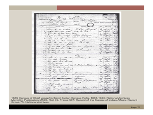
Chief Joseph and the Nez Perce
Eleventh graders explore the life of Chief Joseph and Nez Perce. In this US History lesson, 11th graders analyze paintings and photos detailing the flight of Nez Perce. Students create a narrative newspaper article based on their...
Curated OER
The Distribution of Earthquakes
Students determine the rate of seismicity by determining the frequency of aftershocks following a major earthquake. They incorporate the use of the Internet, Excel 2000, a map of their area with latitude and longitude markers, and paper...
Curated OER
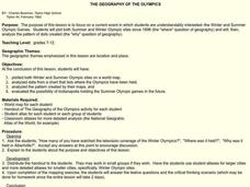
The Geography of the Olympics
Students plot the location of the Winter and Summer Olympics since 1896. Using the maps, they analyze data on where the Olympics have been held and discuss why that location was chosen. They discuss the possiblity of Indianapolis...
Curated OER
Interpreting Weather Station Symbols
In this science worksheet, middle schoolers look at the symbols on the map and make interpretations about temperature or other conditions to master the weather knowledge in the four problems.
Curated OER
The Lewis and Clark Expedition
Students examine the Lewis and Clark expedition. They develop skills for historical analysis. They locate a variety of geographic features encountered by the expedition, and create a timeline that documents Lewis and Clark on their journey.
Curated OER
How Does a Migration Move Forward?
Students record and examine migration data, and calculate how fast and far a migrating animal travels and what influences its progression. They utilize the Journey North website to follow their migrating animals.
Curated OER
Populations in the Path of Natural Hazards
Students read "Geographical Mobility: 1995-2000." They examine the maps in the handouts and compare them with maps from an atlas. In the second part of this lesson, students read "In Harm's Way." They receive three more handouts, one a...
Curated OER
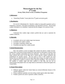
Meteorologist for the Day
Fourth graders examine the symbols used on weather maps. They analyze a newspaper weather forecast and identify and discuss the various symbols used on the map. Next, they prepare a weather map for their own city using the symbols...
Curated OER
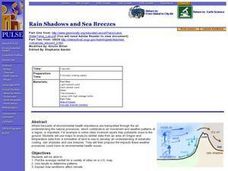
Rain Shadows and Sea Breezes
Students plot the average rainfall for a variety of cities in the United States. Using the map, they work together to determine patterns on which toxicants are transported through the air. They determine the impacts of various weather...
Other popular searches
- Weather Map Analysis
- Gis Data Map
- Gus Data Map
- Map Data Layer
- Interpreting Map Data
- Interpret Ting Map Data
- Interpretting Map Data
- Gs Data Map


