Curated OER
Map Skills
Thirds graders reinforce that a map is a drawing that shows what a place looks like from above. They use a map key and symbols to create a map of the school and its neighborhood.
Curated OER
Introducing Maps Through Dance
Students are introduced to the key concepts of maps; direction, pathway/line, shape and symbol. They create the pathways and shapes they have "mapped" out on paper on the floor. They dance along the paths.
Curated OER
Pirate Map
Students write directions explaining how to get from one location to another by using a map of their town and use simple maps to identify and locate places.
Curated OER
Mapping the News
Students explore cartography. In this map skills and map making lesson, Students work in groups to create wall size world maps including legends, compass roses, latitude and longitude, and physical features. Students collect...
Curated OER
People Change the Landscape
Students examine ways in which humans have brought change to the natural environment. In this ecology and literacy lesson, students listen to the book Island Boy by Barbara Cooney. Students observe and define map-reading vocabulary as...
Curated OER
Drake's West Indian Voyage 1588-1589
Students investigate several maps detailing Sir Francis Drake's voyages. For this geography lesson, students practice reading maps and locating the precise locations of where Sir Francis Drake visited. Students create an...
Curated OER
Do the Tallywalker
Students study the basics of mapmaking, then make a tally walker, (geographic location device used in secret).
Curated OER
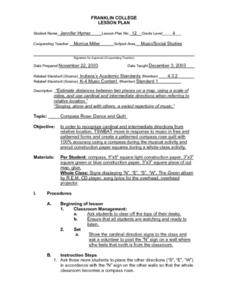
Compass Rose: Dance and Quilt
Fourth graders identify the cardinal directions by listening to a song entitled, "Stand," and by reviewing the lyrics to that song. They notice the cardinal directions that are posted around the classroom. They perform the motions as...
Curated OER
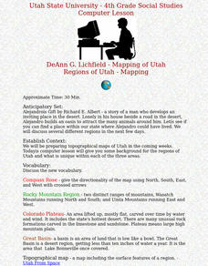
Regions of Utah - Mapping
Fourth graders draw a rudimentary map of the state of Utah, dividing it into the three regions: the Great Basin, the Colorado Plateau, and the Rocky Mountain Region.
Curated OER
Capitals, Oceans, And Border States
Students investigate geography by completing games with classmates. In this United States of America lesson, students examine a map of North America and identify the borders of Mexico and Canada as well as the Pacific and Atlantic....
Curated OER
George Washington Teaches Map Directions
Learners follow teacher given directions, either oral or written to plot points on a grid to create a profile of George Washington. They apply cardinal and ordinal directions to find the points on the grid.
Curated OER
U.S. Geography: The Northeast
Students investigate U.S. Geography by creating a map in class. In this natural resource lesson, students create a map of the United States and research the Northeast based on their resources and recyclable materials. Students...
Curated OER
Geo-Town
Second graders use a checklist to construct a Geo-Town map including a compass rose, a map key, and a paragraph about a walk around Geo-Town, using appropriate geometric and directional vocabulary to identify the two-dimensional figures...
Curated OER
How Do You Know Where You Are?
Seventh graders are introduced to geographic thinking, setting the stage for the creation of a map showing distance, direction, location and symbols from their residences to school.
Curated OER
Book: First Encounters Between Spain and the Americas: Two Worlds Meet
Students, after reading Chapter 1 in the book, "First Encounters Between Spain and the Americas: Two Worlds Meet," design and create a map of the Aztec Empire at the time of the first contract with the Spanish. They create the map from...
Curated OER
GPS Treasure Hunt
Learners explore geography by participating in a treasure hunt activity. In this Global Positioning System lesson, students define the terms latitude and longitude while utilizing an electronic GPS device. Learners view a PowerPoint...
Curated OER
Roller Coaster Mania
Fifth graders extend their knowledge of developing maps. They work in cooperative groups to develop an amusement park display and a brochure.
Curated OER
Microsoft Publisher Country Brochure
Students explore geographic information. In this geography and technology lesson, students choose a county and answer related questions on a Webquest. Students create a word web and design a country brochure.


