Curated OER
Denali Park Topographic Maps
Young scholars construct a topographic map of the Denali National Park. They identify different elevations and record historic landmarks in student science journals.
Curated OER
European Elevation Sort
Given a prepared database of European countries, sixth graders sort the countries in ascending order by elevation and identify the five countries with the highest elevations. This cross-curricular activity combines elements of computer...
Curated OER
Layers with Lines
Students examine topographical maps and the challenges faced by cartographers when drawing the maps. While creating collages, they use contour lines to add dimension much in the same way they are used on maps to show elevation.
Curated OER
Political Legends and Map Symbols
Students identify the legend and map symbols. For this map skills lesson, students use a world map to find various locations using a map key.
Curated OER
Hurricane Impact: Storm Surges and Elevation Transitions
In this hurricane worksheet, student answer 6 multiple choice questions and 8 short answer questions about hurricanes. They color the map to show flooded areas.
Curated OER
Topographic Maps
In this topographic map worksheet, learners learn how to read a topographic map and create a topographic map of their own using clay or Play-Doh. Students include contour lines by layering the clay. Learners answer 6 questions about...
Curated OER
Identifying Watersheds with Topographic Maps
Middle schoolers model a watershed and delineate one using topographic maps. In this hydrology lesson, students use aluminum foil to model a landscape and observe how water moves on it. They also observe the features of a topographic map...
Curated OER
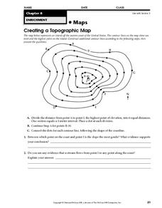
Creating a Topographic Map
In this topographic map worksheet, students add contour lines to a topographic map using instructions provided. Once topographic map is finished, students complete 2 follow-up short answer questions.
Curated OER
Introduction To Topographic Map Activities
Students discuss different types of maps, their similarities and differences. Using a Topographical Maps CD-rom program students create their own map.
Curated OER
Mapping It Out
Fourth graders examine various aspects of the environment of Utah. In groups, they create four maps of Utah, based on temperature, precipitation and elevation. To end the lesson, they are asked a question as a group and use their maps...
Curated OER
Designing a Hiking Trail
Put your students' map skills to the test with this engaging cross-curricular project. Given the task of developing new hiking trails for their local community, young cartographers must map out beginner and intermediate paths that meet a...
Curated OER
Working With Electronic Topography Maps
Junior geologists examine topographic maps online and learn how to read them. they answer seven associated follow-up questions. This lesson plan is only a general outline and does not provide the details or the websites that you would...
Curated OER
Outdoor Education; Maps, Elevation
Ninth graders use online topographical maps to fill in a chart regarding elevation and contour lines.
Curated OER
Land Elevation
Students investigate land elevation. In this map skills lesson, students use a physical map to identify various elevations of the land. Students find landform features such hills and coastlines.
Curated OER
Lesson Design Archaeology- USGS Maps
Students research USGS maps and identify the major features. In this map skills lesson, students identify low and high elevations on a USGS map and practice finding latitude and longitude.
Curated OER
Introduction to Topographic Maps
Tenth graders create a topographic map and see how it represents different elevations. In this topographic maps lesson students read and interpret topographic maps.
Curated OER
"Potato Mountain": Reading/Understanding Topographic Maps
Pupils investigate how to read topographic maps. In this map reading lesson students complete a topographic map activity.
Curated OER
Elevation at its Peak
Students pretend they are hiking up a mountain. They practice making calculations on angles and elevation. They use topographic maps to estimate distances and trigonometric ratio methods.
Curated OER
What You Can Learn From a Map
Students discover how to interpret maps. In this geography skills lesson, students explore geographic themes as they complete worksheet activities regarding road maps, shaded relief maps, and topographic maps.
Curated OER
Working with Contour Maps
For this contour maps worksheet, students use contour maps to determine the slope and steepness of different land masses. This worksheet has 16 fill in the blank questions.
Curated OER
Topographic Maps Worksheet
In this geography skills worksheet, students respond to 37 multi-part questions that require them to read and interpret topographic maps.
Curated OER
Using GIS to Construct Water Table Maps and Flow Nets
Students examine how to use GIS software to analyze patterns of groundwater flow. Seepage lake elevation data from the Sand Hills of Nebraska is used to construct a water table map and flow net using Esri's Arc Map software.
Curated OER
Tooling Around Arizona: Reading Arizona Maps
Students research Arizona maps. In this map lesson, students discuss map titles, scales, directions, elevation, and symbols. The class will examine topography, landforms, and rivers found on an Arizona map.
Curated OER
Mapping Potato Island
Students create their own topographical map using a potato. In this hands on lesson students construct a topographical map and explain what contour lines are using a potato.
Other popular searches
- Elevation Map
- Elevation Relief Map
- Elevation Map Worksheet
- Elevation Map of Florida
- Reading an Elevation Map
- Elevation Relief Map Asia
- Land Elevation Map
- Greek Elevation Map
- Michigan Elevation Map
- Puerto Rico Elevation Map
- Europe Elevation Map
- Elevation Relief Map Florida


