Curated OER
Globe Skills Lesson 5
In this map skills instructional activity, students read a text selection about locations during the American Revolution and then respond to 8 fill in the blank questions.
Curated OER
Globe Skills Lesson 1 Some Early American Cultures
Students apply their knowledge of geography. In this geography skills instructional activity, students read brief selections regarding early Americans. Students respond to the questions included in the self-guided map...
Curated OER
Design an Island
Young scholars make a map of an imaginary island using the topographic symbols provided from a worksheet. Students place lakes, dwellins, reefs, etc. in areas where they would logically be located from understanding how the topography...
Curated OER
Geography Skills
Students practice their geography skills. For this geography skills lesson, students locate, plot, and label places on maps and globes.
Curated OER
Globe Skills Lesson 8 Dust Bowl Travelers
Students develop their globe and map skills, In this geography lesson plan, students examine the Dust Bowl as they complete an activity that requires them to plot latitude and longitude.
Curated OER
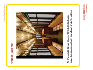
"L" Stands for Elevated
Students play a trivia game to learn more about the Chicago public transportation system. In this transportation lesson plan, students also create an "L" car, and write advertising slogans for Chicago's elevated trains.
Curated OER
Design an Island
Students explore islands. They create a two- or three-dimensional map of an island. They explain how the topography of an area influences the location of water sources, ecosystems, and human settlements. Lesson includes adaptations for...
Curated OER
Salad Tray 3D Topographic Model
Students explore the characteristics of topographical maps. They examine the relationship of contour lines and vertical elevation. Students create a three-dimensional model of a landscape represented by a topographic contour map.
Curated OER
Lesson on GPS
Learners investigate global positioning systems. In this technology and mapping lesson, students view a PowerPoint presentation in which they identify the features of a GPS, state its uses, and follow steps to find a waypoint.
Curated OER
Highest Cities in the USA
In this online interactive geography quiz activity, students respond to 32 identification questions regarding the highest elevated cities in the U.S. Students have 4 minutes to finish the timed quiz.
Curated OER
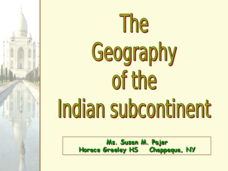
The Geography of the Indian Subcontinent
Gloriously adorned with a glimpse of the Taj Mahal, these slides detail important facts and characteristics of South Asian cultures, such as India, Pakistan, Afghanistan, and several other surrounding countries. Slides cover the...
Curated OER
Nature and Place Names in Arkansas
Middle schoolers examine the way that many place names in Arkansas came to be. By looking at Arkansas highway maps, they find names that come from the characteristics of each of the state's six geographical divisions. This interesting...
Missouri University of science & Technology
General Overview History of the Panama Canal
Called the Eight Wonder of the World by some and the Big Ditch by others, the Panama Canal is indeed an engineering marvel. The long, complicated, and sometimes controversial history of the canal is captured in a presentation loaded with...
Curated OER
Oregon Rainshadows
Students brainstorm list of possible highest locations in Oregon, identify and label places from list on map using color code, and discuss and identify causes of a rain shadow.
Curated OER
Watershed Island
Students make a clay model and a geographic map of a watershed. They talk about the differences between the two representations and the potential human threats to watersheds.
Curated OER
Topography: Know the topography of your neighborhood
Students read and identify features on a topography map. In this topography lesson plan, students learn how to read a topography map, and then go out and take pictures of their own and discuss the topography pictures they took.
Curated OER
Building a Topographic Model
Students explore the features of a topographic map. They make paper models that portray, in three-dimensions, features represented by contour lines on a topographic map. Students demonstrate different elevations shown on a...
Curated OER
Natural History of Costa Rica
Students use outline maps to become acquainted with Costa Rica. They see how it was formed and how its origin has created very diverse environments. Students then use atlases and compare their physical maps with maps of climate and the...
Curated OER
From the Heights to the Depths
Students create a relief map of Asia and Australia. They work in small groups on sections of the map to make one complete map of the continents.
Curated OER
Landscape Picture Map: Natural Features
Students discover six landscapes. In this natural features lesson, students review the meaning and examples of natural features. Students use a landscape picture map to identify six natural features.
Curated OER
Building A Topographic Model
Students visualize, in three dimensions, features represented by contour lines on a topographic map. They see that the different elevations shown on a two dimensional topographic map can be used to build a 3-D model.
Curated OER
Rock River Watershed
Young scholars discover what a watershed is and which one they live in. Using the internet, they research why watersheds are important to an ecosystem and how to keep them from getting polluted. They use a map to locate various items...
Curated OER
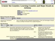
Cruisin' the Counties: Learning Counties and Major Roads in Arizona
Pupils examine Arizona counties and use the themes of location and movement to develop an Arizona map.
Curated OER
Kansas Land
Fourth graders discover the geographic regions of Kansas. In this geography lesson, 4th graders explore the different regions of Kansas and determine how the different geography affects daily life in Kansas.
Other popular searches
- Elevation Map
- Elevation Relief Map
- Elevation Map Worksheet
- Elevation Map of Florida
- Reading an Elevation Map
- Elevation Relief Map Asia
- Land Elevation Map
- Greek Elevation Map
- Michigan Elevation Map
- Puerto Rico Elevation Map
- Europe Elevation Map
- Elevation Relief Map Florida


