Curated OER
Geography of South America
Student's identify geographic features of a South American map. They use the scale of the map to calculate distances between points. They identify examples of the five geographic themes on the map of South America.
Curated OER
What's Your Temperature?
Learners take a look at the local newspaper and focus on the weather section. They get into small groups, and each one looks at the same map, but of a different part of the country. They must prepare a presentation that shows how...
Curated OER
Global History & Geography: Latin America
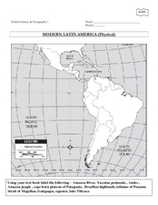
The instructions say to use a text-book to label 11 different regions in modern Latin America. If a text-book is not available a map can be found on-line and printed for student reference.
Curated OER
Map Puzzles
Students make puzzles from world maps, dramatizing how much of the globe is covered by ocean.
Curated OER
Americas: Political Map
In this North America and South America outline map learning exercise, students examine the political boundaries of the 2 continents.
Curated OER
A Comparison of Cloud Coverage Over Africa
Students use a NASA satellite data to contrast amounts of cloud coverage over different climate regions in Africa. They explore how Earth's major air circulations affect global weather patterns, and relate to local weather patterns.
World Maps Online
Introduction to the World Map
Students identify the differences between maps and globes. In this map skills instructional activity, students are shown a globe and a map and recognize the differences. Students use post-it notes to locate several locations on the world...
Curated OER
Exploring the World's Geography
Students discuss the seven continents of Earth and the diverse geography. After discussion, they create their own paper-mache globes which properly display all seven continents, the equator, and the prime meridian. They conduct research...
Curated OER
Latitude and Longitude
Students demonstrate how to locate places on a map using a grid. In this map skills lesson plan, students are introduced to latitude and longitude lines. Students define these terms and view a large map of a state. Students come up to...
Curated OER
Viewpoints
In this latitude and longitude worksheet, middle schoolers complete 10 matching questions identifying key features or locations on a map. Students also use lines of latitude and longitude to identify the time in 4 different places.
Curated OER
The Country of Kenya
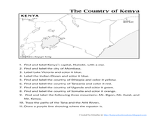
For this map completion worksheet, students observe a map and map scale of Kenya to find and label bodies of water, cities, countries, and the equator. Students answer 11 questions.
Curated OER
Places on the Planet: Latitude and Longitude
Students locate different places on globes and maps by learning about latitude and longitude lines. In this latitude and longitude lesson plan, students identify specific locations based on the degrees of latitude and longitude.
Curated OER
5th grade social studies geography
In this geography worksheet, 5th graders complete multiple choice questions about hemispheres, maps, cities, ecology, and more. Students complete 25 questions.
Curated OER
Cacao Tree Geography
Students use a map to learn about where chocolate comes from. In this lesson on the cacao tree, students locate various regions where the cacao tree grows. They will discuss why the cacao tree grows more favorably in particular climates...
Curated OER
Equator, North Pole, and South Pole
Learners identify the Equator, North Pole, and South Pole on the globe. In this map skills lesson, students use a globe marker to locate specific locations on the globe. Learners find where they live in relation to the Equator.
Concord Consortium
The Six Faces of Amzora
Here's a task that is out of this world! Given a description of a fictional cube-shaped planet, scholars answer a set of questions about the planet. They create a two-dimensional map and consider the distances between locations on the map.
Curated OER
MAP GRIDS, CLIMATES AND HEMISPHERES
Students compare/contrast the grid and latitude/longitude system used on a globe. They describe the areas which are considered to be a tropical, temperate, and polar, based on knowledge of climates.
California Academy of Science
Tropical Belt
Where in the world is the equator? Explore a world map with your class, coloring in oceans, continents, and rainforests while locating the three major lines of latitude: the equator, Tropic of Cancer, and Tropic of Capricorn. Discuss how...
PBS
Make a Balloon Globe
"We've got the whole world in our hands," is what your students will be singing after completing this fun geography activity. Using the included templates for the seven continents and a balloon, they create their very own globes.
Curated OER
Chalkboard Challenge: Social Studies Online
If used as an independent review, this presentation could be a quick way for students to study U.S. History facts. Since it only presents a few simple facts, it would not be adequate for a comprehensive review, but a teacher could...
It's About Time
Where are the Volcanoes?
Middle school geologists map the volcanoes closest to themselves, learn about map distortion, and infer possible future volcano locations. A focus on latitude, longitude, and volcanoes beneath the ocean helps connect the lesson.
CK-12 Foundation
Location on the Earth: Longitude and Latitude
To what degree do learners understand coordinates? Get them some practice in Yosemite National Park in a simple, fun interactive. Pupils explore a map and locate coordinates of popular sights within the park, then answer questions to...
Curated OER
Americas: Physical Map
In this Americas physical map learning exercise, students make note of the major landforms and bodies of water located on the North American and South American continents.
Curated OER
Explore Surface Types on a Journey Around Earth
Students explore satellite data. In this technology cross-curriculum math and world geography lesson plan, students locate specific map areas using a microset of satellite data. Students use technology and math skills to determine...


