Scholastic
Volleyball Road Trip
Review coordinate mapping with your young geographers by matching cities on a volleyball team's road trip itinerary to their appropriate coordinate locations.
CK-12 Foundation
Direction on the Earth: Using a Compass
Navigate the world of orienteering in an informative interactive. Earth science scholars learn practical direction skills, such as proper polar coordinates and pairing compasses with maps. The interactive map allows them to practice...
Curated OER
Locating Places
Learners demonstrate how to use the map grid system. In this map skills lesson, students are given coordinates to locate several locations on a world map. Learners use the map grid system to identify these locations.
Curated OER
WORLD GEOGRAPHY
Students identify and analyze map symbols and map grids by completing various worksheets and creating their own map using these skills. Students identify and analyze what latitude and longitude are on a map to play a game of Bingo....
Curated OER
Where Am I?
Students apply map reading skills by locating places through the use of latitude and longitude.
Curated OER
Mapping a Site Using a Coordinate Plane
Learners map their playground as if it were an archeological site. They locate objects on the playground and determine their location using coordinate points. A related lesson is Coordinate Grid: Mapping an Archeological Site.
Benjamin Franklin Tercentenary
From Ben’s Pen to Our Lives
What would Ben do? Jumping off from the pseudonymous letters Ben Franklin fooled his older brother into publishing when he was still a teenager, young literary lovers dive into acting, writing, and addressing a local issue with wit and...
Curated OER
Landscape Picture Map
Students design a landscape picture map. For this landscape picture mapping lesson, students understand when and why to use a landscape picture map. Students discuss landscape picture maps.
Curated OER
Map Work: Using the Index and Grid References
In this maps worksheet, students use the Oxford First Atlas to answer 20 questions about cities in Great Britain. Students will need to use the index and grid references to locate cities or countries.
Curated OER
Draw an Inch, Walk a Mile
Students work in small groups to solve the problems presented. The main project, mapping the classroom, use these discussions to collaborate in creating a tangible demonstration of their understanding.
Mathematics Assessment Project
Generalizing Patterns: Table Tiles
As part of a study of geometric patterns, scholars complete an assessment task determining the number of tiles needed to cover a tabletop. They then evaluate provided sample responses to see different ways to solve the same...
Curated OER
Gridding a Site
Students establish a grid system over an archaelogical site. They label each grid unit. They determine the location of artifacts within each grid unit. They construct a scientific inquiry concerning the location of artifacts on the site.
Curated OER
Coordinate Grid: Mapping an Archaeological Site
Middle schoolers examine how archaeologists preserve context of sites through use of rectangular grid or Cartesian coordinate system, and develop sense of distance by pacing off and estimating distances.
Curated OER
Location, Location, Location: Using a Grid to Determine Context
Seventh graders are introduced to making inferences about artifacts. Using a grid system, they locate the artifacts and determine where they originated from. They use this information to make conclusions about the way people lived...
Curated OER
Making Topographic Maps and Mountain Profiles
Learners study how to mark inclines and construct a mountain profile. In this topographic map activity students mark contour intervals and draw mountain profiles.
Curated OER
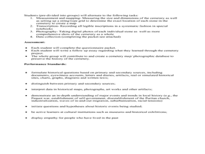
Cemetery Mapping Lesson
Eighth graders explore historical records. In this cemetery mapping lesson, 8th graders analyze local community data as they examine gravestones and read epitaphs.
Curated OER
Absolute Location
Fifth graders examine the geographic concept of absolute location. Using a variety of resources, they create a life-size classroom grid and locate the coordinates of a point, identify latitude and longitude of different locations, and...
Curated OER
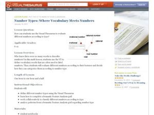
Number Types: Where Vocabulary Meets Numbers
Rational, irrational, real, natural. All these words can refer to numbers. Who knew? Learners use the Visual Thesaurus and a semantic feature analysis grid to examine the different attributes of numbers. Step-by-step instructions for...
Curated OER
Where in the World
Students explore the global grid system. In this globe lesson, students identify latitude and longitude lines and how these can tell the coordinates of any place. They use the Internet to find the exact coordinates for their town.
Curated OER
"Yarning" About Latitude and Longitude
Learners identify various locations using latitude and longitude. In this map skills lesson, students use yarn and labels to create a "human globe." Learners identify the Prime Meridian, the Equator, and Northern and Southern Hemisphere.
Curated OER
All About the Animals
Whose footprints are those? After reading Janet Halfmann's book, Little Skink's Tail, young scholars use footprints to determine where on a gridded map certain animals have been spotted. They use the map to answer 3 questions, one...
Curated OER
What do Maps Show?
Eighth graders practice the skill of reading maps. In this geography lesson, 8th graders participate in a classroom lecture on how to read a map.
Curated OER
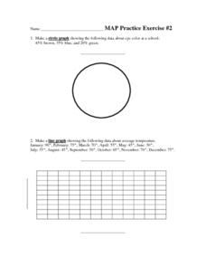
MAP Practice
In this geometry activity, students create circle, line and bar graphs using different comparisons of events. There are 24 questions with an answer key.
University of Southern California
What Is The Ocean?
Go on a tour of the ocean through the lens of a scientist. Learners read maps of the ocean floor, study tide behavior, examine wave motion, and analyze components of soil. Each lesson incorporates a hands-on component.


