Balanced Assessment
School Zone
Find the right house within walking distance from school. The short assessment has pupils determine the houses that are a given maximum distance from a school. Individuals then determine the shortest and longest walks from the homes that...
Curated OER
Making Maps
In this map making activity, students learn about the science of making maps, which is cartography. They then answer the 11 questions on the activity. The answers are on the last page.
Curated OER
Map Analysis Worksheet
For this map analysis worksheet, students decipher what type of map they are using based on a complete list of criteria. Students then answer multiple questions based on their discoveries.
Curated OER
Kinds of Maps
In this map instructional activity, students match a set of descriptions with the names of different types of maps and answer true/false questions and short answer questions about using maps.
Curated OER
Map Skills
For this map worksheet, students use a map and key to complete a set of 7 questions. Answers are included on page 2, questions focus on miles and direction.
Curated OER
Map Skills
For this history worksheet, students use a map and legend to answer nine comprehension questions. Students check their answers when done.
Curated OER
Map Skills
For this history worksheet, students utilize a map and legend to answer eleven comprehension questions. Students check their answers when done.
Curated OER
Map Reading
In this social studies worksheet, 3rd graders discover the various attributes of a road map. Students work with routes, map keys, and scale to find distances from one city to another.
Balanced Assessment
Ford and Ferrari
Which is faster, a Ford or a Ferrari? The short assessment has pupils analyze graphs to determine the rates of change between the two. Individuals interpret the rates of change within the context of speeds of the cars and develop a map...
Curated OER
Map Study
In this geography instructional activity, students study the United States. Students respond to 6 multiple choice questions about the map.
Messenger Education
Look But Don’t Touch—Exploration with Remote Sensing
Mars is home to the tallest mountain in our solar system, Olympus Mons. In this set of two activities, learners review geologic land formations through the analysis of aerial maps. They then apply this knowledge to aerial maps of objects...
Curated OER
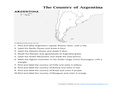
Map of Argentina
In this map of Argentina instructional activity, students label key areas, cities, bodies of water and surrounding countries, then color the map according to directions.
Curated OER
Make a Map
In this mapping activity worksheet, students finish the map by following the 5 directions and using the map key. Students the map key, scale, and an inch ruler for help.
Curated OER
U.S. Geography for Children: Michigan
In this Michigan map activities learning exercise, students observe an outline map of the state of Michigan, locate and label specific places and areas, and create a map key. Students complete 5 activities.
Curated OER
U.S. Geography for Children: The Northeast
In this map skills of the northeastern United States worksheet, students observe an outline map, locate and label the states, and designated landforms and bodies of water; and create symbols and a map key for sources of economy and other...
Curated OER
U.S. Geography: California
In this map skills about the state of California worksheet, students locate and label specific places and areas and create a map key and symbolize the economy and areas of personal interest. Students answer 5 questions.
Curated OER
U.S. Geography for Children: State Capitals
In this United States map skills instructional activity, students locate and label specified states and their capitals, and create icons and a map key to show something for each state that is famous. Students answer 5 questions.
Curated OER
Cause and Effect: Light Clusters and Geography
After viewing a map of lights at night over a variety of geographic formations, young topographers connect the location of light clusters to geographic features that encourage human settlement. They list causes and effects of large...
Cheetah Outreach
Habitats
Explore six different habitats—wetlands, rainforest, savannah, desert, city, and cultivated land—to determine which habitat factors (food, water, shelter, and space) are high, medium, or low in each. Learners also use maps of Africa to...
Super Teacher Worksheets
United States of America
Here is the perfect assessment to test your young learners on labeling the 50 states! Each state is given a number on a blank map of the United States, and a second page lists the numbers in order for learners to identify.
Curated OER
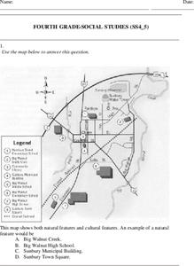
Fourth Grade Social Studies
In this social studies worksheet, 4th graders answer multiple choice questions on state maps, city maps, road maps, political maps, and more. Students complete 25 multiple choice questions.
Curated OER
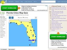
Florida Cities Map Quiz
For this online interactive geography worksheet, students examine a map of Florida and identify the 12 noted cities on the map using a pull down menu within 3 minutes.
Curated OER
Lakes of Methane on Titan
In this methane lakes worksheet, students read about the false-color synthetic radar map taken by the Cassini spacecraft indicating methane lakes on Titan. Students solve 4 problems about the surface area of the lakes from the image, and...
DK Publishing
Finish the Picture
Youngsters add some shapes to this castle drawing before analyzing its geometry. They count the circles, triangles, rectangles, and squares. The objectives here include drawing, recognizing, and counting shapes as well as writing numbers...
Other popular searches
- Map Key and Legend
- Using a Map Key
- Create Map Key
- Map Key and Symbols
- Project Map Key
- Map Key Topography
- Map Key Legend
- Reading a Map Key
- Map Keys and Legends
- Map Key Worksheets
- Read a Map Legend
- Reading Map Keys


