Curated OER
Park Problems
Students calculate park acreage and map the distribution of parks in Austin, TX using GIS. Students use a specific website to find the information.
Curated OER
Texas: U. S. Geography for Children
In this Texas map instructional activity, students locate and label key features of Texas on the map and create icons to symbolize the economy and culture of Texas.
Curated OER
Florida: U.S. Geography for Kids
In this Florida geography worksheet, students locate and label the important features of Florida and create icons for the economy and culture of Florida.
Curated OER
Coordinate Seating: Using a Coordinate System
Fourth graders discover coordinate systems. In this mapping lesson, 4th graders create a coordinate system for theater seating. Students observe a video based on a theater's seating map.
Curated OER
17 states
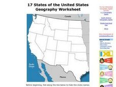
In this states worksheet, students label states in the United States that are on the west side of the country. Students label 17 states.
Curated OER
What Do You Know About Oceans?
Students brainstorm and discuss what they know about oceans and seas, read poem My Ocean Speaks by Olga Cossi, discuss narrator's feelings about ocean, write reflective journal entries about their experience or inexperience with the...
Curated OER
Natural History of Costa Rica
Students use outline maps to become acquainted with Costa Rica. They see how it was formed and how its origin has created very diverse environments. Students then use atlases and compare their physical maps with maps of climate and the...
Curated OER
The United Kingdom
In this United Kingdom activity, students label the capitals and color the countries of the United Kingdom. Students complete 8 tasks.
Curated OER
Plotting the Ocean Floor
Fourth graders plot points on a graph, connect the dots to make the ocean floor profile and label the topographical features. They utilize a worksheet and a website imbedded in this plan to plot the ocean floor.
Curated OER
Gridding a Site
Students establish a grid system over an archaelogical site. They label each grid unit. They determine the location of artifacts within each grid unit. They construct a scientific inquiry concerning the location of artifacts on the site.
Curated OER
Countries of the World
Students in a ESL classroom examine a world map and study the various countries' names. The study the cultures of selected countries and create a vocabulary list. Finally they label an empty map with the countries' names and a short...
Curated OER
Finding Your Spot in the World
Students practice locating places on a Thomas Brothers map. In this map skills lesson, students locate places on the map of where their ancestors are from and then practice finding various community places on a map. Students graph the...
Curated OER
The Birmingham River System
After a lesson on geography and the features of a river, students view a map of the Birmingham river system, which is in England. They are then asked to label 4 features on the map.
Curated OER
Where In the World Are You?
Fourth graders fill in blank copies of the United States Map and then the World Map.
Curated OER
Topography: Know the topography of your neighborhood
Middle schoolers read and identify features on a topography map. In this topography lesson plan, students learn how to read a topography map, and then go out and take pictures of their own and discuss the topography pictures they took.
Curated OER
Dandelion Seed Lesson Plan
Students create a map using the story The Dandelion Seed by Joseph Anthony. In this early childhood lesson plan, students develop map skills as they illustrate the path of the seed in The Dandelion Seed.
Curated OER
The UK and the Republic of Ireland
In this maps activity, students label the cities and countries of the United Kingdom and the Republic of Ireland and answer a short answer questions. Students complete 4 activities.
Curated OER
The Landscape of Poland
Students recognize and re-create the political boundaries and physical features of the nation of Poland. They create three dimensional topographic maps of Poland. In addition, they compose two journal entries written in two different...
Curated OER
States and Capitals of the United States
Learners label states and capitals on a United States map and complete research on one of the states. In this states lesson plan, students fill in the states on blank maps.
Curated OER
Apple: Seed to Tree
Students grow seeds of an apple and learn about Johnny Appleseed. In this apples lesson plan, students map Johnny Appleseed's travels, learn how he got his name, compare different Johnny Appleseed books, and grow apple seeds themselves.
Curated OER
The Edge of the Lake
Second graders explore the geography of Nevada. In this map-making instructional activity, 2nd graders use salt dough to create a relief map of Nevada. Students label the landforms and bodies of water that are studied and specified in...
Curated OER
Partition of Africa Questions
In this colonial Africa activity, students study a map of Africa from 1885-1914. Students then respond to 9 short answer questions based on the information presented in the map.
Curated OER
Continents
Students investigate World Geography by researching the different continents. In this Asian Geography lesson, students discuss the continent of Pangaea and color a worksheet of the continents. Students locate China on the map worksheet...
Curated OER
Unnatural Scavenger Hunt
In this science observation scavenger hunt worksheet, learners use 10 riddles to find items hidden in an outside area then map the locations of each item.
Other popular searches
- Labeling a Map
- Africa Map Labeling
- Midwest Map Labeling
- Geography Map Labeling
- Labeling a Map Continents
- Labeling Map Parts
- Labeling Parts of Map


