Curated OER
United States Map: Capitals
In this United States outline map activity, students make note of the political divisions of 50 states of the nation. This map is labeled with the 50 state capitals.
Curated OER
European Country Map
In this Europe political map worksheet, students examine the national boundaries. The country names are labeled on the map.
Curated OER
South America Map
In this South America political map worksheet, learners examine the country boundaries. The map also labels each of the countries and their capitals.
Curated OER
Mexico and Central America Map
In this outline map instructional activity, learners study the political boundaries of Mexico and the Central American countries. This map is labeled with the country names.
Curated OER
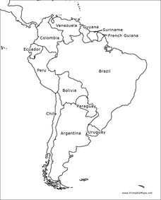
South America Outline Map
In this blank outline map worksheet, students explore the political boundaries of South America and the nations there. This map may be used in a variety of classroom activities. The map is labeled with the country names.
Curated OER
World: Political Map
In this world political outline map worksheet, students examine boundaries of each of the countries in the world. This map not is labeled.
Curated OER
United States Outline Map
In this United States outline map worksheet, students note the political boundaries of the states that are labeled with state capitals.
Curated OER
Mexico and Central America Map
In this blank outline map worksheet, students study the political boundaries of Mexico and Central America. Each of the counties is labeled and the capital cities are starred.
Curated OER
Northern Hemisphere Map
In this Northern Hemisphere polar projection map worksheet, students examine this region of the world. The continents shown are labeled.
Curated OER
US: Midwest Region Map
In this U. S. outline map worksheet, students examine boundaries of the Midwest Region states and the placement of the capital cities. This map is labeled.
Curated OER
South Asia: Political Map
In this South Asia outline map instructional activity, students & examine boundaries of each of the countries in the region. This map is labeled with the country and capital city names.
Curated OER
World Pacific Map
In this world Pacific projection outline map activity, students examine boundaries of each of the countries in the world. This map not is labeled.
Curated OER
United States of America Map
For this United States of America map worksheet, students examine boundaries of each of the 50 states in the nation. This map not is labeled.
Curated OER
Africa & Asia: Labeled Map
In this African and Asian political map worksheet, students examine national boundaries and national capitals of the continents.
Curated OER
Asia and the South Pacific : Political Map
In this Asia and the South Pacific map worksheet, students examine the boundaries of the nations in this region of the world. Students also note the location of capital cities as they are denoted by stars. Major bodies of water are labeled.
Curated OER
US: Western Region Map
In this U. S. Western Region outline map worksheet, students examine boundaries of each of the states and the placement of the capital cities. This map is not labeled.
Curated OER
Europe Outline Map (Labled)
In this blank outline map activity, students study the political boundaries of the labeled European nations.
Curated OER
Australia Map
In this blank outline map worksheet, students explore the political boundaries of Australia. This map is labeled and may be used in a variety of classroom activities.
Curated OER
States: United States Map
In this United States political map worksheet, students examine state boundaries. The map is labeled with the names of each of the 50 states.
Curated OER
North America Map
In this North America political map worksheet, students examine the labeled countries and their respective national boundaries.
Curated OER
The Crimean War
Use the list of cities, countries, and water ways to correctly label a map of the regions associated with the Crimean War. There are approximately 20 locations to locate and identify.
Curated OER
Alabama Map
In this Alabama worksheet, students explore the state of Alabama. Students are given a blank map of Alabama where they are to label the capital city, other major cities, and any other important state attractions on the map.
Curated OER
Labeling a Map of Australia
Third graders label a map of Australia. Using the internet, they research the history and maps of the continent and print a blank map. They review on how to use a compass rose and legend. In groups, they create a brochure to share...
Curated OER
Map of Egypt
In this map of Egypt activity, students label the cities, bodies of water, surrounding countries and color the map according to the directions.
Other popular searches
- Labeling a Map
- Africa Map Labeling
- Midwest Map Labeling
- Geography Map Labeling
- Labeling a Map Continents
- Labeling Map Parts
- Labeling Parts of Map


