Curated OER
Asian Civilizations
Seventh graders complete computer based research to complete a travel brochure that highlights an Asian civilization.
Silos & Smokestacks National Heritage Area
Life as a Pioneer
Learners examine historical documents and research why early pioneers settled on the Iowa prairie. They review maps, describe the impact of railroading, describe life in pioneer times, and identify the effects of drought, prairie fire,...
Curated OER
Geography And The Gulf War
Students develop maps, tables, graphs, charts, and diagrams to depict the geographic implications of current world events, and analyze major human conflicts to determine the role of physical and cultural geographic features in the...
Utah Education Network (UEN)
Order of Operations Treasure Hunt
In this algebra lesson, students work in groups to design a treasure map in which algebraic equations must be solved using the correct order of operations. Students decide where treasure is hidden, then create and follow their group's...
Curated OER
Boston Massacre Trial
Students participate in trial simulation following the Boston Massacre in which they use core map A to help present their evidence and testimony.
Curated OER
Around the World in 5 Days
Learners explore continents, draw map, discuss cultures, use research to learn geography, and investigate cultures.
Curated OER
Landforms: Geomorphology of Arkansas
Second graders create large, salt dough maps of Arkansas and the natural regions in the state created by geographical and morphological features.
Curated OER
In Our Time
Young scholars map the ideas, people, and beliefs of a period of history. They analyze influences of historical eras. Students use mapping as a prewriting strategy. They use Inspiration to map the key events, ideas, and personalities...
Curated OER
Pennsylvania Watersheds
Students identify the major watersheds of Pennsylvania. In this forestry lesson, students learn what a watershed is and are assigned one of the major watersheds of Pennsylvania. Groups then need to determine the boundaries of the...
Curated OER
Deadly Shadow of Vesuvius
Students view a video clip about volcanoes. They collect data and create maps to see the relationship between volcanoes, earthquakes and plates. They share their maps with the class.
Curated OER
Ellis Island/Angel Island
Fourth graders research Ellis Island and Angel Island. In this library media lesson, 4th graders use resources from the library to locate facts about Ellis Island and Angel Island. Students construct a Venn diagram to compare and...
Curated OER
The Coldest Place at the Bottom of the World
Students research and trace Shackleton's actual and intended route on an area map. They analyze the altitude changes involved in a trek across Antarctica and complete a worksheet comparing Antarctica to their own state.
Curated OER
We the People
Students create a map illustrating the three branches of goverment. They identify the branches of government and the shared or exclusive powers of each. Students use mapping as a prewriting stategy. They discuss our national...
Curated OER
Antebellum North Carolina
Eighth graders examine pictures & documents relating to the Hayes Plantation (Edenton, NC). They also use various maps of North Carolina to help them analyze how James Cathcart Johnston used, modified and adapted to the physical...
Curated OER
Legendary Myths Verses Modern Life
Students discover that some of the influences ancient myths have had on the way of life still practiced today in a Spanish speaking country they have chosen. They work in small groups to devise their own essential question, research...
Curated OER
Exploring the World's Geography
Students discuss the seven continents of Earth and the diverse geography. After discussion, they create their own paper-mache globes which properly display all seven continents, the equator, and the prime meridian. They conduct research...
Curated OER
The Holocaust: Concentration Camps
Tenth graders, after reading a variety of passages and watching a video on "Children Remember the Holocaust," explore the concept of brutality of deportation and analyze conditions in concentration and death camps. They review maps and...
Curated OER
Holy Mole
Third graders explore the Mexican sauce Mole and the culture of Mexico. In this Mexican culture lesson, 3rd graders find Mexico on the map and access prior knowledge about the country. Students discuss Mexican foods....
Curated OER
ABCs of Endangered Species
Learners create an ABC Book of Endangered Animals that includes locator maps, "fast facts," and explanations about why those animals are endangered.
Curated OER
Pennsylvania Colony
Students research the main reasons for the colonists moving to the Pennsylvania colony. They analyze maps, label a bubble map, list similarities/differences of immigrants then and now, and create a colonial newspaper advertisement.
Curated OER
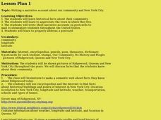
Our community and New York City
Fourth graders research websites to gather information about New York City and the Ridgewood community. In this New York City and Community lesson, 4th graders make a semantic map. Students write short postcards to send to students...
Curated OER
How Can We Write A Story Using Dr. Seuss' Writing and Illustration Style?
Students write a story. In this writing style and illustration lesson, students review elements of Dr. Seuss' writing and illustration style and read a few more books written by him, examining the writing style. Students work...
Curated OER
Diversity: Origin Myths
Fifth graders analyze origin myths and the diversity of First Nations groups. In this history lesson, 5th graders review the geography of Canada and read various origin myths. Students illustrate one of the myths and research...
Alabama Learning Exchange
Do You Have a Babushka?
Young scholars retrieve information about Patricia Polacco from selected sources. They classify information into prescribed categories on a concept map.
