Curated OER
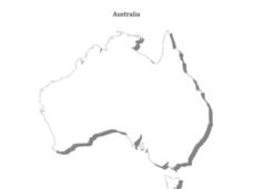
Australia
In this Australia map, students research and locate the main regions, states and important landmarks found on the map and discuss them with their classmates.
Curated OER
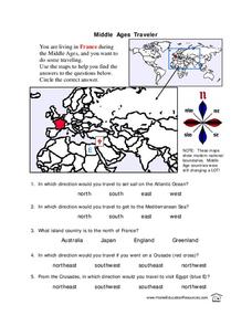
Middle Ages Traveler
In these Middle Ages worksheets, students use the maps to help them find the answers to the questions that help them understand the directions of north, south, east and west. Students also color another map of France according the...
Curated OER
Australian Map (Regions)
In this Australian map worksheet, students research and label the regions of Australia on an Australian map. Students check their labeled regions when completed.
Curriculum Corner
Earth Day Book
This Earth Day, celebrate our beautiful planet with an activity book that challenges scholars to show off their map skills, complete a crossword puzzle, write acrostic poems, alphabetize, and reflect on their personal Earth-friendly habits.
Curated OER
Africa Capitals Map Quiz
In this online interactive geography quiz worksheet, students examine the map that includes 53 African countries. Students match the names of the countries to the appropriate locations.
Curated OER
Mapping Australia
In this mapping Australia activity, students locate and label various features and places on a blank map, 10 total. A reference web site is given for additional activities.
Cornell University
Too Much of a Good Thing?
Continuing their study of beneficial insects, young entomologists discover where in the world some of these bugs are. By labeling, coloring, and using the scale on a map, pupils explore the territories and arrival of the Asian lady...
Curated OER
Australia Cities Map Quiz
In this online interactive geography quiz activity, students respond to 17 identification questions regarding Australian cities. Students have 3 minutes to finish the timed quiz.
Curated OER
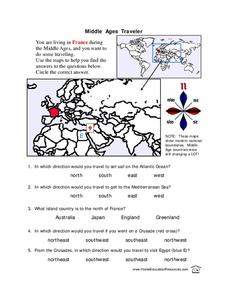
Middle Ages Traveler
In this map worksheet, young scholars are given three maps of France to use to answer multiple choice questions. Students complete an activity from the perspective of a Middle Ages traveler.
Curated OER
Continents and Oceans
In this geography worksheet, students read a paragraph and learn about the seven continents and five oceans of the world. Students study a map of the world and answer 12 short answer questions. This is an online interactive worksheet.
Curated OER
World Map Labels
In this geography skills worksheet, students identify the countries and bodies of water labelled on the maps of the world, Africa, Asia, Canada, Europe, the Caribbean, the Middle East, North America, Australia, and South America.
Curated OER
Geography Worksheet
In this geography skills worksheet, students respond to 14 short answer questions by using maps and atlases. The maps and atlases are not included.
Curated OER
Coral Reef Geography
In this coral reef geography worksheet, students find locations of reefs on a globe or map. There are 10 instructions to follow. There is no map provided--an atlas, globe or map is needed.
Curated OER
Canada Map Quiz
For this online interactive geography quiz worksheet, students respond to 12 multiple choice questions regarding Canadian countries.
Curated OER
Project Map: Latitude And Longitude Worksheet
In this latitude and longitude worksheet, students find the coordinates of 14 cities around the world and use this information to complete 14 short answer questions. This worksheet includes online atlas web links.
Curated OER
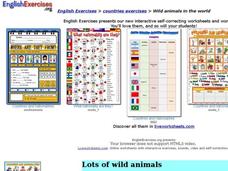
Wild Animals in the World
For this wild animals worksheet, students answer multiple choice map questions, choose the correct animal names for the pictures, and more. Students complete 4 activities.
Curated OER
Breaking News English: Map Shows Chinese Discovered America
In this English worksheet, students read "Map Shows Chinese Discovered America," and then respond to 47 fill in the blank, 7 short answer, 20 matching, and 8 true or false questions about the selection.
Curated OER
Breaking News English: Map Shows the Chinese Discovered America
For this English worksheet, students read "Map Shows the Chinese Discovered America," and then respond to 47 fill in the blank, 7 short answer, 20 matching, and 8 true or false questions about the selection.
Curated OER
Oceania Map Quiz
In this online interactive geography quiz learning exercise, learners respond to 14 identification questions about Oceania. Students have 2 minutes to complete the quiz.
Curated OER
Sign a Map
For this geography worksheet, students think and identify the different features and landforms that an explorer would come across the continent of Antarctica. They use body gestures to communicate their list of items to a partner and...
Curated OER
Global Connections: Internet Research
In this geography Internet research worksheet, students find out facts about the capital cities of 12 nations. Students then research facts about Australia, and also find out the country of origin for 4 prominent organizations such as...
Curated OER
Time Zones
In this time zones worksheet, students are given a map of the Earth indicating the time zones, the prime meridian and the international date line. Students answer 5 questions about solar occurrences and determine when each would be seen...
Curated OER
Where in the World? Oceans & Continents
In this geography worksheet, young scholars answer 6 questions using a coded map as a reference, then students identify labeled geographic features.
Curated OER
Ancient Mesopotamia
In this geography worksheet, high schoolers read about ancient Mesopotamia and respond to five short answer questions that follow. They identify what part of the country was the heart of Mesopotamia. Then students compare the given map...
Other popular searches
- Australia Outline Map
- Australia Map
- Australian Map/regions
- Australia Map Skills
- Australian Map
- Australia Geography Map
- Social Studies Australia Map
- Australian Rainforest Map
- Label Map of Australia
- Australia Map Game
- Australian Rain Forest Map
- Australia Map Worksheet
