Hi, what do you want to do?
Curated OER
Educational Technology Clearinghouse: Maps Etc: Connecticut, 1902
A map from 1902 of Connecticut showing the State capital of Hartford, major cities and towns, railroads, lakes and rivers, and the coastal features of the Long Island Sound.
Curated OER
Educational Technology Clearinghouse: Maps Etc: Connecticut, 1906
A map from 1906 of Connecticut showing the State capital of Hartford, major cities and towns, railroads, lakes and rivers, and the coastal features of the Long Island Sound.
Curated OER
Educational Technology Clearinghouse: Maps Etc: Connecticut, 1909
A map from 1909 of Connecticut showing the State capital of Hartford, major cities and towns, railroads, lakes and rivers, and the coastal features of the Long Island Sound.
Curated OER
Educational Technology Clearinghouse: Maps Etc: Connecticut, 1922
A map from 1922 of Connecticut showing the State capital of Hartford, major cities and towns, railroads, lakes and rivers, and the coastal features of the Long Island Sound.
Curated OER
Educational Technology Clearinghouse: Maps Etc: Connecticut, 1892
A map from 1892 of Connecticut showing the State capital of Hartford, counties and county seats, major cities and towns, railroads, lakes and rivers, and the coastal features of the Long Island Sound.
Library of Congress
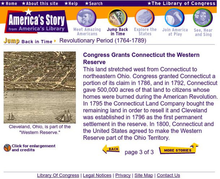
Loc: The Western Reserve Is Granted to Conn.
A brief explanation of Connecticut's acquisition of the Western Territory. Provides several historical maps to provide a view of The United States as it appeared after the Revolutionary War.
Other
New Netherland Institute: Virtual Tour of New Netherland
A comprehensive site on the colonization of New Netherland by the Dutch. Find maps, pictures, and artifacts on this interesting tour.
A&E Television
History.com: The States
Learn unique facts about each American state. You can also read a more in-depth history of each state, watch videos and play a game about all the states.
Curated OER
Educational Technology Clearinghouse: Maps Etc: Connecticut River, 1666
A facsimile of an early Dutch map of the Connecticut River, the eastern boundary claimed by New Netherlands in 1666. The map is oriented with north to the right, and shows the early settlements and native villages, shoreline, and water...
Curated OER
Educational Technology Clearinghouse: Maps Etc: Connecticut River Valley, 1872
A map from 1872 of the Connecticut River and Valley in Massachusetts from Bernardston and Greenfield south to Springfield and Long Meadow.
Other
Hartford Friends and Enemies of Wallace Stevens
This site is maintained by an organization in Hartford, Connecticut, Stevens' home town, devoted to promoting Stevens' poetry and contribution to the Hartford community. It contains a map and photos of the route Stevens walked to work...
Curated OER
Educational Technology Clearinghouse: Maps Etc: West Indies, 1906
A map from 1906 of the Greater Antilles and Bahama Island group of the West Indies. The map shows capitals, major cities, and ports, terrain and coastal features, submerged banks or reefs, and smaller islands. The water depths are...
Curated OER
Educational Technology Clearinghouse: Maps Etc: Hawaiian Islands, 1906
A map from 1906 of the Hawaiian Islands showing the main islands of Hawaii, Maui, Kahoolawe, Lanai, Molokai, Oahu, Kauai and Niihau, cities, towns, ports, volcanoes, terrain, and coastal features. The inset map shows the western islands...
Curated OER
Educational Technology Clearinghouse: Maps Etc: Bridgeport, Connecticut, 1919
A road map of Bridgeport, Connecticut, from the Official Automobile Blue Book (1919), showing Bridgeport, Connecticut, showing the Long Island Sound, the major roads, ferry routes, railroads and stations, parks, cemeteries, and major...
Curated OER
Educational Technology Clearinghouse: Maps Etc: Hartford, Connecticut, 1919
A road map of the vicinity of Hartford Connecticut from the Official Automobile Blue Book (1919), showing the Connecticut River, Capitol building, bridges, major roads, railroads and stations, parks, and major landmarks of the area.
Curated OER
Educational Technology Clearinghouse: Maps Etc: Central Connecticut, 1919
A road map of central Connecticut from the Official Automobile Blue Book (1919), keyed to show the best auto routes, other auto routes, unreported roads, railroads, and canals.
Curated OER
Educational Technology Clearinghouse: Maps Etc: Coastal Connecticut, 1919
A road map of coastal Connecticut from the Official Automobile Blue Book (1919), keyed to show the best auto routes, other auto routes, unreported roads, railroads, and canals.
Curated OER
Educational Technology Clearinghouse: Maps Etc: Eastern Connecticut, 1919
A road map of eastern Connecticut from the Official Automobile Blue Book (1919), keyed to show the best auto routes, other auto routes, unreported roads, railroads, and canals.
Curated OER
Educational Technology Clearinghouse: Maps Etc: Central Connecticut, 1919
A road map of central Connecticut in the vicinity of Meriden from the Official Automobile Blue Book (1919), keyed to show the best auto routes, other auto routes, unreported roads, railroads, and canals.
Curated OER
Educational Technology Clearinghouse: Maps Etc: Danbury, Connecticut, 1920
A road map of Danbury, Connecticut, from the 1920 Automobile Club of Rochester showing the Still River and Blind Brook, the major roads, railroads and stations, parks, and major landmarks.
Curated OER
Educational Technology Clearinghouse: Maps Etc: Bridgeport, Connecticut, 1920
A road map of Bridgeport, Connecticut, from the 1920 Automobile Club of Rochester showing the Long Island Sound, the major roads, ferry routes, railroads and stations, parks, cemeteries, and major landmarks.
Curated OER
Educational Technology Clearinghouse: Maps Etc: Northwestern Connecticut, 1919
A road map of northwestern Connecticut in the vicinity of Winsted from the Official Automobile Blue Book (1919), keyed to show the best auto routes, other auto routes, unreported roads, railroads, and canals.
Curated OER
Educational Technology Clearinghouse: Maps Etc: Southeastern Connecticut, 1919
A road map of southeastern Connecticut in the vicinity of New London from the Official Automobile Blue Book (1919), keyed to show the best auto routes, other auto routes, unreported roads, railroads, and canals.
Curated OER
Educational Technology Clearinghouse: Maps Etc: Meriden, Connecticut, 1919
A road map of the vicinity of Meriden Connecticut from the Official Automobile Blue Book (1919), showing the major roads, railroads and stations, parks, and major landmarks of the area.


