Curated OER
Lincoln Home National Historic Site: A Place of Growth and Memory
Eighth graders study the history of Lincoln's home. In this American History instructional activity, 8th graders examine artifacts from his home to learn about his beliefs. Students participate in a webquest on Lincoln's...
Curated OER
States in the USA Quiz
In this online interactive geography quiz worksheet, students respond to 50 identification questions about the states in the United States of America. Students have 4 minutes to complete the quiz.
Curated OER
For the Fun of It
Middle schoolers investigate author's purpose in autobiography by reading Amelia Earhart's autobiography entitled The Fun of It. Middle schoolers examine character traits needed to fulfill personal goals.
Curated OER
United States Prepositions
In this prepositions worksheet, students use the clues to help them locate the positions of the state according to the prepositions given in each sentence.
Enchanted Learning
Enchanted Learning: Iowa
This site has a colorful display of information about Iowa. It contains a map, pictures, a list of state symbols, and links to related information.
Cayuse Canyon
The Us50: Iowa
Provides key information regarding Iowa's history, famous people, cities, geography, state parks, tourism, and historic sites. A fact sheet of information and a quiz are also available.
Johns Hopkins University
The Johns Hopkins University: Iowa State Maps
Find out more about the state of Iowa through maps at this site from The Johns Hopkins University Applied Physics Laboratory. This site has several map choices for you to look at.
University of Iowa
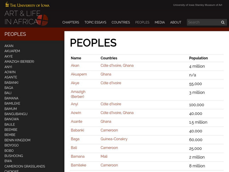
University of Iowa: Arts and Life in Africa: People Resources
Essential information on African countries and African peoples assembled by the University of Iowa.
Curated OER
Educational Technology Clearinghouse: Maps Etc: Iowa, 1904
A map from 1904 of Iowa showing the State capital of Des Moines, major cities and towns, railroads, and rivers. "Iowa (Hawkeye State) - The first white settlement was made in 1788. Admitted to the Union in 1846. Area, 66,025 square...
Curated OER
Educational Technology Clearinghouse: Maps Etc: Iowa, 1920
A map from 1920 of Iowa showing the State capital of Des Moines, counties and county seats, major cities and towns, railroads, and rivers, including the border rivers of the Mississippi and Missouri. A grid reference in the margins of...
Curated OER
Educational Technology Clearinghouse: Maps Etc: Iowa, 1914
A map from 1914 of Iowa showing the State capital of Des Moines, counties and county seats, major cities and towns, railroads and electric railroads, and rivers, including the border rivers of the Mississippi and Missouri. A grid...
Curated OER
Educational Technology Clearinghouse: Maps Etc: Iowa, 1892
A map from 1892 of Iowa showing the State capital of Des Moines, counties and county seats, major cities and towns, railroads, and rivers.
Curated OER
Educational Technology Clearinghouse: Maps Etc: Iowa, 1902
A map from 1902 of Iowa showing the State capital of Des Moines, major cities and towns, railroads, and rivers, including the border rivers of the Mississippi and Missouri.
Curated OER
Educational Technology Clearinghouse: Maps Etc: Iowa, 1906
A map from 1906 of Iowa showing the State capital of Des Moines, major cities and towns, railroads, and rivers, including the border rivers of the Mississippi and Missouri.
Curated OER
Educational Technology Clearinghouse: Maps Etc: Iowa, 1909
A map from 1909 of Iowa showing the State capital of Des Moines, major cities and towns, railroads, and rivers, including the border rivers of the Mississippi and Missouri.
Curated OER
Educational Technology Clearinghouse: Maps Etc: Iowa, 1919
A map from 1919 of Iowa showing the State capital of Des Moines, major cities and towns, railroads, and rivers, including the border rivers of the Mississippi and Missouri.
Curated OER
Educational Technology Clearinghouse: Maps Etc: Iowa, 1922
A map from 1922 of Iowa showing the State capital of Des Moines, major cities and towns, railroads, and rivers, including the border rivers of the Mississippi and Missouri.
Curated OER
Educational Technology Clearinghouse: Maps Etc: Iowa, 1903
A map from 1903 of Iowa showing the State capital of Des Moines, counties and county seats, major cities and towns, railroads, and rivers, including the border rivers of the Mississippi and Missouri.
Curated OER
Educational Technology Clearinghouse: Maps Etc: Iowa, 1919
A map from 1919 of Iowa showing the State capital of Des Moines, counties and county seats, major cities and towns, railroads and electric railways, and rivers, including the border rivers of the Mississippi and Missouri.
University of Iowa
University of Iowa Libraries: The Atlas of Early Printing
View this interactive reference tool to learn about the history of printing in Europe during the fifteenth century. Features a map that displays layers of information that can be viewed together or individually along with a timeline of...
CRW Flags
Flags of the World: Clickable Map of the United States
Includes both printable images and fascinating trivia behind the flag of each state. It includes alternate flags used in the past.
University of Iowa
University of Iowa: Art and Life in Africa
A comprehensive resource about African art and cultures.
Other
University of Northern Iowa: Study Skills
Collection of web sites that provide tips to help you study more effectively, manage your time, take better notes, and handle the stresses of school life.
Curated OER
Educational Technology Clearinghouse: Maps Etc: The United States, 1850
A map of the United States in 1850, showing the frontier line, indicate by the thick black line. The map shows the States added to the Union between 1840 and 1850, including Florida (1845), Texas (1845), Iowa (1846), Wisconsin (1848),...


