Hi, what do you want to do?
Curated OER
Etc: Land of the Hebrews, 971 931 Bc
A map of the Hebrew lands in the time of King Solomon, around 971 to 931 BC. The map shows the land of Canaan, with the boundaries of Phoenicia, Israel, Philistia, and Judah, the important coastal cities of Sidon, Tyre, Joppa, Ashdod,...
Israel Ministry of Foreign Affairs
Israel Mfa: Jerusalem in Old Map and Views
Resource provides the contents of an exhibition in Israel on the history of the city of Jerusalem through maps. It starts with the oldest map, a mosaic known as the "Madaba Mosaic," found in Jordan and goes to the 19th century. Click on...
Curated OER
Etc: Maps Etc: Sea of Gennesareth or Galilee, 1881
A map from 1881 of the Sea of Gennesareth, also known as the Sea of Galilee or Lake Tiberias, the largest freshwater lake in Israel. The map shows the cities and towns on the shores of the lake, roads, terrain features, rivers and...
Curated OER
Educational Technology Clearinghouse: Maps Etc: Palestine, 1916
A map from 1916 of Palestine as it was recognized at the time.
Curated OER
Educational Technology Clearinghouse: Maps Etc: Jerusalem, 1903
A plan from 1903 for city of modern Jerusalem, showing prominent churches, hospitals, and religious monuments. The map shows the Armenian Quarter, Jewish Quarter, Moslem Quarter, and Christian Quarter of the city within the walls,...
Curated OER
Educational Technology Clearinghouse: Maps Etc: Jerusalem, 1881
A map from 1881 of Jerusalem, showing historical sites within the city walls, important city gates, roads, and neighboring sites, including David's Tomb, Mount of Olives and the Russian Property (Russian Orthodox Church compound) to the...
Curated OER
Educational Technology Clearinghouse: Maps Etc: Holy Land, 1910
A map from 1910 of the Holy Land, generally referred to as the geographical region of the Levant. This map shows the territories of Upper Galilee, Lower Galilee, Decapolis, Samaria, Perea, Judaea, and Idumaea, and shows major cities,...
Curated OER
Etc: Maps Etc: Palestine, With Detail of Old Jerusalem, 1915
Ancient Palestine, with an inset of Old Jerusalem, intended for use in Bible studies.
Curated OER
Educational Technology Clearinghouse: Maps Etc: Ancient Jerusalem, Around Ad 100
A plan of ancient Jerusalem around AD 100, showing the walls of the city and places of historic interest.
Curated OER
Etc: Maps Etc: Jerusalem in Nehemiah's Time, Around Ad 35
A plan of ancient Jerusalem at the time of Nehemiah and of the Gospels, showing the walls of the city and places of historic interest. - Smith, 1911.
New York Times
New York Times: Trading Attacks
An interactive map that shows the conflict in Israel and Hezbollah. There is a timeline at the side of the map that shows different events that occurred on different days. Click on an event and it will move the map to where it happened....
Nations Online Project
Nations Online: Palestine
Great reference guide that takes you on a virtual trip to the Middle East nation of Palestine. Background overview is given on its art, culture, people, environment, geography, history, tourism, economy, and government. There are...
Curated OER
Israel
A comprehensive report on the food of Israel. This site contains a detailed description of food history, food for religious and holiday celebrations, mealtime customs as well as many recipes!
Other
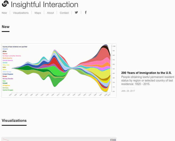
Insightful Interaction: Visualizations
A collection of interactive visualizations that were produced through analysis of economic, political, and market research data. Topics are diverse, e.g., military spending and trade, immigration, consumer spending, crime, unemployment,...
Luther Seminary
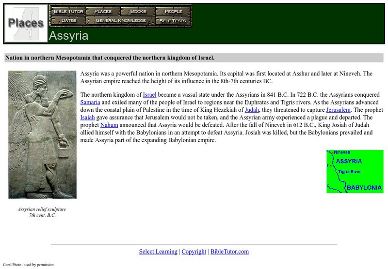
Bible Tutor: Assyria
Bible Tutor offers a brief description of the location and history of Assyria. Inlcudes image and map.
American-Israeli Cooperative Enterprise
Jewish Virtual Library: The Golan Heights
Information on the Golan Heights includes: an overview of the geography, geology, maps, statistics, and history. Also, a section on the Golan Heights Law of December 14, 1981 is included. Please know that some statistical information may...


