Curated OER
Agriculture Shapes Kentucky History
Young scholars explore the lives of early American Indians and settlers in Kentucky. They describe the agricultural practices of Indians native to Kentucky and develop a supply list for a group of settlers coming to the state to...
Curated OER
Kentucky State Map
In this map worksheet, students will study a map of Kentucky. Students will use this map to label and/or familiarize themselves with various aspects of the state.
Curated OER
Kentucky Outline Map
In this Kentucky outline map worksheet, students examine political boundaries of the state and the placement its capital city as well as its major cities. This map is not labeled.
Curated OER
Water Features - Lesson 2 - U.S. Political Map Grade 4-5
Students locate water features on maps. In this geography lesson, students complete worksheets that require them to identify water features on a U. S. political map.
Curated OER
Mystery State #10
In this mystery state worksheet, students answer five clues to identify the state in question. They then locate that state on a map.
Curated OER
Export-Import Game
Students recognize how international trade affects them as consumers and become familiar with basic agricultural crops grown in Kentucky. They identify items used in their daily lives and .heir place of origin and examine export/import...
Curated OER
State Map Locations
In this four state map locations learning exercise, students match up the following four state names to their actual locations on a United States map: Vermont, Tennessee, Kentucky and Rhode Island.
National Endowment for the Humanities
African-American Communities in the North Before the Civil War
Middle schoolers may be surprised to learn that before the American Civil War there were more slaves living in New York than there were in Kentucky! Young historians examine maps and census data to gather statistics about...
Curated OER
Third Grade Social Studies Quiz
In this social studies worksheet, 3rd graders complete multiple choice questions about communities, maps, distances, and more. Students complete 11 questions.
Curated OER
State to State Scavenger Hunt
For this states worksheet, learners utilize the Internet to access one specific website to locate the answers to five fill in the blank statements about the states found on a United States map.
Curated OER
Do You Know Your 50 States?
Learners use the names and abbreviations of the 50 states to label a blank map of the United States.
Curated OER
Ozark Folk Culture and Geography in the Mountain View, Arkansas Area
Upper grade through early high schoolers develop an understanding of Ozark culture, and the geography of the Ozark Plateau. They study place, location, human environmental impacts, and movement. This interesting plan incorporates muic,...
American Battlefield Trust
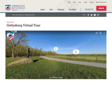
Gettysburg Virtual Tour
Step into one of the most iconic battlefields of the American Civil War with an educational interactive resource. Young historians learn about key moments, locations, soldiers, and turning points in the battle with a clickable map and...
ReadWriteThink
Biography Project: Research and Class Presentation
I Have A Dream ... that after the lesson, all individuals master the reading, writing, researching, listening, and speaking skills the biography project helps them develop. Martin Luther King, Jr. serves as a topic example for a model...
Curated OER
Name the States Worksheet 5
In this name the states worksheet, learners examine 6 state map outlines and identify each of them by writing the state names and postal abbreviations.
Curated OER
Lewis & Clark: The Louisiana Purchase
In this facts about the Louisiana Purchase and the Lewis and Clark expedition online interactive worksheet, students read information and observe a map of the Louisiana Purchase to answer questions showing their comprehension skills....
Curated OER
The Battle of Corydon
Fourth graders study the Battle of Corydon, its military leaders, and its influence on the town. In this Battle of Corydon activity, 4th graders develop vocabulary needed to complete the activity, listen as the teacher reads The Battle...
Curated OER
Scrapbook of Freedom
Third graders examine what it was like for a child traveling in the Underground Railroad.
Curated OER
Scrapbook of Freedom
Third graders create a scrapbook using personal narratives and samples of artifacts to connect to maps of geographical locations of the Underground Rail Road. they describe at least one of the feelings a child slave might have had...
Curated OER
Virginia: The Land and its First Inhabitants
Students review the five geographical regions of the state of Virginia. Using a map, they locate and label Virginia, surrounding states and the crops grown in the area. They present their map to the class and complete a worksheet to end...
Curated OER
"Mill Springs Battlefield"
Students investigate the Civil War caused deep division in the border states and discover the significance of Kentucky to the Union and the Confederacy. They examine how battle casualties were and are honored in the local community.
Curated OER
Hidin' Out
Fourth graders draw three major Underground Railroad routes crossing Indiana on an outline map and include habitats and towns. They produce an oral history involving at least three natural habitats and one human habitat.
Curated OER
States of Fitness
Young scholars participate in physical activities coordinating to divisions on a map.
Curated OER
Quarters: Arkansas and Vermont
Students compare and contrast the natural resources of Arkansas and Vermont and the design of the quarter. Students infer from their Venn diagrams and maps how regions differ across the United States.


