Other
Map of the Union and Confederate States
Two maps showing the Union and Confederate states at the beginning of the Civil War.
Wisc-Online
Wisc Online: European Union
This is an animated resource that lists countries that have joined the European Union. Includes dates and maps of the countries.
NOAA
Noaa: National Weather Service: Regional Climate Maps Former Soviet Union
Find weekly, monthly, and 3-month climate maps for Russia and the Former Soviet Union. Includes total precipitation and minimum and maximum temperature.
University of Texas at Austin
University of Texas Libraries: Russia and the Former Soviet Republics Maps
Collection of maps (political, geographic, thematic, topographic, etc.) related to Russia and the former Soviet Union.
Library of Congress
Loc: Civil War Maps
The Library of Congress provides a large collection of maps dating back to the Civil War. The collection consists of reconnaissance, sketch, coastal, and theater-of-war maps which depict troop activities and fortifications during the...
American Battlefield Trust
American Battlefield Trust: Civil War: Animated Map: Chantilly
Animated map shows the troop movements of both the Union and Confederate armies prior to and during the battle at Chantilly, in Virginia, in 1862.
American Battlefield Trust
American Battlefield Trust: Civil War: Animated Map: Franklin
Animated map shows the troop movements of both the Union and Confederate armies prior to and during the Civil War battle at Franklin, Tennessee, in 1864.
American Battlefield Trust
American Battlefield Trust: Civil War: Animated Map: Cedar Creek
Animated map tells the story and shows the troop movements of both the Union and Confederate armies prior to and during the battle fought at Cedar Creek, Virginia, 1864.
American Battlefield Trust
American Battlefield Trust: Civil War: Animated Map: Fredericksburg
Animated map shows the troop movements of both the Union and Confederate armies prior to and during the battle of Fredericksburg.
Other
Battle of Gettysburg: Battlefield Maps
This site provides a complete map of the battle fought at Gettysburg.
Annenberg Foundation
Annenberg Learner: Teaching Geography: European Union
Explore the European region and consider what makes a successful city and how effective is supranationalism? A video features Berlin and Amsterdam for urban development and then looks into the concept of supranationalism in the European...
NOAA
Noaa: Cpc: Regional Climate Maps
Provides large colorful maps of climate data about each continent for the current week, month, or previous quarter.
US Holocaust Memorial Museum
U.s. Holocaust Memorial Museum: World War Ii in Europe: Animated Maps
The maps on this website show the ebb and flow of Germany's initial domination of Europe, and then the allies' retaking of the territory in WW II. Audio commentary describes the changes from 1939 to 1945.
Curated OER
Historical Maps: Civil War 1861 1865
A very interesting map that shows the area under Union control in 1861 and the subsequent land lost by the Confederacy to the Union year by year. From the Perry-Castenada Collection.
University of Texas at Austin
Perry Castaneda Library Map Collection: Historical Maps of Russia
This outstanding collection of historical maps contains a wide variety of maps from various parts of the Soviet Union as well as the former Soviet Republics, and from different parts of history. Each map is accompanied by a brief...
American Battlefield Trust
American Battlefield Trust: Civil War: Maps of Gettysburg Campaign
Full color map on the Battle of Gettysburg depicts Union and Confederate movement and strategy at Gettysburg, between June 3 and July 1, 1863.
Civil War Home
Home of the American Civil War: Gettysburg Battle Maps
This site provides three small maps depicting the troop alignments on the battlefield of Gettysburg on July 1-3, 1863.
Other
Matthew White: Map of the Collapse of the Soviet Union
A colorful map showing the states of the old Soviet Union and the dates they left the Union.
Stanford University
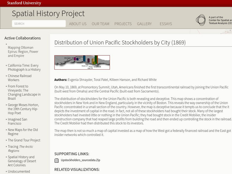
Stanford University: Spatial History: Distribution of Union Pacific Stockholders
This map reveals the way ownership of the Union Pacific concentrated in New England and New York. It also shows how the West got a federally financed railroad, and the east got the insider networks which controlled it.
Curated OER
Educational Technology Clearinghouse: Maps Etc: Union of South Africa, 1920
A map of the Union of South Africa in 1920.
European Union
The European Parliament
Overview of the European Parliament, president, organization, purpose, maps of Europe.
Library of Congress
Loc: Illinois Entered the Union 21st State
A brief history of Illinois including the origin of its name and famous landmarks. Features a historic map, a 1913 photograph of the city a
Other
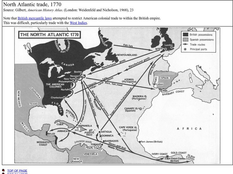
Union College: North Atlantic Trade, 1770
This is a map that shows the trade routes, principal ports, goods being traded, and the areas possessed by the British and the Spanish.
Library of Congress
Loc: American Treasures: A More Perfect Union: Gallery B
This is a large site from American Treasures covering primary source documents from the early 1800s through the Civil War and on to Western Expansion.


