Hi, what do you want to do?
Yale University
The Yale Map Collection: Online Maps
Yale University provides us with one of the largest collection of maps in the United States. Here you can view historical online maps covering a variety of subjects.
Other
City Data
A great source for finding stats and data about U.S. cities compiled from a variety of government and commercial sources. Profiles both large and small cities and includes maps, pictures, population, income and geographical data.
Curated OER
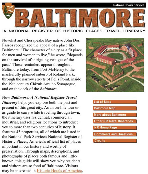
National Park Service: Baltimore, Maryland: Discover Our Shared Heritage
Explore both the past and present of this city by taking this on-line tour of 43 properties. Use the maps, descriptions and photographs to increase your knowledge of this interesting city.
Curated OER
Educational Technology Clearinghouse: Maps Etc: Civil War, 1861 1865
A series of maps showing important campaigns and regions of the American Civil War (1861-1865). The maps show important cities and towns, railroads and campaign routes, terrain and coastal features, and rivers. The maps include (1)...
Curated OER
Educational Technology Clearinghouse: Maps Etc: Red River Expedition, 1864
A map of Louisiana and Mississippi showing the area of the Red River Campaign of 1864 during the American Civil War (March 10 to May 22). The map shows major cities and towns, forts, railroads, rivers, and coastline, and includes the...
Curated OER
Educational Technology Clearinghouse: Maps Etc: Campaigns in Missouri, 1861
A map of Missouri showing the operations in the area during the first year of the American Civil War (1861). The map shows the cities of St. Louis, Jefferson City, and Springfield, the routes of Union campaigns, and the engagements at...
Curated OER
Etc: Route of the Us Army in Mexican American War, 1846 1848
A map of the area between Mexico City and Vera Cruz showing the route of General Scott during his campaign in the Mexican-American War (1847). The map shows the battle sites, including the siege of Fort San Juan de Ulloa and Vera Cruz,...
Curated OER
Educational Technology Clearinghouse: Maps Etc: The War in the East, 1863
A map showing the major battle sites in the east in 1862-1863 during the American Civil War. The map shows major cities, rivers, and the sites of Fredericksburg, Chancellorsville, Wilderness, Spottsylvania, Mount Cedar, Mechanicsville,...
Curated OER
Educational Technology Clearinghouse: Maps Etc: The Civil War, 1861 1865
A map of the southeastern part of the United States showing important sites of the Civil War (1861-1865). The map shows major cities, railroads, rivers, and terrain of the region. An inset map shows northeastern Virginia, with forts and...
Curated OER
Educational Technology Clearinghouse: Maps Etc: Atlanta to Savannah, 1864
A map of part of Georgia in 1864 showing the area of the march by Sherman from Atlanta to Savannah. The map shows cities and towns, roads, railroads, rivers, and coastal features in the area from Decatur to Savannah, including Macon,...
Curated OER
Educational Technology Clearinghouse: Maps Etc: Chattanooga Campaign, 1863
A detailed map of the area around Chattanooga, Tennessee, showing the region during the Chattanooga Campaign of the American Civil War in October-November, 1863. The map shows the state boundaries of Tennessee, Alabama, and Georgia,...
Curated OER
Educational Technology Clearinghouse: Maps Etc: Operation in Louisiana, 1863
A map of the vicinity of New Orleans showing operations in Louisiana during the American Civil War, from February to July, 1863. The map covers the area from New Orleans west to New Iberia and north to the Mississippi State Line, showing...
Curated OER
Etc: Maps Etc: Forts Jackson and St. Philip, 1862
A map of Fort Jackson and Fort St. Philip, two Confederate forts on the Mississippi River in Louisiana. The map shows the fortifications, batteries, and the chain barrier across the Mississippi. These forts were essential to the...
Curated OER
Etc: Maps Etc: Pope's Retreat to Washington, 1862
A map of the area between Cedar Mountain, Virginia, and Washington showing the route of General Pope in his retreat to Washington. The map shows the cities and towns, railroads, terrain, and rivers in the area, and includes the important...
Curated OER
Etc: Maps Etc: The Civil War in the United States, 1861
A map of the southeastern States showing the Federal and Confederate territories at the end of 1861. The railroad network shown is based on 1860 lines. The map shows major cities, mountain systems, rivers, and coastal features of the area.
Curated OER
Etc: Maps Etc: The War in the South and Southwest, 1862
A map of Arkansas, Louisiana, Tennessee, Mississippi, Alabama, and the western portion of Florida showing the area of western campaigns (1862) during the American Civil War. The map shows major cities, the railroad network, forts,...
Curated OER
Etc: Maps Etc: Campaigns Around Perryville Kentucky, 1862
A map of the Kentucky and Tennessee region showing the western area of operations around Perryville, Kentucky, during the American Civil War (1862). The map shows state boundaries, major cities and towns, forts, and rivers in the area....
Curated OER
Etc: Maps Etc: United States and Confederate States, 1861
A map of the United States and Confederate States in 1861. The map is color-coded to show Free Union States, Slave Union States, Confederate States seceding before April 15, 1861, Confederate States seceding after April 15, 1861,...
Curated OER
Educational Technology Clearinghouse: Maps Etc: Pope's Campaign, August 24, 1862
A map of northern Virginia showing the area of the campaign of General Pope on August 24, 1862. The map shows cities and towns, roads and railroads, woodlands, rivers, the route of Stonewall Jackson's flanking maneuver, and the Union and...
Curated OER
Educational Technology Clearinghouse: Maps Etc: Pope's Campaign, August 28, 1862
A map of northern Virginia showing the area of the campaign of General Pope on August 28, 1862 in the morning of the Second Battle of Bull Run. The map shows cities and towns, roads and railroads, terrain, woodlands, rivers, and the...
Curated OER
Educational Technology Clearinghouse: Maps Etc: Pope's Campaign, August 29, 1862
A map of northern Virginia showing the area of the campaign of General Pope at noon on August 29, 1862 during the Second Battle of Bull Run. The map shows cities and towns, roads and railroads, terrain, woodlands, rivers, and the Union...
Curated OER
Educational Technology Clearinghouse: Maps Etc: Charleston Harbor, 1861
A map of the Charleston Harbor, South Carolina, site of the Battle of Fort Sumter (April 12-13, 1861) at the outbreak of the American Civil War. The map shows the city of Charleston and railroads, the Union held Fort Sumter at the mouth...
Curated OER
Educational Technology Clearinghouse: Maps Etc: Charleston Harbor, 1861
A detailed map of Charleston Harbor, South Carolina, in April, 1861 at the beginning of the American Civil War, and site of the Battle of Fort Sumter (April 12-13, 1861). The map shows the city of Charleston and railroads, rural roads,...
Curated OER
Educational Technology Clearinghouse: Maps Etc: The War in the West, 1861 1865
A map of the western seat of war during the American Civil War, showing cities, forts, rivers, and significant battle sites.


