Curated OER
Mapping the News
Students explore cartography. In this map skills and map making lesson, Students work in groups to create wall size world maps including legends, compass roses, latitude and longitude, and physical features. Students collect...
Curated OER
Drake's West Indian Voyage 1588-1589
Middle schoolers investigate several maps detailing Sir Francis Drake's voyages. In this geography lesson, students practice reading maps and locating the precise locations of where Sir Francis Drake visited. Middle schoolers...
Curated OER
Understanding: Geography
Students explore their neighborhoods. In this geography lesson, students make a map of their neighborhood. They must include a key, natural terrain, buildings and streets. They also write a descriptive paragraph about their neighborhood.
Curated OER
Make a Map
In this mapping activity worksheet, students finish the map by following the 5 directions and using the map key. Students the map key, scale, and an inch ruler for help.
Curated OER
Playground Mapping
Young scholars review their physical models of the objects on their playground at school. Using the model, they convert it into a map with a scale and key. To end the lesson, they use the map to locate different objects and measure the...
Teaching Tolerance
Identity Self-Portraits
What symbols represent you best? Individuals consider how they would draw peers using symbols about their identities with an interview and art activity. After conducting interviews and portraits, the art makes a great centerpiece for...
Curated OER
3D Textured Globe
The earth, our home planet, and the star of Earth Day celebrations everywhere! Celebrate Earth Day or examine Earth's place in the solar system, with a fun and easy craft, perfect for children nine and up. Paper mache ornaments, paint,...
Teaching Tolerance
Community Mural / Poster Campaign
Every piece matters. A creative lesson provides an opportunity for scholars to create murals or posters that represent their views on social justice. Academics work on smaller posters or pieces of a mural that will ultimately be...
Curated OER
School Neighborhood Walking Tour
Students list specific boundaries in their school neighborhood and explain their possible purpose. They examine a neighborhood and see what connects us and what divides us. They, in groups, make maps of various neighborhoods and present...
Curated OER
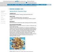
Emphasizing Scale When Creating a Site-Specific Work of Art
Students study art by Matthew Ritchie. Students view pictures of the artist and discuss art that is created specifically for a designated area. Students create pen and ink drawings on letter size paper. Using an overhead, students...
Curated OER
Carving Mountains
Students explore geography by participating in an illustration activity. In this land-form lesson, students define vocabulary terms associated with glaciers and forests. Students utilize pens, cardboard and pottery clay to draw and...
Curated OER
Comparing Distances
Students practice estimating distances by analyzing a map. In this length measurement lesson, students view a map with a distance key and use their measurement skills to estimate the distance between two cities. Students utilize an...
Curated OER
U.S. Geography: The Northeast
Students investigate U.S. Geography by creating a map in class. In this natural resource lesson, students create a map of the United States and research the Northeast based on their resources and recyclable materials. Students...
Curated OER
Cartography
Students follow directions to draw a map of an island. They complete the island map adding their own details using symbols and a legend.
Curated OER
Night by Elie Wiesel
Tenth graders explore WWII by reading a book with their class. In this Holocaust research instructional activity, 10th graders read the book Night, and discuss the horrors of the concentration camps and Nazi brutality during WWII....
Curated OER
Map-Making Basics
Students study maps. In this geography and art lesson, students create their own map of the classroom.
Curated OER
It's Greek to Me!
Students explore Greek Mythology. In this Greek Mythology unit, students read myths, pantomime vocabulary words, practice research skills, create city-states, and demonstrate knowledge of ratios and proportions. This unit includes many...
Teaching Tolerance
Community Puzzle Mural
Every piece of the puzzle is important. A lesson gives individuals the opportunity to create artwork that spreads a message of inclusion and tolerance. Class members work in teams to create pieces of the mural that form a larger picture....
Curated OER
Park Brochures
Sixth graders investigate natural environments by researching national parks. In this brochure making lesson, 6th graders explore a specific national park and research it's information by utilizing the web. Students create travel...
Curated OER
GPS Art
Students design their own logo or picture and use a handheld GPS receiver to map it out. They write out a word or graphic on a field or playground, walk the path, and log GPS data. The results display their "art" on their GPS receiver...
Teaching Tolerance
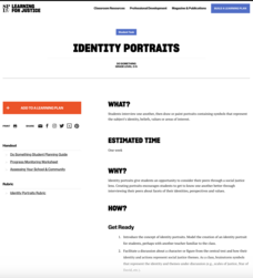
Identity Portraits
When you look at me, what do you see? Young learners answer this question by creating a portrait that reflects the identity of one of their peers. First, class members create interview questions. Then, they interview classmates to...
Curated OER
Castle Builder
Fifth graders discuss the importance of castles in medieval times. Using the internet, they research the parts of a castle and design their own using the components. They use everyday materials to build the castle to a specific scale.
Curated OER
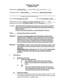
Compass Rose: Dance and Quilt
Fourth graders identify the cardinal directions by listening to a song entitled, "Stand," and by reviewing the lyrics to that song. They notice the cardinal directions that are posted around the classroom. They perform the motions as...
Curated OER
Exploring History Through Photographs
Fifth graders compare and contrast photographs from the 1800s to those of 2003. In groups, they create drawings of how society has changed over time and use maps to locate local streets. Individually, they practice measuring the...


