Curated OER
Through the Looking Glass: Recognizing Developing and Industrialized Countries
Students examine the regions of the world, and identify the basic characteristics of industrialized and developing countries. They conduct Internet research on the economic and population characteristics of industrialized and developing...
Curated OER
Music to Learn Countries and Capitals Around the World: Learning Countries and Capitals in Asia
Students use musicto explore the countries and capitals of Asia.
Curated OER
Where is ? ? ? ?
Students explain and explain the concept of a grid system. They define absolute and relative location and develop an imaginary city on graph paper using a grid system.
Curated OER
Turtle Legends
Students listen to the legend, Thirteen Moons on Turtle's Back. They create a new moon for the calendar based on this natural part of everyday life in the seasons. They illustrate it under the story using water color paints.
Curated OER
Dream House
Students solve real world problems involving area and perimeter in this unit culminating activity.
Curated OER
The Tennessee River: The Tie That Binds
Seventh graders examine the Tennessee River to see why it is still a major transportation artery in lieu of the age of modern transportation such as interstate highways, air cargo, and elaborate railway systems.
Curated OER
ExplorA-Pond: 1st Grade Shapes
Young explorers review the basic shapes (circle, triangle, square, rectangle) and practice putting them together to make new shapes. Given an outline of a pond, they recreate it by combining other shapes.
Curated OER
ExplorA-Pond: 6th Grade Area and Random Number Tables
Sixth graders estimate surface area of a pond using a random number table.
Curated OER
Classroom Supplies
Challenge young mathematicians to buy classroom supplies by staying within the means of a $1,000 budget. The mathematical activity provides learners with the opportunity to decide what items from the supply list would benefit a class of...
Curated OER
Analyzing the Relationship between Snowpack and River Flow
Students use the Internet to research current and past snowpack levels and river gauging station readings. They determine the relationship between snowpack and river flow. They predict future river flow.
Curated OER
Human Impacts on Major Rivers of the World
Students explore motivations behind human intervention in the stream flow of selected rivers, infer kinds of interventions and their results, and evaluate level of success of such interventions of stream flow as well as environmental...
Curated OER
The Influence of Physical Geography
Students explore the limits and demands of their physical world and how it relates to the survival and well-being of people.
Curated OER
Sandscapes to Landscapes
Students explore landscapes and create their own in a creative project.
Curated OER
'Cross the Wide Missouri
Students perform a song, identify melodies, and discuss the history of folk songs.
Curated OER
Social Studies: Area and Population Density
Math scholars of many ages examine the concept of population density and then discuss the significance of the population densities of Minnesota and China. They figure the population density of their school.
Curated OER
Glimpses of Japan: Picture books are an avenue to geographical knowledge
Student gains insight into the culture of Japan. They articulate the main ideas and supporting details, also they create a "glimpse of Japan" with an illustrated and written summary of the main idea and four supporting details from the...
Curated OER
Aerosol Lesson: Science - Graphing SAGE II Data
Students examine and plot atmospheric data on bar graphs.
Curated OER
Colvin Run Mill: A Peek into 19th Century Community and Technology
Fourth graders take a field trip to a mill, identify the parts of a mill, what was produced there, and what types of occupations were associated with a mill. They write an essay detailing the reasons they would or wouldn't like to have...
Curated OER
How Does Your Soil Stack Up?
Learners examine the soil in their local area and create a soil profile. They record observations in the field and the classroom. They create their own display of the soil profile as well.
Curated OER
What is the Rock Cycle and Its Processes?
Geology beginners examine three different rock samples and determine their origin by their characteristics. By making and recording observations, they become familiar with features of igneous, metamorphic, and sedimentary rock types....
Curated OER
Earthquakes and Seismic Waves
Students explore earthquakes and seismic waves. They investigate how energy is released in the subsurface to create seismic waves. Students explore the inner workings of a seismograph and how they are used to determine the location of an...
Curated OER
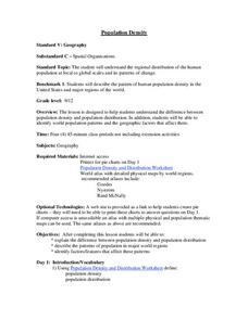
Population Density
Students examine world population density and population distribution. They create pie charts showing population distribution and analyze population patterns in the United States and major regions of the world. They identify...
Curated OER
Dinosaurs and Classification
Second graders explore dinosaurs and identify them by their size. They compare the dinosaurs with objects around the school or on the playground. Students predict which dinosaurs are the largest and then measure the length of dinosaurs.
Curated OER
Sam Houston for President...Again
Fourth graders discover the political career of Sam Houston. In this Texas history lesson, 4th graders research primary resources and create a modern-day version of Sam Houston's political campaign of the 1840s.
Other popular searches
- Math Map Scales
- Using Map Scales
- Reading Map Scales
- Identify Map Scales
- Use Map Scales
- Geography Map Scales
- Comparing Map Scales
- Map Scales Conversion
- Geography Map Scales
- Making Map Scales
- Map Scales Lesson Plans
- Math Map Scales Problems


