Curated OER
United States: Physical Features Fun
In this map worksheet, students color and trace eleven listed features on a map of the United States. Students answer six additional questions about the map. A United States map is not provided. However, websites are provided to find...
Curated OER
Johnny Appleseed Walkabout
Second graders calculate mileage for a journey. For this place value and measurement lesson, 2nd graders read Johnny Appleseed, work in groups to locate his birthplace on a map, locate the other states he stopped in, and measure the...
Curated OER
Summer Trip
Fourth graders search for information and directions to specific cities from their homes, figure cost of trip when given miles per gallon, distance, and cost per gallon of gas, develop outline budget for summer trip, and draw and label...
National Endowment for the Humanities
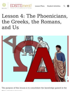
Lesson 4: The Phoenicians, the Greeks, the Romans, and Us
Learners review knowledge gained in the three-part unit on the history of the alphabet. Using maps and images, learners consolidate their understanding of ancient Greece, the Romans and the Phoenicians, and their respective impacts on...
Curated OER
Character Development Story Map
For this character development story map worksheet, students complete a flow chart about a character in a book. Students fill in the name of the character and write how the character feels and acts before and after a character change in...
Curated OER
The Globe and World Map
Students explore how to use maps for travel. In this map skills lesson, students read the text, With Love from Gran and discuss the places the character traveled. Students list the names of each city and country on chart paper.
Curated OER
Concise Directions: Pictures in School
Students practice giving directions. In this descriptive writing lesson, students create maps and other visual aids that provide sets of directions for students to get from one location of their school building to another.
Curated OER
The Roman Empire-Map Activity
In this Roman Empire worksheet, students complete a map activity in which they label and color civilizations, countries and physical features as instructed. There are no maps included.
Curated OER
A Walk Around the School: Mapping Places Near and Far
After reading Pat Hutchins’ Rosie’s Walk, have your young cartographers create a map of Rosie’s walk. Then lead them on a walk around the school. When you return class members sequence the walk by making a list of how the class got from...
Curated OER
North Dakota Map
In this North Dakota instructional activity, students study an outline map of North Dakota with the capital city marked. Students color the map and add other important cities and landmarks.
Curated OER
English Vocabulary Skills: AWL Sublist 1 - Exercise 3b
In this online interactive English vocabulary skills worksheet, students answer 10 matching questions which require them to fill in the blanks in 10 sentences. Students may submit their answers to be scored.
Curated OER
English Vocabulary Skills: AWL Sublist 8 - Exercise 4c
In this online interactive English vocabulary skills worksheet, high schoolers answer 10 matching questions which require them to fill in the blanks in 10 sentences. Students may submit their answers to be scored.
Curated OER
English Vocabulary Skills: AWL Sublist 10 - Exercise 1b
In this online interactive English vocabulary skills worksheet, high schoolers answer 10 matching questions which require them to fill in the blanks in 10 sentences. Students may submit their answers to be scored.
Curated OER
Story Map--Upper Elementary Worksheet
In this retelling of a story instructional activity, students choose a story they've already read and fill out the story map. Students follow the sequence of the story map step-by-step.
Curated OER
Through the Forest and Home Again: Maps Help Us Find Our Ways
Students read Little Red Riding Hood, focusing on her path home to Grandma's house. In this language arts and geography lesson, students perform a reader's theater, re-creating the walk home and possible routes that could have been...
Curated OER
Map Reading
In this reading maps practice worksheet, students respond to 16 questions that require them to determine the directions north,, south, east, and, west.
Curated OER
The Crash Scene
Fifth graders explore geography by participating in a mapping activity. In this engineering instructional activity, 5th graders identify the differences between latitude and longitude and practice locating precise points on a globe or...
Curated OER
Borrowing Narrative Skills from Mr. Fletcher: Using a "Prompts in Reverse" Technique to Inspire Your Writers
Help your class find their writing voices with this lesson which uses the work of Ralph Fletcher to guide a "Prompt in Reverse" activity. Using the chapter "First Pen" from Fletcher's Marshfield Dreams, learners decipher what they...
Curated OER
Mapmaker, Make Me a Map!
Students are introduced to the state quarter program and examine the Colorado state quarter. They locate Colorado on a map and create a map with a key. They discuss the state motto and examine pictures of the state's geographical features.
Curated OER
Kid Maps: Reading and Creating Maps with Human Characteristics
Students look at maps. For this map lesson, students listen to the book My Map Book by Sara Fanelli and they see the difference between human characteristics (buildings, etc.) and natural characteristics (rivers, etc.). They create...
Curated OER
Map of Kellyburi
For this map worksheet, 6th graders use a map to label 12 locations, answer 6 directional questions, write the answer for 17 general information questions, select the word for 10 sentences and read 25 English words for Thai animal names.
Curated OER
Arkansas Geography/History Relief Map
Sixth graders research a number of sources including the Internet to find information about the regions of Arkansas while locating sites of national historic interest. They located sites on maps while working at assigned websites. They...
Curated OER
U.S. Geography for Children: The Northeast
In this map skills of the northeastern United States worksheet, students observe an outline map, locate and label the states, and designated landforms and bodies of water; and create symbols and a map key for sources of economy and other...
Curated OER
U.S. Geography: California
In this map skills about the state of California worksheet, students locate and label specific places and areas and create a map key and symbolize the economy and areas of personal interest. Students answer 5 questions.
Other popular searches
- Map Skills Lesson Plans
- Map Skills Worksheets
- Elementary Map Skills
- Geography Map Skills
- Basic Map Skills
- Social Studies Map Skills
- Globe and Map Skills
- Beginning Map Skills
- United States Map Skills
- Map Skills, Continents
- Early Explorers Map Skills
- Free Map Skills Worksheets


